Curated OER
Geographic Landforms
Each slide is a simple notebook page with one landform in blue and its definition in red. There are 26 vocabulary terms in all, some you may want to use, and others easily hidden. It is recommended that you add photos or other graphic...
Curated OER
Things That Stick Out Or: How To Find Your Way Around on a Map
Students explain the meaning of and recognize the map outlines of a peninsula, an isthmus, and a cape.
Yale University
Yale University: Hay Bunau Varilla Treaty
Open this page to read the full text of the Hay-Bunau-Varilla Treaty, which gave the U.S. rights to build the Panama Canal.
Scholastic
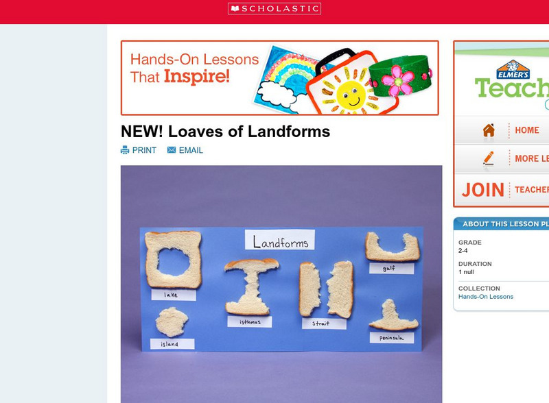
Scholastic: Loaves of Landforms!
A foundation in geography begins with an understanding of the terms geographers use to describe the features of Earth. This lesson is designed to help young scholars grow their vocabulary and learn to recognize common landforms in a...
eSchool Today
E School Today: Landforms
Understand the formation and geology of different landforms around the Earth.
ClassFlow
Class Flow: Geographic Terms
[Free Registration/Login Required] These five Activote questions will help determine if students can identify major geographic features to include fjords, canyons, cliffs, channels, sea, bay, and isthmus.
Other
Maps & Globes: Other Land Forms
A very simple overview of various land forms and their characteristics: peninsula, cape, isthmus, valley, canyon, cliff, and swamp.


