Curated OER
West Virginia Map
In this map activities worksheet, students use an outline of the map of West Virginia to add the state capital, major cities, and other state attractions. Students complete 3 activities.
Curated OER
A View from the Ground
Students look at a park from ground perspective. In this map skills lesson, students are introduced to a story about a girl at a park and make observations about the park based on a picture. This prepares students for the next lesson in...
Curated OER
Latitude on World Maps - World Map Activity 2
Students explore the concept of latitude. In this geography instructional activity, students discover the global grid system and complete a map activity which require them to record the latitude of various cities in the world.
Curated OER
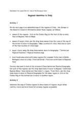
Regional identities in Italy
In this Italy map activity worksheet, students complete 2 map activities that require them to identify major cities and landforms in the country.
Curated OER
Defining a Cultural Region Worksheet
For this cultural regions worksheet, students click on the webpage names listed to find information about the different cultures and cultural regions in Louisiana that may be used for research purposes.
Microsoft
Microsoft: Map Reading in the 21st Century
Students learn how to make informed use of new digital mapping information and tools. Learners create hands-on learning experiences for understanding the relevance of maps. The lesson plan consists of student activities, resources,...


