Curated OER
Middle East
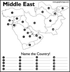
In this map of the Middle East worksheet, students study the map of the Middle East and then write the names of the 20 countries on the provided lines.
PBS
Wide Angle: Interactive Map: Middle East
An interactive map that shows the countries of the Middle East in 2003. Gives information such as population, government, and history about each country.
Central Intelligence Agency
Cia: World Factbook: Regional and World Maps
Maps of major areas of the world can be downloaded here. The maps have excellent detail and are in color.
Other
Owl & Mouse Educational Software: Middle East Map Puzzle
This site has a puzzle of the countries of the Middle East that you can play online.


