Curated OER
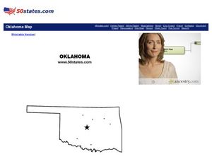
Map of Oklahoma
In this map of Oklahoma worksheet, students view a blank map of Oklahoma with dots on designated cities. Worksheet has no other associated activities.
Enchanted Learning
Enchanted Learning: Oklahoma
This site has a colorful display of information about Oklahoma. It contains a map, pictures, a list of state symbols, and links to related information.
Johns Hopkins University
The Johns Hopkins University: Oklahoma State Maps
This site from The Johns Hopkins University Applied Physics Laboratory contains links to a shaded relief map, county map, black and white map, satellite image, 1895 map, and a PostScript map.


