Curated OER
Fourth Grade Social Studies
In this social studies worksheet, 4th graders complete multiple choice questions about the climate, landforms, regions, government, and more. Students complete 25 multiple choice questions.
Curated OER
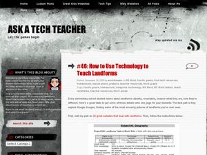
How to Use Technology to Teach Landforms
Students create a landform table on the computer. In this geography lesson, students use Microsoft Word to design a 3 column table. They list different landforms, examples, and attach a picture of each.
Curated OER
Landforms
In this landforms activity, students answer 2 questions about the major land forms and types of mountains. They match 10 landforms and types of mountains with their definitions.
Curated OER
Google Earth Landforms
In this lesson, Google Earth Landforms, students research a landform that has been studied in class. Students explore Google Earth and record everything they find about their landform. Students have the opportunity to extend their...
Curated OER
Water Works Wonders
Students examine where water is found in the world, how we use it, and the various forms it takes. They observe the refraction of light through a prism, record the day and night sky over a week's time, and create a topographic model of...
Curated OER
Cold As Ice
Fourth graders investigate how glaciers cause the weathering of landforms. They observe a brick that has been placed on a frozen slab of ice, and discuss the results, comparing them to the movements of a glacier. In small groups, they...
Curated OER
Geological Features: How Weathering & Erosion Help Create Landforms
Students explore how the Earth's surface changes resulting in geological features and landforms. They perform a read-a-loud on Thomas
Locker's Mountain Dance, complete a KWL chart, and create a
landform using plaster of paris.
Curated OER
Who Are the Aliens in Our Inland Seas?
Students work in teams to research specific landforms in Great Lakes Watershed, compile information into data table, and write legend explaining landform for children's book. Students then research area surrounding landform, compile...
Curated OER
Sub-Sahara Africa
Students listen to a lecture on the geography of sub-Sahara Africa. They then make a poster that illustrates the various landforms and climates that can be found in Africa. Students listen to a lecture on the diversity of African...
Curated OER
Georgia's Regions
Students understand that Georgia has 5 main land regions. They are able to identify the geographic regions of Georgia and describe the regions by completing a research project about a given region with 100% mastery.
Curated OER
Rocks and Minerals
Students are able to describe earth processes (e.g., rusting, weathering, erosion) that have affected selected physical features in students, neighborhoods. They are able to identify various earth structures (e.g., mountains, faults,...
Curated OER
Landforms
Learners study how landforms affect all aspects of a community. Students work in groups to identify landforms from other works of art. In cooperative groups Learners select a work of art depicting a particular land form and create a poem.
Curated OER
Carve That Mountain
Students investigate major landforms (e.g., mountains, rivers, plains, hills, oceans and plateaus). They build a three-dimensional model of a landscape depicting several of these landforms. Once they have built their model, they act as...
Curated OER
Is There Water on Mars?
Young scholars decide whether or not there is or has even been water on Mars. They analyze temperature and pressure data from the Pathfinder mission to Mars, and then they analyze images of Mars, interpreting the landforms they see and...
Curated OER
Landforms: Geomorphology of Arkansas
Second graders create large, salt dough maps of Arkansas and the natural regions in the state created by geographical and morphological features.
Curated OER
A Shuttle's Eye View
Students explore the goals of the Shuttle Radar Topography Mission as a springboard to exploring the topographical features of their own state or region. They synthesize their understanding of landforms and topography by mapping their...
Curated OER
Working With Electronic Topography Maps
Junior geologists examine topographic maps online and learn how to read them. they answer seven associated follow-up questions. This lesson plan is only a general outline and does not provide the details or the websites that you would...
Curated OER
Common Themes
Tenth graders test usefulness of a model Earth by comparing its predictions to observations in the real world. In this landforms lesson students construct an island from a contour map using model clay then analyze the landscape features...
Curated OER
The Southeast Region
Students write a song about the southeast region. In this southeast region lesson plan, students view pictures of landforms, hear music, look at maps of states, and more.
Curated OER
Landforms
In this landforms learning exercise, 3rd graders cut out a set of riddles and match with pictures of landforms, glueing next to each. An answer key is included.
Curated OER
Landforms
Students research landforms created by tectonic movement. For this landforms lessons, students discuss caves, canyons, mountains, valleys, and undersea vents and the ecosystems unique to these environments.
Curated OER
Deep Blue: Exploring the Deep Ocean
Students examine landforms. In this social studies lesson, students bounce a beach ball around in order to discover that seventy percent of the Earth is covered in water. Students
Curated OER
The Earth's Layers: Day 6: Landforms II
Students closely examine the earth's crust and various landforms. In this Earth's layers instructional activity students work in cooperative groups and analyze their roles and responsibilities therein. Each group is assigned a specific...
Curated OER
I Am A Rock, I Am An Island: Describing Landforms and Bodies of Water
Students identify common landforms and bodies of water from descriptions of distinguishing features. In this landforms and bodies of water lesson plan, students describe the features they see in the pictures given to them.


