Curated OER
10 Biggest Islands Map Quiz
In this online interactive geography quiz worksheet, students respond to 10 identification questions regarding the biggest islands in the world.
Curated OER
Biggest Cities in Canada Quiz
In this online interactive geography quiz worksheet, students examine the chart that includes the population of 20 Candian cities. Students identify the names of the largest cities in Canada in 4 minutes.
Curated OER
City to Country Quiz
In this online interactive geography quiz worksheet, students examine the chart that includes 20 world cities. Students identify the names of the countries where the cities are located in 4 minutes.
Curated OER
Africa Map Quiz
For this online interactive geography quiz worksheet, learners examine the map that includes all of Africa's countries. Students match each of the country names to the appropriate locations on the map.
Curated OER
Southern Africa Map Quiz
In this online interactive geography quiz worksheet, students examine the map that includes 15 Southern African countries. Students match the names of the countries to the appropriate locations on the interactive map.
Curated OER
African Lakes, Rivers, Bays, and Seas Map Quiz
In this online interactive geography quiz worksheet, students examine the map that includes 25 African lakes, river, bays, and seas. Students match the names of the bodies of water and waterways to the appropriate locations.
Curated OER
Middle East Map Quiz
For this online interactive geography quiz worksheet, students examine the map that includes 21 Middle Eastern countries. Students identify the names of the countries in 3 minutes.
Curated OER
Asia Rivers Map Quiz
For this online interactive geography quiz worksheet, students examine the map that includes 18 Asian rivers. Students match the names of the rivers to the appropriate locations on the interactive map.
Curated OER
Australia and Oceania Map Quiz
In this online interactive geography quiz worksheet, students examine the map that includes 23 countries, territories, and dependencies of Oceania. Students match the names of each to the appropriate locations on the interactive map.
Curated OER
Caribbean Map Quiz
In this online interactive geography quiz worksheet, high schoolers examine the map that includes 20 Caribbean countries and territories. Students identify the names of the countries and territories in 3 minutes.
Curated OER
Europe Rivers Map Quiz
In this online interactive geography quiz worksheet, students examine the map that includes 14 European rivers. Students match the names of the rivers to the appropriate locations on the interactive map.
Curated OER
Europe Seas Map Quiz
In this online interactive geography quiz worksheet, students examine the map that includes 14 European seas. Students match the names of the bodies of water to the appropriate locations on the interactive map.
Curated OER
Germany States Map Quiz
In this online interactive geography quiz worksheet, learners examine the map that includes 12 German states. Students match the names of the states to the appropriate locations on the map.
Curated OER
South America and Central America Map Quiz
In this online interactive geography quiz worksheet, students examine the map that includes all of Central and South America's countries. Students match each of the country names to the appropriate locations on the map.
Curated OER
South America and Central America Capitals Map Quiz
In this online interactive geography quiz worksheet, students examine the map that includes all of Central and South America's countries. Students match each of the country names to the appropriate locations on the map.
Curated OER
European Capitals Quiz
In this online interactive geography worksheet, students respond to 15 multiple choice questions that require them to name capital cities in European countries. Students may submit their answers to be scored.
Curated OER
South America Map Quiz
In this online interactive geography quiz worksheet, students examine the map that includes all of South America's countries. Students identify the 13 countries in 2 minutes.
Curated OER
Canada Map Quiz
In this online interactive geography quiz worksheet, students examine the map that includes 13 Canadian provinces and territories. Students identify the names of the provinces and territories in 2 minutes, 30 seconds.
Curated OER
Countries and Languages Quiz
For this online interactive geography quiz worksheet, students examine the chart that includes 20 languages. Students identify the names of the countries with the greatest number of native speakers in 4 minutes.
Curated OER
State Nicknames Quiz
In this online interactive geography quiz worksheet, students examine the chart that includes the names of 49 states. Students identify the nicknames of the states in 6 minutes.
Curated OER
Biggest Cities in Each State Quiz
In this online interactive geography quiz activity, students examine the chart that includes the names of 50 U.S. states. Students identify the names of the two largest cities in each state in 8 minutes.
Curated OER
World's Biggest Lakes Quiz
In this online interactive geography quiz worksheet, students examine the chart that includes the area of 20 of the world's largest lakes. Students identify the names of the lakes in 4 minutes.
Curated OER
Natural Features of Countries Quiz
In this online interactive geography quiz worksheet, students examine the chart that includes the names of 20 physical features located throughout the world. Students identify the names of the countries where the features are...
Curated OER
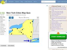
New York Cities Map Quiz
In this online interactive geography worksheet, students examine a map of New York and identify the 11 noted cities on the map using a pull down menu within 3 minutes.


