Curated OER
What A Tombstone Can Tell Us
In this coordinates worksheet, learners determine the coordinates to visit a cemetery. Students determine 18 coordinates on this worksheet.
Curated OER
Latitude on World Maps
Sixth graders examine the purposes of maps. In this Geography lesson, 6th graders practice using latitude and longitude on a map.
Curated OER
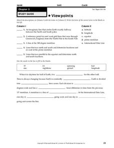
Viewpoints
In this map worksheet, students review latitude, longitude, equator, and prime meridian. This worksheet has 5 matching and 8 fill in the blank questions.
Curated OER
Sunrise and Sunset
Students utilize a Mesonet daily solar radiation to determine the times of sunrise and sunset and the length of the day. They describe how sunrise and sunset change with latitude and longitude and how the length of the day changes with...
Curated OER
Latitude and Longitude
Fifth graders study latitude and longitude. They estimate the latitude and longitude of their hometown and find the latitude and longitude of other cities using a map. They use a website to find out the cities' actual latitude and...
Curated OER
Geometry: Mountain Rescue Mission
Fifth graders improve their skills using map coordinates by playing a mountain rescue game. In pairs, they roll dice to determine their moves up a mountain. The team that reaches the rescue site in the shortest distance on the grid...
Curated OER
Latitude & Longitude Bingo
Pupils practice map reading skills through a reinforcement game of bingo. They select any 24 of 30 listed cities to write on blank bingo cards. Then using atlases, locate a city based on the latitude and longitudinal coordinates called...
Curated OER
Tracking Satellites Using Latitude and Longitude
Young scholars investigate how to track satellites using latitude and longitude. They investigate what man learns from all the satellites currently being studied today. Students analyze the four basic types of satellite orbits.
Curated OER
Social Studies: African Folklore and Geography
Students discover the connection between geography and folklore in several African nations. In groups, they record information from maps of their assigned countries. Students observe the pictures in books and match the geographic...
Curated OER
Mapping and Topgraphy- 8th Grade
Eighth graders practice interpreting a contour map as well as reading latitude and longitude in a team activity. Following a discussion on mapping terms, teams are given maps and estimate the distance between two points. Students...
Curated OER
Stranded along the Coast
Pupils plot stranding sites onto a map using latitude and longitude as well as compass directions with respect to coastal features. They identify several species of marine animals that might become stranded; distinguish their...
Curated OER
Lost at Sea: The Search for Longitude
Students research and chart the shortest course to circumnavigate the globe.
Curated OER
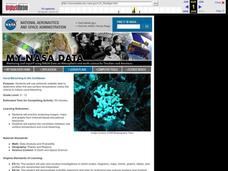
Coral Bleaching in the Caribbean
Students use authentic satellite data on the NASA website to determine when the sea surface temperature meets the criteria to induce coral bleaching.
Curated OER
Science: Hurricanes As Heat Engines
Students conduct Internet research to track the path of Hurricane Rita. They record the sea surface temperature of the Gulf of Mexico during and after the hurricane and draw conclusions about how hurricanes extract heat energy from the...
Curated OER
Map Coordinate Bingo
Students play a bingo-type game to locate cities by coordinates. They explain the use of orientation on a map and identify cities in the western hemisphere. They compare road maps, shutttle images, and a CIR image and obtain an...
Curated OER
Tell Time With Your Feet
Students discover what the latitude and longitude of their location is. They start walking and measure their shadow. They fill in a chart to discover the approximate time.
Curated OER
Mission Planning: Geography
Students investigate the use of latitude and longitude to locate specific locations on Earth and evaluate that location as a potential landing site for researchers, terrestrial or alien space missions.
Curated OER
Research Cruise Scavenger Hunt
Students track the research cruise of the Ronald H. Brown from San Diego to the Galapagos Islands. They match research groups with the key words, using the ship's daily logs to find the answers.
Curated OER
States with Attitude, Latitude and Longitude Dude
Sixth graders identify states whose boundaries are formed by lines of latitude and longitude or natural borders such as rivers. They trace a map of the U.S., and fill in borders, rivers and lines of latitude and longitude.
Curated OER
Finding Longitude and Latitude on Pennsylvania Maps
Students draw the lines of longitude and latitude on a map. Students look at a topographical maps to see how topography relates to land use.
Curated OER
How far have we traveled?
High schoolers practice longitude and latitude to determine given position on Earth's surface, convert and calculate angular measurements, and use Pythagorean Theorem to determine change in position or distance traveled between any two...
Curated OER
Navigation
Students study the basic methods for finding one's position on Earth. Latitude can be deduced from the height above the horizon of the pole star or of the noontime Sun, while longitude requires an accurate clock giving universal time.
Curated OER
Eagle Creek Park (A Hike)
Students plot a hiking course using aerial photos and a topographic overlay and find the latitude and longitude of absolute locations. They measure the total distance of a hiked area and figure the area of the ground walked using Heron's...
Science Buddies
Science Buddies: A Matter of Degrees: Tilt of Earth's Axis Affects the Seasons
In this science fair project, use a globe and a heat lamp to investigate how the angle of the Sun affects global warming. This project includes the objective, background questions, a list of all the materials you'll need, and the...


