Curated OER
The Geography of Europe
Students examine maps of Europe. In this geography skills lesson, students interpret several maps to determine the boundaries of the European Union and respond to assessment questions about the maps.
Curated OER
The Ottoman Empire
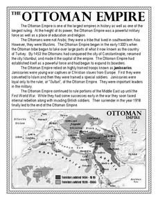
In this Ottoman Empire worksheet, students read a 1-page selection about the empire and examine a map. Students then respond to 5 short answer questions about the reading selection and the map.
Curated OER
Ancient Rome: Map Work
Seventh graders explore the Roman Empire. In this ancient Rome lesson, 7th graders participate in activities that require them to examine the history , political structure, chronology, and significant figures of the empire.
Curated OER
Topographic Maps
Students complete a worksheet about topographic mapping. In this map skills lesson, students examine the features and discuss the uses for topographic maps.
Curated OER
World War II Map
In this World War II map worksheet, students identify the labeled Axis and Allied countries on the map.
Curated OER
In Mr. Lincoln's Shoes
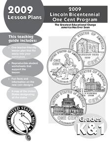
Students demonstrate basic map skills. In this US history lesson, students review cardinal directions and use a compass rose while at the same time discuss what life was like for Abraham Lincoln.
Curated OER
Roman Empire Map
In this Roman Empire worksheet, students label the 6 noted areas of the Roman Empire marked on the map.
Curated OER
Basic Geography of Canada
Young scholars identify different geographical locations in Canada by using an Atlas. In this geography of Canada lesson plan, students locate features such as rivers, lakes, cities, provinces, and more.
Curated OER
Maps, Maps, and More Maps
First graders create a map and display an understanding of the cardinal directions. In this map skills lesson, 1st graders listen to stories where a map would come in handy, create their own map, and use the cardinal directions accurately.
Curated OER
Consequences of the French and Indian War
In this map skills worksheet, students examine maps that show European land claims in North America in 1753 and 1763. Students respond to 4 short answer questions regarding the information.
Curated OER
Roman Empire: Physical Framework - Location, Borders, Dimensions
Students relate the classical world to the modern world. In this map skills lesson, students turn a blank map into a colorful complete map by following step-by-step directions. This lesson allows students to connect our current geography...
Curated OER
You Too Can Haiku
Students explore the country of Japan. In this international studies lesson, students utilize their geography skills to locate Japan on a map. Students explore some Japanese customs and communities. Students use descriptive language...
Curated OER
Grades 6-8 Lesson Plan - Cities as Transportation Centers
Students examine maps of the 1800's and 1900's. For this geography skills lesson, students collaborate to read core maps and identify transportation centers and travel networks.
Curated OER
Globe Skills Lesson 11The Vietnam War
Students develop their globe and map skills, In this geography lesson, students examine the Vietnam War as they complete an activity that requires them to plot latitude and longitude.
Curated OER
What You Can Learn From a Map
Students discover how to interpret maps. In this geography skills activity, students explore geographic themes as they complete worksheet activities regarding road maps, shaded relief maps, and topographic maps.
Curated OER
Getting from Place to Place
Students examine modes of transportation. In this transportation lesson, students listen to their instructor present a lecture on modes of transportation over the past 300 years. Students respond to questions about...
Curated OER
Globe Skills Lesson 1 Some Early American Cultures
Learners apply their knowledge of geography. In this geography skills lesson, students read brief selections regarding early Americans. Learners respond to the questions included in the self-guided map skills lesson.
Curated OER
Globe Skills Lesson 4 The Colonial Period
Middle schoolers practice their map skills. In this Colonial geography lesson, students complete an activity that requires them to locate English colonial locations using latitude and longitude coordinates.
Curated OER
Getting To Know Germany
In this getting to know Germany worksheet, students use map skills (map not included) to answer 14 questions, then draw a map of Germany labeling the capital and major cities.
Curated OER
Globe Lesson 4 - Intermediate Directions
Students explore the concept of intermediate directions. In this geography skills lesson, students use map skills in order to identify intermediate directions as they complete a map activity.
Curated OER
Globe Skills Lesson 6 The Louisiana Purchase
Students explore the Louisiana Purchase territory. In this geography skills lesson, students use map skills in order to plot and note latitude and longitude, measure scale distance, and locate landforms that were part of the Louisiana...
Curated OER
What Do Maps Show?
Students discover the uses for various types of maps. In this geography skills activity, students discuss the type of maps that exist and what their individual features are. Students then practice using different types of maps.
Curated OER
Geography Skills
Young scholars practice their geography skills. In this geography skills lesson, students locate, plot, and label places on maps and globes.
Curated OER
Mapping Electricity
Students complete Internet research and use their map reading skills to learn about how the United States creates and uses electricity in different states. In this energy sources instructional activity, students study the mini map...


