Curated OER
United States Map- Continent, Country, State
Students identify their continent, country, and state on a globe. In this geography instructional activity, students use a globe to identify the seven continents, the United States, and the state which they live in. Students define key...
Curated OER
Using Four Main Directions in the Classroom
Students identify the four cardinal directions. In this map skills geography lesson plan, students use a magnetic compass to label the four directions in the classroom. Students use the four directions to locate objects in the classroom.
Curated OER
World Map and Globe-Equator, North Pole, and South Pole
Learners identify the Equator, North Pole, and South Pole on a map. In this geography lesson, students use a world map and circle the North and South Pole. Learners locate the Equator on a globe and use a map marker to highlight it.
Curated OER
World Map and Globe- Introduction to Symbols
Students investigate picture symbols. In this symbols instructional activity, students define symbols and discuss symbols that they see in everyday life. Students identify symbols on maps by using post-it notes.
Curated OER
Landscape Picture Map
Students identify a neighborhood on a Landscape Picture Map. In this geography activity, students discuss the characteristics of their neighborhood and identify their neighborhood on a Landscape Picture Map. Students use post-it notes to...
Curated OER
Simple Route Map
Students demonstrate how to locate features on a Landscape Picture Map. In this map skills lesson, students locate and circle places where they would go to mail a letter, return a library book, or play a baseball game.
Curated OER
The Changing Landscape
Students explore how the landscape is constantly changing. In this landscape lesson, students identify a building under construction on the Landscape Picture Map. Students discuss the purpose of the construction and the effect on the...
Curated OER
The Globe and World Map
Students explore how to use maps for travel. In this map skills lesson, students read the text, With Love from Gran and discuss the places the character traveled. Students list the names of each city and country on chart paper.
Curated OER
North, South, East, or West
Students participate in a game to learn cardinal directions. In this map skills instructional activity, students move around the room using cardinal directions.
Curated OER
Archaeology- State Map
Students study state maps. In this map skills lesson, students identify the states' location and how to use a legend. Students complete photocopies of the state map.
Curated OER
Going to the Zoo
Students choose a map and follow directions to get to the zoo. In this physical education and map skill lesson, students follow a color map to get to the zoo. Students walk, jump or use other movement skills to reach the zoo.
Education World
Map Skills Worksheet 5
In this map skills practice worksheet, students practice reading a legend as they respond to 12 short answer questions regarding a legend and a map.
Curated OER
Continents and Oceans
In this geography worksheet, students read a paragraph and learn about the seven continents and five oceans of the world. Students study a map of the world and answer 12 short answer questions. This is an online interactive worksheet.
Curated OER
Latitude and Longitude- Online Interactive
In this maps learning exercise, students learn about longitude and latitude by reading a two paragraph text and studying two maps. Students answer 9 fill in the blank questions. This is an online interactive learning exercise.
Curated OER
Map Work: How Far?
In this map scale worksheet, learners analyze a map of an area with several towns marked. Students use the scale (1 cm = 1 km) to answer 6 questions about the distances between towns.
Curated OER
School-Home Link: Maps
In this atlas and parent communication form worksheet, students use an atlas to find several things: the capitol city of Japan, the number of countries in Africa, where to buy a newspaper, the names of Presidents of the United States,...
Curated OER
Treasure Map
In this writing worksheet, students find a treasure by following the correct path on the map. Students write directions telling exactly how to get there. A list of sequential words is provided to help students write directions.
Curated OER
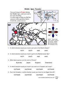
Middle Ages Traveler
In this map worksheet, young scholars are given three maps of France to use to answer multiple choice questions. Students complete an activity from the perspective of a Middle Ages traveler.
Curated OER
African Safari Adventure
Students conduct Internet research on the different safaris available. They locate and label safari sites on the continent of Africa. They create a PowerPoint presentation for the class to persuade the class why they should vote for...
Curated OER
Message in a Bottle
Sixth graders write a short story about being stranded on a deserted island. After a brief geography review of locations at various latitudes and longitudes, 6th graders draft their story about being stranded. They use sensory and...
Curated OER
Mediterranean Lands: A Pilgrimage Through Time and Space
Students will use context clues and examine several maps to answer series of short answer questions over range of geographical topics, identify specific places, practice using GoogleEarth to compare satellite views to those produced two...
Curated OER
Ancient Egypt: Connecting Literature and Geography
Students brainstorm prior knowledge of Ancient Egypt, locate Egypt on map of Africa and on world map, watch King Tut film, discuss term biography, and map geographical information mentioned in stories and documentaries about Ancient Egypt.
Curated OER
Continents and Oceans
Young scholars identify oceans and continents and their locations on a map. They color-code and label their own map of the world's continents and oceans. They play the game Continents and Oceans to identify specific areas.
Curated OER
Direction March
Students participate in a game that explores map reading skills and intermediate directions. The teacher turns over a direction card for each player or team and announces the move, and they move towards a designated cardinal or...


