TED-Ed
A Digital Reimagining of Gettysburg
Why would Robert E. Lee order Pickett's Charge, an action that changed the course of the Civil War? Geographer and historian Anne Knowles uses digital technology to explain what she thinks is the missing piece in trying to understand...
Curated OER
Earth from Space Maps
Learners use photo images from space to create a large map of the United States or the world, find where they live and label other places they know. They are exposed to a Web resource that allows them to view photo images of Earth taken...
Curated OER
Mapmaker, Mapmaker, Make Me a Map
Second and third graders practice with basic map skills. They create their own map including a legend and a compass rose. This fabulous plan has many excellent websites linked which allow learners to explore maps of all kinds; including...
Curated OER
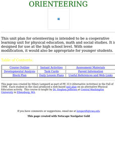
Orienteering
Everything you wanted to know about orienteering, and more! Take your class on an adventure with this creative activity. You will need to gather some supplies and materials and maps for your specific location, but the unit sounds like it...
Curated OER
Mapmaker, Make Me a Map!
Here is a well-designed, very thorough lesson plan on mapping for very young children. Within the six-page plan, you will find everything you need to implement the lesson. They will identify various landforms found in Colorado on a map,...
Teach Engineering
Using Map Scales to Figure Distances and Areas
The asteroid is getting closer and the question is whether the state of Alabraska is large enough for the shelter calculated in the previous activity. Teams determine the scale of their project and then use the scale on the map to...
PBS
Arthur Compass Rose
Keep your class headed in the right direction with this printable compass rose. Large and easy to read with a smiling picture of Arthur in the middle, this resource would make a fun addition to the desk of any primary grade...
PBS
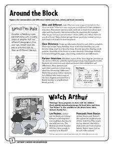
Around the Block
Arthur and his friends help children explore the concepts of family, community, and diversity in a fun series of activities. From performing peer interviews to mapping out the different places learners have lived or visited, this...
Owl Teacher
Imaginary Nation: Constructing a Map
Your young geographers will combine what they have learned about the five themes of geography and their inner creativity to design a physical map for an imaginary nation.
EngageNY
Reading Maps: Locating the Countries We Have Been Reading About
Show your class how to read a map and decipher all of the markings and features. Start out by connecting maps to their homework from the night before and their current reading, in this case That Book Woman, and a related informational...
Curated OER
Introducing Maps Through Dance
Students are introduced to the key concepts of maps; direction, pathway/line, shape and symbol. They create the pathways and shapes they have "mapped" out on paper on the floor. They dance along the paths.
Curated OER
What Can a Map Tell You?
Students investigate how maps can provide useful information about health issues. They study a map to draw conclusions about cholera death in London.
Curated OER
A world of oil
High schoolers practice in analyzing spatial data in maps and graphic presentations while studying the distribution of fossil fuel resources. They study, analyze, and map the distribution of fossil fuels on blank maps. Students discuss...
Curated OER
Understanding "The Stans"
Learners explore and locate "The Stans" in Central Asia to create, write and illustrate maps, graphs and charts to organize geographic information. They analyze the historical and physical characteristics of Central Asia via graphic...
Curated OER
Finding Your Way Around the World
Learners plan a trip around the world and create a PowerPoint presentation of the journey. In this map, atlas, and technology lesson, students plan a trip around the world in which they avoid using an airplane. Learners will consider...
Curated OER
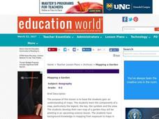
Mapping a Garden
Students study the components of a map, particularly the legend, the key, the symbols and the area. They develop their own map of a garden that they can plant in a future science lesson.
Curated OER
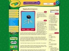
Mapping World Explorers
Students research early explorers from selected nations, routes, or time periods. After finding maps of exploration routes over water and land, they create a time line. Presentations are created in the form of three-dimensional models...
Curated OER
Using Social Studies in Five Shared Reading Lessons: Geography
After several short 15-minute mini-lessons, your learners will gain an understanding of the characteristics of a non-fiction text. Using the book Map It by Elspeth Leacock, your class will become acquainted with non-fiction terms...
Curated OER
Exploring Biomes Lesson 1: Mapping Biomes
Environmental science learners examine satellite imagery of temperature, vegetation, precipitation, and productivity. They use these maps to understand how scientists divide the planet into major biomes. As part of a larger unit on...
Curated OER
"Me" Resource
Learners elucidate themselves by writing up to six entries in different formats. Some formatting choices include a dictionary, encyclopedia, or atlas entry, a magazine article, a newspaper article, and a table of contents. Some...
Curated OER
Geography of South America
Young explorers study South American geography. They study maps and create a physical map of the Andes themselves! They also research the geography, environment, and the culture of the Andes and present a report to the class.
Curated OER
Countries Involved in World War II
Learners create their own floor map of Europe, Northern Africa, and the Pacific. They locate, identify, and speak for one of the countries involved. In addition, they classify the country they represent as an Axis Power or as an Allied...
Curated OER
Tiles, Blocks, Sapphires & Gold: Designing a Treasure Map
Young cartographers in groups hide treasure at school and then create a map to find it using pattern blocks and tiles. They make paintings with clues to create a visual representation of the location of their treasure. Groups present...
Curated OER
US City Quality of Life Analysis and Comparison
Students analyze US census data and criteria to compare and measure the quality of life in the country's fifty largest cities. After accessing the 2005 quality of life world report online, students conduct their study to compare three...


