Curated OER
Maps
If your students are just starting a unit on Geography this could be the introduction you're looking for. This PowerPoint presents a clear and organized overview of the different types of maps people use and why each is important. Tip:...
Curated OER
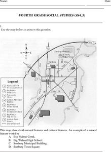
Fourth Grade Social Studies
In this social studies worksheet, 4th graders answer multiple choice questions on state maps, city maps, road maps, political maps, and more. Students complete 25 multiple choice questions.
Curated OER
Maps and Globes: Where in the World are We?
Students explore maps and globes. In this introduction to map and globe concepts lesson, students identify features of physical maps, political maps, and globes. Students locate land and water, and recite a poem about the names of the...
Curated OER
Summertime Travel
Third graders write about a summer event they participated in. In this paragraph writing lesson, the teacher models how to write about a place they have visited. Students then write their own paragraphs. Students will point out on the...
Curated OER
Central American Map
For this Central American political map worksheet, students examine the boundaries of this region of the world. The map may be used in a variety of classroom activities.
Curated OER
Africa Map
In this blank Africa map activity, students investigate the continent of Africa and it's political boundaries. No country borders are denoted.
Curated OER
United States Map
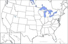
In this United States outline map worksheet, students make note of the political divisions of 50 states of the nation. This map may be used in a variety of classroom activities.
Curated OER
United States Map: Capitals
In this United States outline map worksheet, students make note of the political divisions of 50 states of the nation. This map is labeled with the 50 state capitals.
Curated OER
Australia Map: Labeled
For this Australia outline map worksheet, students make note of the political divisions of the 5 provinces and territories of the nation. This map is labeled.
Curated OER
Canada Outline Map
In this Canada political map worksheet, students examine the province boundaries of the nation. The province names are labeled on the map.
Curated OER
European Country Map
In this Europe political map worksheet, students examine the national boundaries. The country names are labeled on the map.
Curated OER
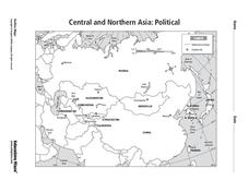
Central and Northern Asia: Political
In this Central and Northern Asia outline map, students examine the political boundaries of the nations in this region and note the location of their capital cities. This unlabeled map may be used in a variety of classroom activities.
Curated OER
Central and Northern Asia: Political
In this Central and Northern Asia map worksheet, students examine national political boundaries and national capitals in this region of the world. The map is labeled.
Curated OER
Water Features - Lesson 2 - U.S. Political Map Grade 4-5
Students locate water features on maps. In this geography lesson plan, students complete worksheets that require them to identify water features on a U. S. political map.
Curated OER
Southeast Asia and the South Pacific: Political
In this Southeast Asia and the South Pacific political map instructional activity, students examine boundaries of each of the countries and the placement of the capital cities. The major bodies of water are labeled.
Curated OER
World: Political Map
In this world political outline map worksheet, students examine boundaries of each of the countries in the world. This map not is labeled.
Curated OER
Asia and the South Pacific: Political Map
In this Asia and the South Pacific map worksheet, students examine national political boundaries and national capitals in this region of the world.
Curated OER
South America Map
For this South American political map worksheet, students examine both national boundaries and national capitals.
Curated OER
Europe: Political Map
In this Europe political map instructional activity, students examine each country's boundaries. The map also highlights each of the nation's capitals with a star.
Curated OER
US: Midwest Region
In this United States political map worksheet, students examine the state boundaries of the Midwestern Region. The map also highlights each of the state capitals denoted by stars.
Curated OER
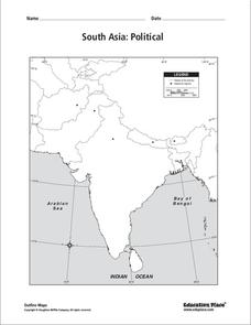
South Asia: Political Map
In this South Asia political map worksheet, students examine the national boundaries. The map also highlights each country's capital city.
Curated OER
South America Map
In this South America political map learning exercise, students examine the country boundaries. The map also labels each of the countries and their capitals.
Curated OER
Central America: Unlabeled Map
In this Central American political map learning exercise, students examine the boundaries of the countries and capital cities located in this region of the world.
Curated OER
Mexico: Political Map
In this Mexico political map worksheet, students examine state boundaries. The map also highlights major cities in Mexico.


