Curated OER
How Big is Big?
Geography learners compare and contrast population densities throughout the world. Using maps, they estimate the relative size of the world's regions and populations. They develop analogies to discover the world they live in and...
Curated OER
Where is Everybody?
Middle schoolers collect data from different grade levels at their school and develop thematic maps which show population density, and determine how this might affect the school and themselves in the future.
Curated OER
Social Studies: Area and Population Density
Math scholars of many ages examine the concept of population density and then discuss the significance of the population densities of Minnesota and China. They figure the population density of their school.
Curated OER
Population Density
High schoolers examine world population density and population distribution. They create pie charts showing population distribution and analyze population patterns in the United States and major regions of the world. They identify...
Curated OER
Size It Up: Map Skills
Compare information from a US population cartogram and a standard US map. Learners draw conclusions about population density by analyzing census data a population distribution. They discover that census data is used to apportion seats in...
Curated OER
Population Pyramid
Young scholars learn about demographic population pyramids. They then design and fictitious nation and draw its population pyramid.
Curated OER
Changes in Ecosystems
In this changes in ecosystems worksheet, students complete 21 various types of questions related to ecosystem. First, they determine whether each statement is true or false based on vocabulary. Then, students determine whether natural...
Curated OER
Comparative Geography I
Students use population density and other statistics to compare countries. They find the population density for the countries listed in the table. Students compare findings with a partner, and then share with the class.
Curated OER
The Effects of Limited Space on a Culture
Students predict the impact of population density on shelter, transportation, recreation, land use, and social skills and then research that impact on Japan. They write a response about the impact of population density on food...
Curated OER
Population Density in the Ghettos
Students make calculations of population density to recognize the stressful conditions experienced by European ghetto dwellers due to high population density and scarcity of resources.
Curated OER
Population and Population Density
Students read and interpret graphs. For this population lesson, students explore population and population density as they read several data graphs and respond to questions.
Curated OER
Population Density in the Ghettos
Students examine population density in Jewish ghettos. In this Holocaust lesson plan, students calculate population density of cities around the world using the provided information. Students then discuss the implications of high...
Curated OER
Size of Per Unit Quantity
Fifth graders use various strategies to find the area of land, the area of forestry and the population of Japan and the US. In this size per unit lesson, 5th graders explore how to figure ratio. Students draw pictures to...
Curated OER
Mapping Counties
Students practice reading a map. In this mapping lesson, students illustrate a map and compare and contrast the counties based on their population. Students also explore what a census is and read census data on a map. A student...
Curated OER
GED Vocabulary: Earth and Space Science-Glaciers and Populations
In this earth and space science worksheet, students complete a crossword puzzle given 7 clues and a word bank on topics such as glaciers, weathering and population density.
Curated OER
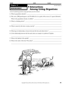
Interactions Among Living Organisms
In this animal population worksheet, students will complete 8 short answer questions based on population density, including limiting factors and carrying capacity.
Curated OER
Europe Puzzle
In this geography learning exercise, students complete a crossword puzzle in reference to the geography of Europe. They identify the capital cities of various countries and the bodies of water which surround specific countries of Europe.
Curated OER
Asia Crossword
In this geography worksheet, learners complete a crossword puzzle on the continent of Asia. They answer 21 questions related to the type of government systems found, capital cities, deepest lake, and lowest population density.
Curated OER
Population Density
Middle schoolers use the scientific method to conduct an experiment and use varied methods to gather background information. They correctly use lab equipment and prepare tables and graphs that organize, conclude, and present their...
Curated OER
Population Dynamics
Pupils are divided into groups, each group goes to a randomly selected area of the field. They lay out a one square meter plot. Using string to mark the square. Students identify some sort of vegetation that is easy to count within...
Curated OER
Where Should We Put a Store?
Students analyze population data. They convert population data into simple density maps to help make decisions about their world. They select the best location for a school store based on population density. They present their maps...
Curated OER
Investigating Space Requirement of Seed Plants
Students use scientific methods to investigate the effects of overpopulation of seed plants on growth in a limited living space. Students relate seed plant population findings to that of other organisms.
Curated OER
Satellite Images- Night Time
Fourth graders study the geography and population distribution of various places on earth. They utilize actual satellite images of the night sky (lights showing heavily around area of dense population) to study and make observations...
Curated OER
Census Report
Students write and or present a report contrasting geographic and demographic features (e.g., average annual income, population density, mortality rate, literacy rate) of countries where the target languages is spoken to the U.S. They...


