Curated OER
Class Activity: Satellite Tracker
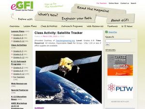
Demonstrate how the Skywatch website works, locating your city via The International Space Station. Have cooperative groups use string and a protractor to identify an azimuth. When each groups' height has been marked, you will have a...
Curated OER
Cryosat Mission
Beginning with general information on satellites and seasons, concluding with polar ice and the Cryosat Mission, this worksheet gives your earth scientists an opportunity to conduct some research. Most of the assignment consists of short...
Smarter Balanced
View Through a Telescope
Preparing for an assessment? Here's an activity that will ensure that all class members have the background knowledge they need to demonstrate their skills on a performance task related to the solar system and the tools astronomers use...
Curated OER
Exploring Space: Scramble
Middle-school space science explorers review remote sensing and electromagnetic radiation vocabulary terms by unscrambling them. Consider having space scholars write out the definitions for each after unscrambling. If they take time to...
Curated OER
Imagers: The Adventure of Echo the Bat Number to Pictures: How Satellite Images are Created
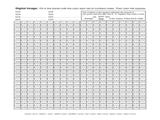
Students examine the three primary colors of light and design a numerical code to represent those colors. They tell how satellites use numbers to create satellite images after completing a number of experimental activities.
Curated OER
Satellites and the Radiation Budget
Students engage in a prelab discussion about the earth's radiation budget and global warming. They use "trading cards" to find specific websites to research radiation budget questions.
Curated OER
Where Am I - Navigation and Satellites
Students explore geography by completing a navigation activity in class. For this satellite positioning lesson, students define terms such as orbit, satellite, GPS and triangulation. Students view diagrams of the Earth's orbit and...
Curated OER
Eyes in the Sky
Students examine the use of satellites. In this research lesson, students discuss the history of satellites and how we use the information today. They will conduct interviews with older adults who have lived in the changing times from...
Curated OER
The STEREO Mission: Getting The Message Across
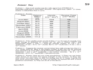
In this STEREO satellites worksheet, students are given a chart with the intensity of the signals from the satellites received on Earth and the distances of the satellite from Earth. Students convert the intensity at each distance to...
Curated OER
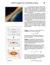
NASA Juggles Four Satellites at Once
In this NASA satellites worksheet, students read about the Magnetosphere Multi-Scale satellite constellation that NASA will launch in 2013. They solve 4 problems including finding the volume of the MMS constellation, finding how long it...
Curated OER
A Matter of Timing
In this orbital period worksheet, students solve 2 problems about satellites and their orbits. They determine how many days it takes for two satellites to be in "opposition", they find the least common factor between their orbit periods...
Curated OER
Stars in Your Eyes
In this solar system worksheet, students answer 20 short answer questions about the stars, the planets, the sun and moon, meteorites and constellations.
Curated OER
Satellite Mobiles K-2
Students explore satellites and their function. They view a photo essay about the many kinds of satellites and the jobs they do. Afterwards, they construct satellite mobiles, discuss the various features of their satellites, as well as...
Curated OER
Cities and Seasons
Students explore how satellite images show seasonal changes in seven cities in North and South America. Through a sequence of images, they study the green-up and brown-down of the seasons and how seasons change over time. Afterwards,...
Curated OER
Introduction To Orbital Mechanics
Students use NASA drawings to build a model satellite for a specific mission. They design a set of drawings for their satellite showing its subsystems as well.
Curated OER
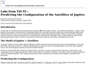
Predicting the Configuration of the Satellites of Jupiter
Learners plot the positions of the planet Jupiter while predicting what the configuration system looks like from Earth. In this configuration of satellites lesson plan, students photograph Jupiter and its moons to record the motions...
Curated OER
Sea Ice and Satellites
Students study satellites and satellite images using Google Earth. In this satellite instructional activity, students discuss satellites and how they work. Students watch a demonstration of how satellites work and learn what they are...
Curated OER
Our Solar System
In this solar system instructional activity, students read about the planets, asteroids, meteoroids, comets, and the moon. Then students complete 25 multiple choice, 4 true or false, and 3 short answer questions.
Curated OER
GPS Worksheet
In this GPS worksheet, students complete 6 fill in the blank questions about GPS satellite signals, receiver units and the acronyms used in GPS technology.
Curated OER
Studying Exothermic and Endothermic Reactions
Learners explore the mesosphere and lower thermosphere globally and achieve a major improvement in our understanding of the fundamental processes governing the energetics, chemistry, dynamics, and transport of the atmospheric region....
Curated OER
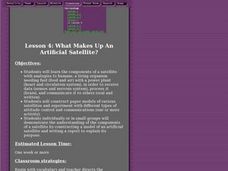
What Makes Up An Artificial Satellite?
Students discover the components of a satellite using analogies to humans in a class discussion and participate in an activity in which they construct a paper model of a satellites and experiment with different types of attitude control...
Curated OER
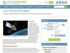
Not So Lost in Space
Students investigate how engineers navigate satellites in orbit around the Earth and on their way to other planets in the solar system. They study vocabulary words and participate in studying a satellite by learning about times and...
Curated OER
It's About Time
Learners investigate how Global Positioning Systems work and how and why GPS receivers make errors. They graph data points and apply estimation and prediction to real-life GPS situations, discuss time delay, and complete a worksheet.
Curated OER
Altimetry
Fifth graders accurately measure the distance to eight points on an uneven surface by conducting a simulation of sattelite altimetry. They create a two-dimensional model of the simulated ocean surface by graphing data from the Radar Run...


