Curated OER
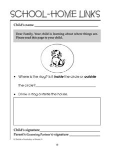
School-Home Links 72
In this spatial concepts worksheet, students tell whether a dog is inside or outside a circle. Students then draw a dog outside a house. Parents or guardians must sign the worksheet.
Curated OER
Visual Arts: Using Imagery
Middle schoolers extend the colors, shapes, textures and lines of an unknown composition to create perspective in their drawings. Using oil pastels, they work in pairs to create a long continuous artwork of imagery inspired by sailing...
Other
Overlap Maps
A map interactive provides an opportunity for observations through overlapping maps. Students are able to better recognize spatial awareness through this program.
Other
Ggmap: Spatial Visualization With Ggplot2 [Pdf]
In spatial statistics the ability to visualize data and models super imposed with their basic social landmarks and geographic context is invaluable. ggmap is a new tool which enables such visualization by combining the spatial...
University of South Florida
Propel: Social Studies Education Geography
Geography studies the relationships between people, places, and environments by mapping information about them into a spatial context.
Alabama Learning Exchange
Alex: Treasure Hunt
Get hands-on with students in building a map with a class. Take students outside to a sandbox and work with them to build a map of campus. Once the map is drawn you can turn their design into a treasure hunt to assess map interpretation.
California Digital Library
Calisphere: Maps
A broad selection of images featuring maps can be found on this site by Calisphere. By clicking on individual images you'll find high quality photographs and image information.
Chateau Meddybemps
Spatial Concepts
Explore spatial concepts with these activities. Use them to aid in-class discussions about spatial sense or as group or partner activities.
National Council of Teachers of Mathematics
Nctm: Figure This: Visualizing
Is seeing believing? Explore visualizing and spatial reasoning with three dimensional shapes in this challenge from the NCTM Math Challenge for Families collection. Discover why visualization is essential skill in real world situations.
Scholastic
Scholastic: I Spy
These interactive matching games for elementary age students combine visuals of familiar objects and rhyming riddles to create brain-teasing puzzles.
University of Nebraska Omaha
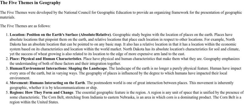
University of Omaha: The Five Themes in Geography
An explanation of the five themes in geography.
Other
Mapping and Map Use in the Age of Information Technology
An article to help one understand the concept of electronic or interactive mapping.
Chateau Meddybemps
Chateau Meddybumps: Learning Activities: Spatial Concepts: Doghouse
Move animals around the doghouse to examine and discuss spatial relationships such as above, under, and next to.
Chateau Meddybemps
Chateau Meddybumps: Learning Activities: Spatial Concepts: Birds in a Row
Move birds in and out of line to create and practice various spatial relationships.
Chateau Meddybemps
Chateau Meddybumps: Learning Activities: Spatial Concepts: Index of Images
An index of images that helps reinforce spatial concepts such as on, in, up, down, over, under, and more.
ClassFlow
Class Flow: Global Knowledge Where in the World Am I?
[Free Registration/Login Required] This flipchart explains the division of the hemispheres, northern and southern, and eastern and western. The Equator and Prime Meridian are defined, as well as latitude and longitude. Students are given...
University of Cambridge
University of Cambridge: Nrich: Roll These Dice
Sharpen your problem solving, sequencing, and spatial reasoning skills playing this interactive game, Roll The Dice. See how many different paths you can take to end up with the same result.
Houghton Mifflin Harcourt
Houghton Mifflin Harcourt: Saxon Activity Center Real World Investigation: The Geometry of Quilts [Pdf]
Investigating designs and shapes in quilts around the world is the activity in this internet exploration. Learners will also design their own quilt on paper or on the computer. Acrobat Reader required.


![Ggmap: Spatial Visualization With Ggplot2 [Pdf] Article Ggmap: Spatial Visualization With Ggplot2 [Pdf] Article](https://d15y2dacu3jp90.cloudfront.net/images/attachment_defaults/resource/large/FPO-knovation.png)


