Curated OER
State or Region Project
Invite your youngsters to learn about a state or region through their choice of a creative project. The resource lists 15 project options that range from a 3-D map of the area, to a puppet show about the region. Pupils can also propose...
Curated OER
Cities, States, Countries & Continents
In this geography worksheet, students fill in 7 blanks with the correct geography word. Clues are given for each blank, and answers are provided.
Curated OER
Geography A to Z: The Letters W,X,Y and Z
Warm up the class with a fun geography quiz. They'll use the letters W, X, Y, and Z to answer seven geography-based questions. Y for Yangtze, Z for Zimbabwe, or Y for Yugoslavia.
Curated OER
Searching the States (or Provinces) Scavenger Hunt
Students examine information on a particular state or province. Groups of students use the internet to locate facts about an assigned state. They research information such as capital, state song, and major crops. students report their...
Curated OER
The City I Live In
Research information about your city and state. Pupils investigate details such as the name of the city mayor, local establishments, and entertainment. For the state, they name the capital, governor, state flower, and flag. There are...
Curated OER
Promote Your State with a Poster
Fourth graders create a poster of their state that would inspire others to want to visit their state. They learn about places that people should and could visit in their state and have a broader understanding of the tourism industry.
Curated OER
Maps
Maps, globes, and computer software aid young explorers as they locate state capitols, major cities, geographic features, and attractions for states they are researching. They then use desktop publishing software to create a map to share...
Curated OER
Me on the Map Lesson 2
Students analyze and interpret maps, globes and geographic information systems to define and identify cities, counties, states, countries and continents to create a booklet called me on the map. They also determine and calculate the...
Curated OER
Three Levels of Government
Young scholars name and broadly classify the powers and duties of each level of executive government in Australia. They identify and examine areas of overlaid and cooperation between various executive levels. Students examine the...
Curated OER
Federal and State Laws on Hazardous Waste
Learners examine how laws on hazardous waste is developed and enforced. They work together to discover how statutes are passed as well. They complete an activity to end the activity.
Curated OER
States and Capitals Unit
Fifth graders explore the regions, states, and capitals that make up the United States. Through the five lessons in this unit students locate and name the fifty states and their capitals.
Curated OER
Energy and Changes of State
Students complete a variety of labs to help them explain how energy affects the changes in states of matter. They also be required to collect and record data, graph data, and apply interpretations of that data.
Curated OER
Makers of the Law, The Legislative Branch
Students, in teams, research the legislative branch and complete a "Legislative Information List." Teams research different parts of the list and jigsaw teach the other groups about each part. One group researches names of state officials.
Curated OER
State Capitals Fun
Third graders study the capitals of each state. In this social studies lesson, 3rd graders use a map of the United States to identify and locate each state's capital city. Students discuss map symbols used to identify capital cities.
Curated OER
State Nicknames - A Right Angle Puzzle
In this right angle puzzle, students identify the names of states by their nickname. They write the names of the states on a puzzle. This three-page worksheet contains 50 clues. Instructions are on the first page,...
Curated OER
Early American Leaders
Learners discover what the qualities or characteristics of a leader are by describing the traits of the principal of the school, followed by the leader of the town, state and country. In this leadership lesson, students will take the...
Curated OER
Flags
First graders investigate flags and their meaning. In this flag lesson, 1st graders explore the flags of states that grow rice. Students understand that flags have meaning and match flags to their states.
Curated OER
United States Map- Continent, Country, State
Young scholars identify their continent, country, and state on a globe. In this geography lesson plan, students use a globe to identify the seven continents, the United States, and the state which they live in. Young scholars define key...
Curated OER
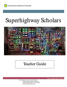
Superhighway Scholars
Young scholars study the states of their choice by using Superhighway Scholars website. For this Unites States history lesson plan, students create a collage using information collected about a state of their choosing. This lesson plan...
Curated OER
Internet Challenge Worksheet
In this Internet challenge worksheet, students research 5 different web sites on the Internet for information. First, they search Yahooligans and Yahoo on Indians to see how many sites they can pull up. Then, students search google and...
Curated OER
Kentucky Puzzle
In this Kentucky word search puzzle, learners identify the names of towns and cities in Kentucky. A list of 48 towns is provided to assist the students in their search.
Curated OER
Idaho Puzzle
In this Idaho puzzle, learners identify the names of cities and towns located in Idaho. A list of 45 towns is provided to assist students in their search.
Curated OER
Indiana Puzzle
In this Indiana word search puzzle, students identify the names of towns and cities located in Indiana. A list of 60 names is provided to assist the students in their search.
Curated OER
Georgia Puzzle
In this Georgia word search puzzle, students identify names of towns and cities found in Georgia. A list of 50 names is provided to assist students in their search.


