Curated OER
Explosive Ideas!
Students explore the layers of the Earth and the dynamic changes that they cause on Earth's surface. Volcanoes and earthquakes become the focus of the lesson as the Oregon State quarter and its Crater Lake images are linked to the topic.
Curated OER
What's the Difference?
Students discover how volcanic processes differ at convergent and divergent tectonic plate boundaries. They identify three geologic features that are associated with most volcanoes on Earth.
Curated OER
The Distance Between Us and Them: Sea Floor Spreading in the Atlantic Ocean
Young scholars examine how geologists determine rates of sea floor spreading between two tectonic plates. They apply mathematical concepts such as the calculation and use of velocities and conversion from one set of units to another.
Curated OER
Peru's Earthquake
Students identify the patterns of earthquakes by mapping USGS data and comparing it to mapped tectonic plates. They discover the relationship between earthquakes and the moving plates of the Earth's crust.
Exploratorium
Exploratorium: Loma Prieta, Bay Area, Earthquake 1989
This outstanding multimedia site documents the earthquake and related events that took place on October 17, 1989 in the San Francisco Bay Area.
Exploratorium
Exploratorium: On the Road With the Faultline Project
This outstanding multimedia website follows the San Andreas fault system up the California coast from San Diego to just north of San Francisco on the coast.
Center for Innovation in Engineering and Science Education, Stevens Institute of Technology
Ciese: Musical Plates: A Study of Earthquakes and Plate Tectonics
This activity has students access USGS earthquake information to plot the their locations on a world map. Doing this will help students discover for themselves the boundaries of tectonic plates.
PBS
A Science Odyssey: You Try It: Plate Tectonics
Using your computer mouse you can simulate transforming, collisional, divergent and convergent plate boundaries. Descriptions of each plate boundary are also available.
American Museum of Natural History
American Museum of Natural History: O Logy: Plates on the Move
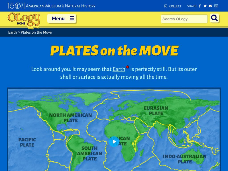
Find an interrelated set of tools--maps, animations, diagrams, photographs, and text--to help you understand tectonic plates and how they move.
eSchool Today
E School Today: Your Cool Facts and Tips on Earthquakes
Explains what earthquakes are, what causes them, the different types, tsunamis that can be caused by them, and how to prepare if living in an earthquake-prone area.
Other
Paleomap Project: Earth History
The PALEOMAP Project illustrates the plate tectonic development of the ocean basins and continents, as well as the changing distribution of land and sea during the past 1100 million years. Includes virtual 3D paeloglobes.
Other
Federal Emergency Management Agency: Tremor Troop: Earthquakes [Pdf]
A 260-page unit of activities on earthquakes. Covers what they are, their cause, why and where they occur, their impact on the Earth, how they are measured, and safety and survival. Includes worksheets and has a glossary at the end.
Other
Nasa: Iss Earth Kam
Students get a whole new perspective of the world through images obtained from the International Space Station. Students can even request images to be taken through ISS EarthKAM. Activities and educator guides are provided.
Annenberg Foundation
Annenberg Learner: Interactives: Dynamic Earth: Slip, Slide, & Collide
Looking for more information about plate tectonics and what happens at plate boundaries? This site gives definitions of all plate boundaries as well as animations to help visualize what is happening.
Texas Education Agency
Texas Gateway: An Introduction to Plate Tectonics
The following learning module is an exploration of plate tectonics.
Annenberg Foundation
Annenberg Learner: Earth and Space Science: When Continents Collide
Material to begin an exploration of plate tectonics and mountain formation. An hour-long video is accompanied by learning goals, an outline and overview, details on metamorphic rocks and mountain building, and ideas for teaching this...
University of Washington
University of Washington: Mountain Building
A detailed description of tectonic plate collisions. There are illustrations of Indian and Eurasian plate collision.
Exploratorium
Exploratorium: Earthquake Faultline Earthquake Activities
This outstanding website provides an excellent variety of hands-on earthquake activities to help you understand what causes earthquakes.
National Geographic
National Geographic: Encyclopedia: Mantle
An in-depth look at the structure and composition of Earth's mantle, with lots of visuals. Covers lithosphere, Mohorovicic discontinuity, asthenosphere, transition zone, lower mantle, the d double-prime region, mantle convection, mantle...
Incorporated Research Institutions for Seismology
Iris: Gps Measuring Plate Motion [Pdf]
This resource looks at how geologists are able to measure the movement of tectonic plates using satellite-based data and how they were able to surmise in the past that the plates were moving. It also discusses how to read GPS time-series...
Indiana University
Indiana University Bloomington: Foldable Fault Blocks [Pdf]
In this lesson, students will create three-dimensional (3-D) blocks out of paper to learn about the types of faulting that occur at the Earth's surface and its interior. Students will manipulate three fault blocks to demonstrate a normal...
National Geographic
National Geographic: Plate Tectonics
A short tutorial on plate tectonics. Includes a video, background reading, three questions, fast facts, and a vocabulary list. Discusses the publication of the Tharp-Heezen map of the seafloor in 1977 which paved the way for a much...
PBS
Pbs Learning Media: Tectonic Plates and Plate Boundaries
This interactive activity adapted from NASA features world maps that identify different sections of the Earth's crust called tectonic plates. The locations of different types of plate boundaries are also identified, including convergent,...
PBS
Pbs Learning Media: Tectonic Plates, Earthquakes, and Volcanoes
This interactive activity produced for Teachers' Domain shows the relationship between tectonic boundaries and the locations of earthquake events and volcanoes around the world.







![Federal Emergency Management Agency: Tremor Troop: Earthquakes [Pdf] Lesson Plan Federal Emergency Management Agency: Tremor Troop: Earthquakes [Pdf] Lesson Plan](https://d15y2dacu3jp90.cloudfront.net/images/attachment_defaults/resource/large/FPO-knovation.png)
