Curated OER
Mountains
An informative and well-designed presentation on mountains awaits your geographers. Excellent photographs from mountain ranges around the world are includedin this terrific PowerPoint. The last slide effectively sums up what pupils have...
Curated OER
Mapping the Aegean Seafloor
Earth science learners create a two-dimensional topographic map of the floor of the Aegean Sea. They use it to then create a three-dimensional model of the ocean floor features. This comprehensive resource delivers strong background...
Curated OER
Changing Planet: Sea Levels Rising
Begin by showing a six-minute video, Changing Planet: Rising Sea Level as an anticipatory set. Pupils draw a topographic map of a potato continent. Finally, they will visit NOAA's sea levels online map and NASA's carbon dioxide...
Curated OER
What Do Maps Show?: Lesson 4 How to Read a Topographic Map
Students examine the use of topographic maps as two dimensional representations that show elevations and slopes with contour lines. They read maps of the Salt Lake City, Utah area and complete the associated worksheets that show map...
Curated OER
Student Exploration: Building Topographic Maps
In this earthquake exploration worksheet, students complete 2 prior knowledge questions, then use "Building Topographic Maps Gizmo" to conduct several activities, completing short answer questions when finished.
Curated OER
When You Were My Age, What Was This Place Like?
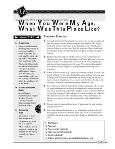
Students discover how land use in their community has changed. In this community and ecology instructional activity, students scan old newspapers to find articles about the development of community land. Students discuss and predict how...
Curated OER
Identifying Watersheds with Topographic Maps
Young scholars model a watershed and delineate one using topographic maps. In this hydrology lesson, students use aluminum foil to model a landscape and observe how water moves on it. They also observe the features of a topographic map...
Curated OER
Creating a Topographic Map
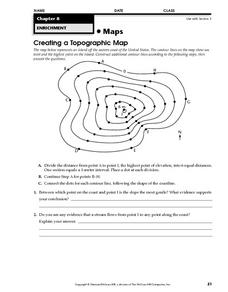
In this topographic map worksheet, learners add contour lines to a topographic map using instructions provided. Once topographic map is finished, students complete 2 follow-up short answer questions.
Curated OER
Denali Park Topographic Maps
Young scholars construct a topographic map of the Denali National Park. They identify different elevations and record historic landmarks in student science journals.
Curated OER
Take a Hike
In this geography skills learning exercise, students respond to 9 questions that require them to read topographic maps and interpret them. The topographic maps are not included.
Curated OER
Topographic Maps Worksheet
For this geography skills worksheet, students respond to 37 multi-part questions that require them to read and interpret topographic maps.
Curated OER
Topographic Maps
Young scholars complete a worksheet about topographic mapping. For this map skills lesson, students examine the features and discuss the uses for topographic maps.
Curated OER
Playdoh Mountains
In this mountain building worksheet, students use playdoh to create mountain features. They cut apart the mountain and then use the pieces to create a topo graphic map of their mountain.
Curated OER
Topographic Map Unit Plan
Students examine topographic maps and discover how to decipher contour intervals, use contour lines and apply information to complete a topographic map lab. Working in groups, they identify the scale of the map, latitude and longitude,...
Curated OER
The Landscape of Poland
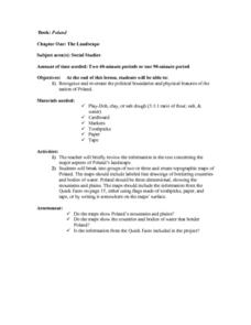
Young scholars recognize and re-create the political boundaries and physical features of the nation of Poland. They create three dimensional topographic maps of Poland. In addition, they compose two journal entries written in two...
Curated OER
River Study
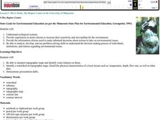
Pupils explore a stream in their area and show the class the topographic map of the stream. They locate the topographic map and name the streams, lakes and ponds in their watershed. They write a paragraph about their stream and complete...
Curated OER
Comparing Topographical Maps to 3-Dimensional Models
Students apply knowledge of topographical maps and how computer programs are used to make 3-D models of areas that humans have never visited. They view a Mars Canyon movie, then map the canyon.
Curated OER
Building A Topographic Model
Students visualize, in three dimensions, features represented by contour lines on a topographic map. They see that the different elevations shown on a two dimensional topographic map can be used to build a 3-D model.
Curated OER
River Study
Students study physical features of a local stream. They study how to identify water features on topographic maps.
Curated OER
Science Excursion: Cover Mapping Land
Students study remotely sensed images and topographic maps to classify land cover types in their watershed area. They take samples in the watershed area to interpret the images.
Science Education Resource Center at Carleton College
Serc: Geo Map App Learning Activities: Rules of Contouring
Using GeoMap software, students learn how to read topographic maps, and the rules for using contour lines on a map. Detailed teacher and student handouts are provided. (GeoMap software can be downloaded at: http://www.geomapapp.org/.)
PBS
Pbs: M, M, M (Maps, Maps, Maps)
This is an online activity on Topographic maps with stated objectives, an activity, background information, evaluation, and resources. This site has information on where you can adjust the activity for elementary or secondary age levels.
Other
Geoscience Australia: Map Reading Guide: How to Use Topographic Maps [Pdf]
A topographic map can be challenging to read. This guide explains how to decipher one and how to use a magnetic compass to orient yourself to the landscape. It also explains how to use GPS coordinates.
US Geological Survey
U.s. Geological Survey: 27 Ideas for Teaching With Topographic Maps
A collection of twenty-seven activities that can be done with topographic maps, for elementary up to university level students. Includes many accompanying resources.








![Geoscience Australia: Map Reading Guide: How to Use Topographic Maps [Pdf] Handout Geoscience Australia: Map Reading Guide: How to Use Topographic Maps [Pdf] Handout](https://d15y2dacu3jp90.cloudfront.net/images/attachment_defaults/resource/large/FPO-knovation.png)