Curated OER
Horse and Rider: The Pony Express in Utah
Fourth graders research the Pony Express. In this Pony Express lesson plan, 4th graders discover the reasons behind the development of this business and the technology that ended it.
Curated OER
Geography and Topography, History and Architecture
In this social studies lesson plan, students answer short answer questions about the geography, topography, history, and architecture of the east part of the United States. Students complete 24 questions.
Curated OER
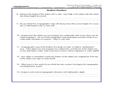
A Watered-Down Topographic Map
Eighth graders explore the ocean floor. In this topography activity, 8th graders compare topographical maps to bathymetric charts. They will create a topographic map and note landmarks and other land features.
Curated OER
Maps
Learners investigate threee types of maps. In this algebra lesson, students idenitfy different maps and explore how they relate to the area keeping cllimate and topography in mind. They discuss maps used to navigate land. air and sea.
Curated OER
Identifying Watersheds with Topographic Maps
Learners model a watershed and delineate one using topographic maps. In this hydrology lesson plan, students use aluminum foil to model a landscape and observe how water moves on it. They also observe the features of a topographic map...
Curated OER
Compare Topography of Earth and Mars with a Worldwide Telescope
Students compare geography to topography. In this topography instructional activity, students examine the topography of the surfaces of the Earth. Students compare one feature of Earth to one feature of Mars and present in a PowerPoint.
Curated OER
Topography of Africa
Students study Africa's diverse landscape and investigate how these features impact the available water supply, food sources, and population distribution of the continent. They compare topographical features and
their affect on each...
Curated OER
Orienteering
Students acquaint with co-participants and identify the practice basic compass functions and orienteering procedures. They also work together to solve a small challenge. Students then identify how the challenge of orienteering relates...
Curated OER
MAPS AND TOPOGRAPHY
Students analyze the details of a topographic map and create one of their own by utilyzing a map of elevations.
Curated OER
Cookie Topography
Learners construct a cross section diagram showing elevation changes on a "cookie island." Using a chocolate chip cookie for an island, they locate the highest point in centimeters on the cookie and create a scale in feet. After tracing...
Curated OER
GEOGRAPHY: SPACE CENTERS
Students examine the descriptive science dealing with the surface of Earth, its division into continents and countries, climate, natural resources, inhabitants and industries of the various divisions and analyze the political geography...
Curated OER
Cookie Mapping
Students study the components of a bedrock geology map through a hands-on activity involving a cookie and graph paper.
Curated OER
A Shuttle's Eye View
Students explore the goals of the Shuttle Radar Topography Mission as a springboard to exploring the topographical features of their own state or region. They synthesize their understanding of landforms and topography by mapping their...
Curated OER
Weathering the War
Students research maps, weapons and weather from a variety of wars, then create a presentation showing the impact weather and topography has had on military operations.
Curated OER
Contour Map Worksheet #4
There are only four questions here. There is a contour map of Cottonwood, Colorado and the creek that crosses it. Earth scientists tell in what direction the creek flows, identify the highest elevation on the map, draw a topographic...
Curated OER
Working With Electronic Topography Maps
Junior geologists examine topographic maps online and learn how to read them. they answer seven associated follow-up questions. This lesson plan is only a general outline and does not provide the details or the websites that you...
Curated OER
Salad Tray 3D Topographic Model
Students explore the characteristics of topographical maps. They examine the relationship of contour lines and vertical elevation. Students create a three-dimensional model of a landscape represented by a topographic contour map.
Curated OER
Trail Construction
Young scholars explore environmental care by participating in a trail building exercise. In this topography lesson, students collaborate in small groups and utilize building materials to create a trail in a nearby park or nature area....
Curated OER
Landslides!
Students discover soil and Earth movement by experimenting in class. In this Earth Science lesson, students utilize a stream table, soil, graduated cylinder and water to create a re-enactment of a landslide. Students simulate...
Curated OER
Down on the Ocean Floor
Students build a map of the Atlantic Ocean floor and mark the different depths. In this ocean floor activity students identify parts of the ocean floor that they created and discuss patterns that they see.
Curated OER
Gilligan's Island
Students investigate topographical maps and match actual landforms to them. In this topographical maps activity students create "Gilligan's Island" to scale then answer questions about it such as what the highest elevations is and...
Curated OER
Sonar Simulation
Students explore how a side-scan sonar can help locate underwater objects. In this hands- on instructional activity students compare side-scan sonar and other methods used to search for underwater objects by creating their own...
Curated OER
Geological Forces and Topography
Students discuss and research the Earth's geological processes. In this geology lesson plan, students study maps of Utah and the United States to learn about geological features. Students then complete the research cards for each area of...
Curated OER
Contour Map
In this contour map activity, students create 3 different contour maps by highlighting all the data points with the same value and connecting the dots.


