Curated OER
University of Texas: Vanuatu: Political Map
A small political map of Vanuatu. Be aware that the country was called New Hebrides until 1971 and is thus labeled on this map. From the Perry Castaneda Collection.
Curated OER
University of Texas: Federated States of Micronesia: Small Political Map
Although small, this map of the Caroline Islands, whose country name is the Federated States of Micronesia, shows clearly the various islands that make up this group. From the Perry Castaneda Collection.
Curated OER
University of Texas: Croatia: Political Map
A political map of Croatia showing its major cities and highways, county boundaries, and neighboring countries. Note that the map is from 2001 so will show Yugoslavia as a neighboring country. From the Perry Castaneda Collection.
Alabama Learning Exchange
Alex: Primary Technology Maps
This hands-on, inquiry-based activity combines maps skills which include identifying map elements, applying an understanding of cardinal directions, interpreting resource maps, and identifying a location. Students will have the...
Alabama Learning Exchange
Alex: Plotting Points in Alabama
The students will be able to use coordinates to find locations of specific cities on a map of Alabama.
Alabama Learning Exchange
Alex: Capture the Flag
This lesson requires students to read maps in order to play the game capture the flag.
Alabama Learning Exchange
Alex: Let Them Eat Cake! Topography Lesson
Contour lines on topographic maps require visual processing to read and interpret. This hands-on activity helps give a tasty mental image.
Khan Academy
Khan Academy: What Maps Tell Us
Maps are subjective, and like any form of art and design they have stories to tell and reveal a lot about the times in which they were produced. Maps involve selections of information, human editing, and a visual language legible to the...
CK-12 Foundation
Ck 12: Earth Science: Maps Study Guide
Get an overview of different types of Earth Science maps.
PBS
Pbs Learning Media: Earth's Systems: Map It
Explore different types of maps and how different things are represented on maps in this media gallery from WGBH. Maps are used to help locate different places and different things. Map symbols are representations of larger things in the...
Louisiana Department of Education
Louisiana Doe: Louisiana Believes: Social Studies: Grade 1: Using Maps
First graders develop and express claims through discussions and writing in which they explore and create maps using map keys, and map symbols. Students engage with the sources to build their map skills.
PBS
Pbs Learning Media: Montana: The Borders of Montana
Students will study a map of Montana's terrain, learn about natural and manmade boundaries, label the major features of the state, and pick which area of Montana would be best for settlement and explain why.
E-learning for Kids
E Learning for Kids: Math: World of Fish: Position on a Map
Students will play an interactive game to interpret simple maps by describing position, plotting points with coordinates, and drawing and following a path.
Houghton Mifflin Harcourt
Holt, Rinehart and Winston: World Atlas: Iran
Find all the basic data on Iran on this page. Contains a clear map from "MapQuest", flag and facts in a list format. Categories include languages, religions, life expectancy, currency, GDP, industry, agriculture and more.
Houghton Mifflin Harcourt
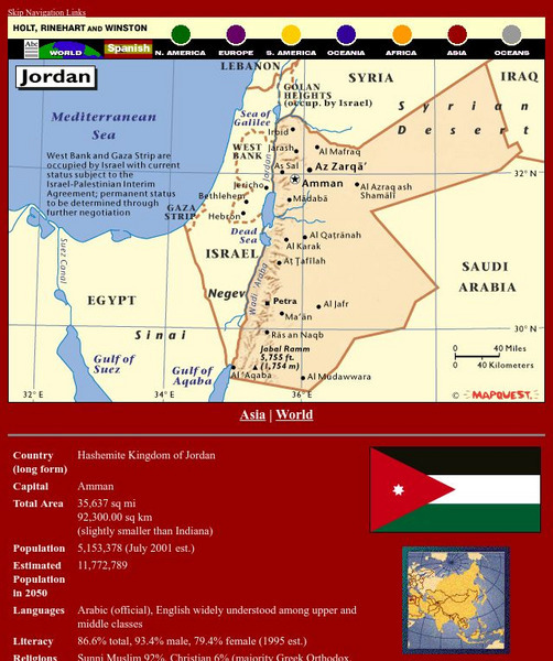
Holt, Rinehart and Winston: World Atlas: Jordan
Find all the basic data on Jordan on this page. Contains a clear map from "MapQuest", flag and facts in a list format. Categories include languages, religions, life expectancy, currency, GDP, industry, agriculture and more.
Houghton Mifflin Harcourt
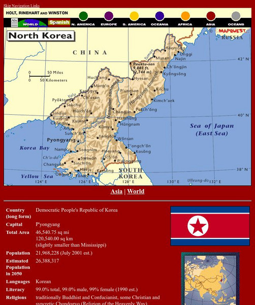
Holt, Rinehart and Winston: World Atlas: North Korea
Find all the basic data on North Korea on this page. Contains a clear map from "MapQuest", flag and facts in a list format. Categories include languages, religions, life expectancy, currency, GDP, industry, agriculture and more.
Houghton Mifflin Harcourt
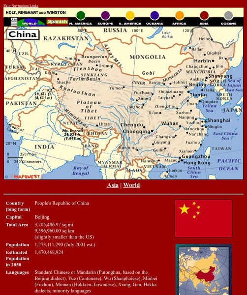
Holt, Rinehart and Winston: World Atlas: China
See a map of China and surrounding countries, and get basic facts and stats about China: capital, total area, population, languages, and more.
Houghton Mifflin Harcourt
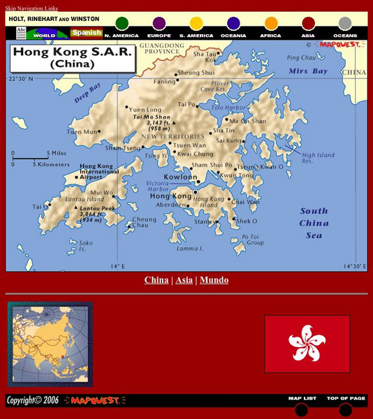
Holt, Rinehart and Winston: World Atlas: Hong Kong
See a map of Hong Kong and an image of Hong Kong's flag. The map includes names of cities, bodies of water, and elevations of Tai Mo Shan and Lantau Peak.
Houghton Mifflin Harcourt
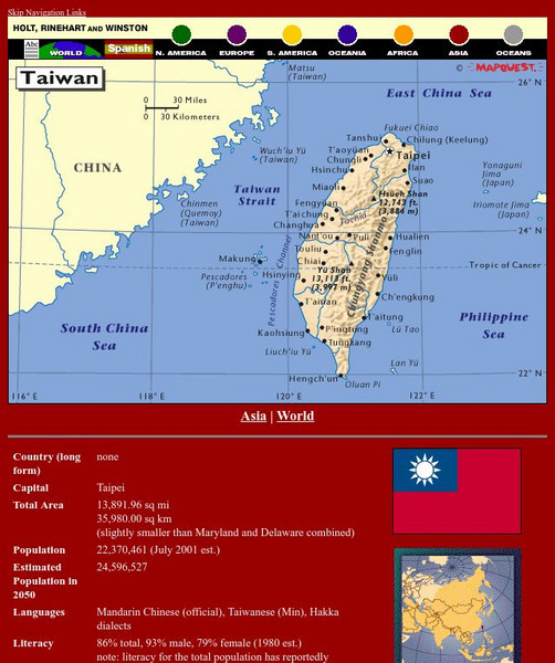
Holt, Rinehart and Winston: World Atlas: Taiwan
Grab quick facts about Taiwan (capital, total area, population, languages, literacy, religions, government, currency, industry, and more) while looking at a map, complete with cities, elevations, bodies of water, longitude, and latitude....
California Digital Library
Calisphere: Maps
A broad selection of images featuring maps can be found on this site by Calisphere. By clicking on individual images you'll find high quality photographs and image information.
Houghton Mifflin Harcourt
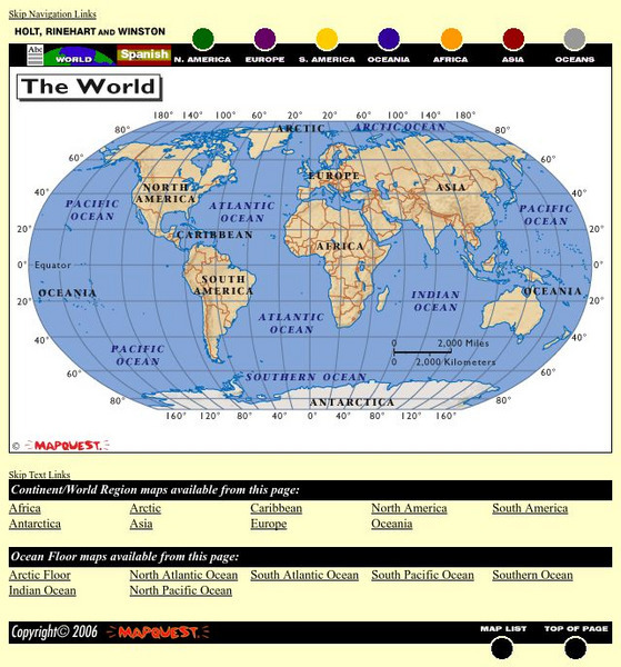
Holt, Rinehart and Winston: World Atlas
This site provides geographic maps of the world by continent, ocean, and country.
University of California
Earthguide: Maps: Shaded Relief: South America [Pdf]
View a digital image of a colored shaded relief map of South America.
University of California
Earthguide: Maps: Shaded Relief: Australia [Pdf]
View a digital image of a colored shaded relief map of Australia.
University of California
Earthguide: Maps: Shaded Relief: Antarctica [Pdf]
View a digital image of a colored shaded relief map of Antarctica.


