University of California
Earthguide: Maps: Shaded Relief: Europe [Pdf]
View a digital image of a colored shaded relief map of Europe.
Latimer Clarke Corporation
Atlapedia Online: Political Map of China, Mongolia, Hong Kong, Macau
A great map of China and surrounding countries, with locations of major cities and bodies of water. Below map are links to general information on China and other countries.
Latimer Clarke Corporation
Atlapedia Online: Physical Map of China, Mongolia, Hong Kong, Macau
Here is a physical map of China and surrounding countries. Includes links below map to further information on each country shown.
Wikimedia
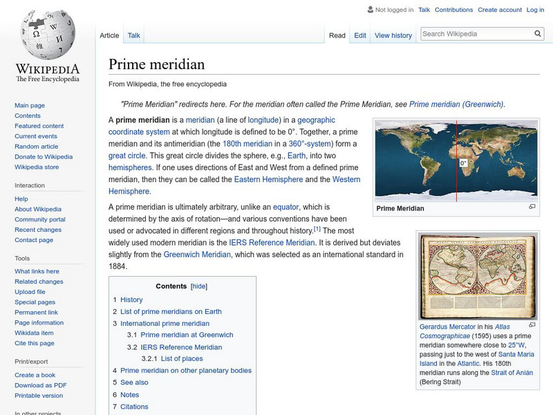
Wikipedia: Prime Meridian
This site from the Encyclopedia Wikipedia provides an encyclopedia article on the prime meridian discusses the important principles were established at the International Meridian Conference in 1884.
US Department of Agriculture
Nrcs: Web Soil Survey
Mapping the earth's soils can help us understand how the land can be used. Find out how to use soil characteristics obtained through soil surveys to create a soil map. Learn about the methods of soil mapping including digital soil mapping.
Other
The Teacher's Corner: Atlas Game
Use this resource to learn how to use a gazetteer index in this atlas game.
Other
Tomas Kubes: Google Map Generator
A free site that customizes Google maps that can be inserted into a website.
Other
Aardvark Internet: Aardvark Map
Want to create a map for your friends to show them in an email where to meet? This easy-to-use website works with Google Maps to allow you to create a custom map of a location. Site contains steps that are easy to follow.
Other
Map Channels: Dual Maps
"Dual maps combine Google Maps, Google Street View and Microsoft Bing Maps into one embeddable control" that allows the user to customize to fit their needs.
Other
Barbados by Map
Discover the beautiful Caribbean Island of Barbados through these interactive maps listed by subject. Click "read more" for further information.
Other
Asia Tour: Map of Cambodia
Follow the key on this map of Cambodia from Asia Tour to find the many things to see in this interesting country.
Other
Antique Maps of the Pacific Ocean: Indonesia Java
Contains five different maps of Java, an island in Indonesia. The map dates from the 1600s and 1700s.
Other
Essential Norman Conquest
This rich site offers an interactive timeline, interactive 3D and 2D maps, as well as in interactive tour of the Bayeux Tapestry and other features.
English Zone
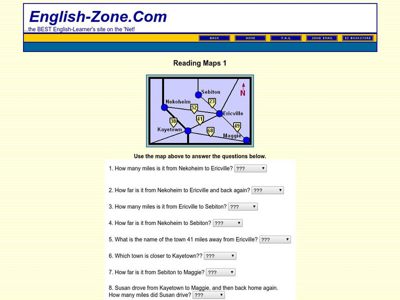
English Zone: Reading Maps 1
Using the map provided, students are to answer questions such as how far is it from one town to another.
US Geological Survey
Usgs: Map Adventures Lesson 4 Symbols and Legends
This lesson plan offers detailed instructions on the types and uses of map symbols.
Instituto Latinoamericano de la Comunicacion Educativa
Red Escolar: Coloreando Matematicas
In Spanish. Cartographers know that four colors are enough to illuminate their maps thus making their maps clear and easy to understand. Try to color the maps by following the two rules: 1) use the least number of colors and 2) keep in...
Other
Quiz Hub: u.s. Map Game
Test your knowledge of United States geography by playing this U.S. map game. Game is timed.
Education Place
Houghton Mifflin: Eduplace: Made in the u.s.a.: Economic, Geography
Site presents activities, that are fun and innovative. These tasks will assist students in their understanding of how the economics of manufacturing effects the student's daily life.
Enchanted Learning
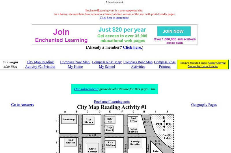
Enchanted Learning: City Map Reading Activity #1
Using a diagram of a labeled map, students follow the directions given to find a certain location.
Enchanted Learning
Enchanted Learning: Label the Map of South Korea
Find a printout of South Korea that can be labeled by the student. Site also provides a map with answers.
Enchanted Learning
Enchanted Learning: Mexico Map: Quiz Printout
Utilize the Mexico map quiz to test student's knowledge of geography, location of cities and capitals in Mexico.
Digital Dialects
Digital Dialects: Geography Games
A collection of geography games where you study a labeled map, and then try to match place names to their locations on a map that is now blank.


![Earthguide: Maps: Shaded Relief: Europe [Pdf] Graphic Earthguide: Maps: Shaded Relief: Europe [Pdf] Graphic](https://d15y2dacu3jp90.cloudfront.net/images/attachment_defaults/resource/large/FPO-knovation.png)


