Curated OER
State Quizzes-Grades 3-6 State Quiz Elementary Education Lesson Plans
Here is an interractive, on-line lesson which allows learners to test their knowledge of the states. They have the opportunity to take quizzes on any of the 50 states. These quizzes determine the students retention of important...
Curated OER
State Notebooking Pages
Studying US states in your class? Then this note-taking page is perfect for you! Pupils can fill in information about a chosen state in the provided and labeled spaces. By the time they've filled out all the boxes, they'll know the...
Curated OER
Mystery State # 41
Kids use their deductive reasoning skills, state knowledge, and five clues to determine mystery state #41. They'll follow the clues to locate the mystery state on a US map. Note: This is a warm-up activity, so it includes two short...
Curated OER
Fun With Pacific Northwest Cities and Towns
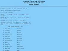
Intended for fun only, learners play with the names of cities common to their region or state. This lesson includes a list of cities in Oregon and not much else. What you and your class choose to do with your list of cities is up to you.
Curated OER
Name The States Worksheet 3
In this states worksheet, students analyze the shape of 5 US states. Students identify each state and write the name of the state and its postal abbreviation.
Curated OER
Utah Worksheet
In this Utah instructional activity, students examine a large color picture of the Utah state flag. After doing their own research, students fill in facts about the state: capital city, flower, tree, motto, date of statehood and what the...
Curated OER
South Carolina Worksheet
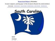
In this South Carolina activity, students examine a large color picture of the South Carolina state flag. After doing their own research, students fill in facts about the state: capital city, flower, tree, motto, date of statehood and...
Curated OER
United States of America: Name That State!
In this states worksheet, learners write the names of all 50 states, matching numbers on a map of the US with their correct state names.
Curated OER
Vermont Map, Word Search, Scrambled Places and Crossword Puzzle
In this geography instructional activity, students learn the important physical features and major cities in the state of Vermont by completing any of the 5 worksheets. There is a free form map, a "label me" map, word search, scrambled...
Curated OER
Maps that Teach
Students study maps to locate the states and capital on the US map. Students locate continents, major world physical features and historical monuments. Students locate the provinces and territories of Canada.
Library of Congress
Loc: Local Legacies
Experience America through its grassroots! Diverse populations lend cultural colorfulness to our country. Read about an International Food Fair in California, Annie Oakley Days in Ohio, and Wabanaki Basketry in Maine. Click on your...
Library of Congress
Loc: America's Story: State Websites
A great page for state reports! Find a special section for kids from each state as well as some extra sites of interest such as the Kansas State Historical Society for Kids.
A&E Television
History.com: The States
Learn unique facts about each American state. You can also read a more in-depth history of each state, watch videos and play a game about all the states.
50 States
50 States: States and Capitals
This guide to the 50 U.S. states provides maps, pictures of state symbols, statistical information, and links to many other related sights. Test your knowledge with one of the quizzes or search for one of the fun facts.
Digital Dialects
Digital Dialects: Geography Games: States of the Usa
Study a map showing the states in the USA, and then try to match their names to their locations on a blank map.
New York Times
New York Times: Crossword Puzzle: The Fifty States
The New York Times Learning Network presents an online crossword puzzle that you can print or play online. This one is on The Fifty States. Subject matter may be a bit deep for an elementary student to work on independently.


