TeachEngineering
Teach Engineering: Topo Map Mania!
Maps are designed to allow people to travel to a new location without a guide to show the way. They tell us information about areas to which we may or may not have ever been. There are many types of maps available for both recreational...
Cornell Lab of Ornithology
Habitat Network: Map Your Community
The Habitat network wants to show how mapping is a powerful way to connect you to your community.
Cornell Lab of Ornithology
Habitat Network: Mapping Habitat 101: The Tutorial
Watch this tutorial to understand how to participate in the Habitat Network citizen science habitat mapping project.
Cornell Lab of Ornithology
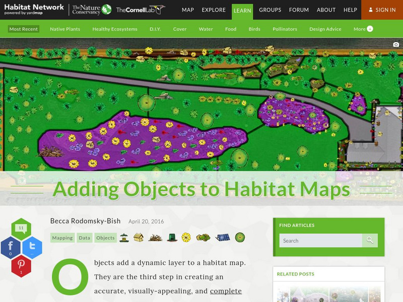
Habitat Network: Adding Objects to Habitat Maps
Find out how to add objects, or emojis, to a habitat map for this citizen science project.
Library of Congress
Loc: History of Railroads and Maps: Railroad Maps 1828 1900
This history of the American railroad from the Library of Congress also provides an understanding of how maps and mapmaking were so closely related to the growth of our railway system.
Read Works
Read Works: How to Draw a Map Passage & Question Set
[Free Registration/Login Required] This informational text passage explains how to draw a map. This passage reinforces essential reading comprehension skills. Opportunities for vocabulary acquisition are also included. Several questions...
Read Works
Read Works: A School Map
[Free Registration/Login Required] This fiction piece tells the story of a little girl who draws a map of the school for her little brother. This passage is a stand-alone curricular piece that reinforces essential reading skills and...
Read Works
Read Works: Tamika's Trip to the Zoo
[Free Registration/Login Required] A literary text about a little girl named Tamika who went to the zoo with her father to see the polar bears. A question sheet is available to help students build skills in reading comprehension.
Read Works
Read Works: Learn About Maps
[Free Registration/Login Required] Intended to support early elementary students' reading comprehension, the basic terminology associated with map are explained in this informational text. A question sheet is available to help students...
Read Works
Read Works: This Is North America
[Free Registration/Login Required] Intended to support early elementary students' reading comprehension, geographical information about North American is provided in this informational text. Questions that assess multiple reading skills...
CK-12 Foundation
Ck 12: Physical Science: Distance
[Free Registration/Login may be required to access all resource tools.] Explains what distance is, its SI unit, and how to use maps to measure distance.
Utah Education Network
Uen: Community Map
This lesson focuses on helping students understand the location of their physical community and the relationship they have with the community and the neighborhood.
Utah Education Network
Uen: Tortoise and Hare Races
In this activity students use the fable "The Tortoise and the Hare" while learning basic mapping skills.
Can Teach
Can Teach: Creating an Edible Map
This imaginative lesson uses food products to demonstrate the physical characteristics of maps.
Smithsonian Institution
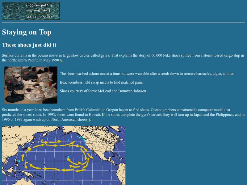
National Museum of Natural History: Ocean Planet: Staying on Top
This is the story of the infamous Nike shoes that washed off a cargo ship. The shoes later showed up along beaches, giving oceanographers another clue as to how ocean currents move.
Other
Paleomap Project
Virtual reality animation map showing continental drift from 200mya to the present. The animation map is small but effective in showing the positions of the land masses.
Read Works
Read Works: How to Draw a Map
[Free Registration/Login Required] An informational text about how to draw a map. A question sheet is available to help students build skills in reading comprehension.
PBS
Pbs: The u.s. Mexico Border a History
This site has complete information about the U.S.-Mexico border. It has an interactive timeline of important border events and a morphing map that shows changes in the border.
Other
Stones of Wales
This is an interactive map of Wales, if you click on the major cities, links are provided to give more information.
Other
Stones of Wales
This is an interactive map of Wales, if you click on the major cities, links are provided to give more information.
TOPS Learning Systems
Top Science: Treasure Map [Pdf]
An activity where students construct a 3-D scene using lentils and props, and bury a coin in it. They then create a map showing the location of the buried coin. This instructional activity from TOPScience gives clear instructions on how...
American Geosciences Institute
American Geosciences Institute: Earth Science Week: Gis and Careers
Students learn about GIS technology for solving problems and learn how employers seek workers who know how to make good decisions in a complex world.
National Institute of Standards and Technology (NIST)
Dictionary of Algorithms and Data Structures: Abstract Data Type
The DADS description of the dictionary abstract data type.
Other
Intellicast: Daily Parcipitation in the United States
This page has a map of the United States with a key for precipitation. The key tells you the estimated precipitation for previous day.


![Top Science: Treasure Map [Pdf] Lesson Plan Top Science: Treasure Map [Pdf] Lesson Plan](https://d15y2dacu3jp90.cloudfront.net/images/attachment_defaults/resource/large/FPO-knovation.png)

