Houghton Mifflin Harcourt
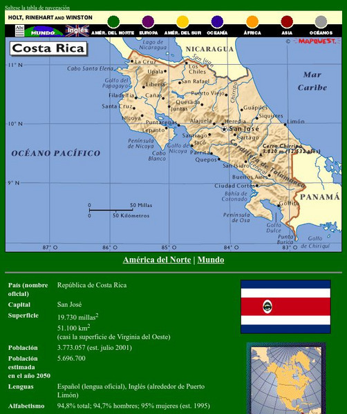
Holt, Rinehart and Winston: America Del Norte: Costa Rica
This site has a map of Costa Rica in Spanish, with informational data also presented in Spanish about the country. Land mass, population, life expectancy, literacy, industry, agriculture, minerals, and resources are among the topics...
Houghton Mifflin Harcourt
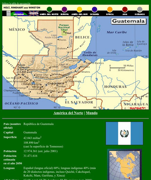
Holt, Rinehart and Winston: America Del Norte: Guatemala
This site has a map of Guatemala in Spanish, with informational data also presented in Spanish about the country. Land mass, population, life expectancy, literacy, industry, agriculture, minerals, and resources are among the topics...
Houghton Mifflin Harcourt
Holt, Rinehart and Winston: America Del Norte: Honduras
This site has a map of Honduras in Spanish, with informational data also presented in Spanish about the country. Land mass, population, life expectancy, literacy, industry, agriculture, minerals and resources are among the topics...
Houghton Mifflin Harcourt
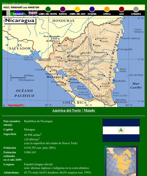
Holt, Rinehart and Winston: America Del Norte: Nicaragua
This site has a map of Nicaragua in Spanish, with informational data also presented in Spanish about the country. Land mass, population, life expectancy, literacy, industry, agriculture, minerals, and resources are among the topics...
Houghton Mifflin Harcourt
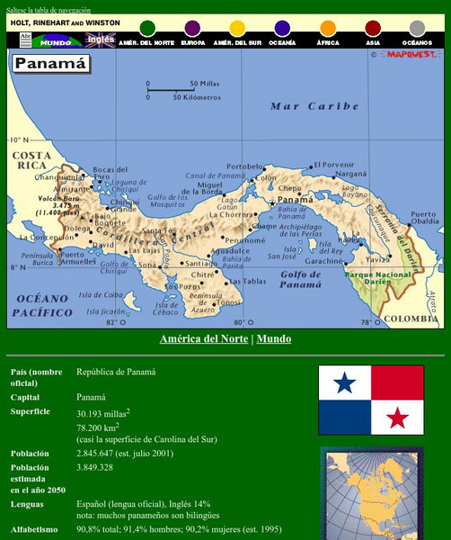
Holt, Rinehart and Winston: America Del Norte: Panama
This site has a map of Panama in Spanish, with informational data also presented in Spanish about the country. Land mass, population, life expectancy, literacy, industry, agriculture, minerals and resources are among the topics...
Houghton Mifflin Harcourt
Holt, Rinehart and Winston: Caribe: Cuba
This site has a map of Cuba in Spanish, with informational data also presented in Spanish about the country. Land mass, population, life expectancy, literacy, industry, agriculture, minerals, and resources are among the topics addressed....
Houghton Mifflin Harcourt
Holt, Rinehart and Winston: Caribe: Republica Dominicana
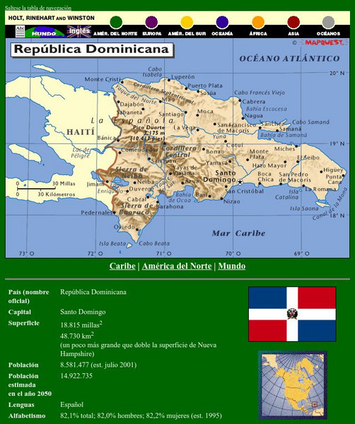
This site has a map of the Dominican Republic in Spanish, with informational data also presented in Spanish about the country. Land mass, population, life expectancy, literacy, industry, agriculture, minerals, and resources are among the...
Houghton Mifflin Harcourt
Holt, Rinehart and Winston: America Del Sur: Argentina
This site has a map of Argentina in Spanish, with informational data also presented in Spanish about the country. Land mass, population, life expectancy, literacy, industry, agriculture, minerals, and resources are among the topics...
Houghton Mifflin Harcourt
Holt, Rinehart and Winston: America Del Sur: Bolivia
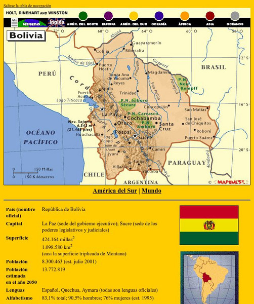
This site has a map of Bolivia in Spanish, with informational data also presented in Spanish about the country. Land mass, population, life expectancy, literacy, industry, agriculture, minerals, and resources are among the topics...
Houghton Mifflin Harcourt
Holt, Rinehart and Winston: America Del Sur: Chile
This site has a map of Chile in Spanish, with informational data also presented in Spanish about the country. Land mass, population, life expectancy, literacy, industry, agriculture, minerals and resources are among the topics addressed....
Houghton Mifflin Harcourt
Holt, Rinehart and Winston: America Del Sur: Colombia
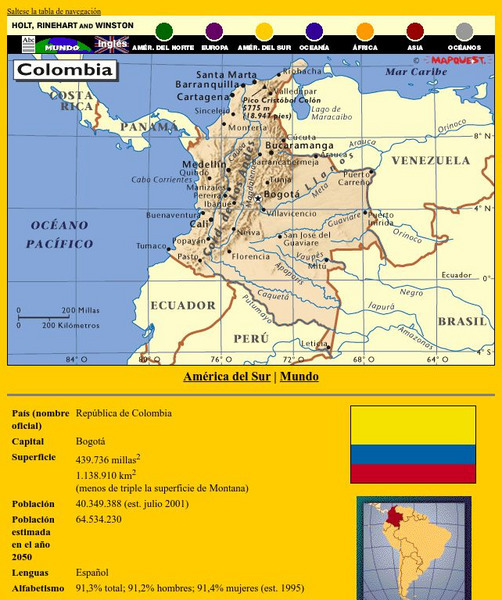
This site has a map of Colombia in Spanish, with informational data also presented in Spanish about the country. Land mass, population, life expectancy, literacy, industry, agriculture, minerals and resources are among the topics...
Houghton Mifflin Harcourt
Holt, Rinehart and Winston: America Del Sur: Venezuela
This site has a map of Venezuela in Spanish, with informational data also presented in Spanish about the country. Land mass, population, life expectancy, literacy, industry, agriculture, minerals, and resources are among the topics...
Houghton Mifflin Harcourt
Holt, Rinehart and Winston: America Del Sur: Paraguay
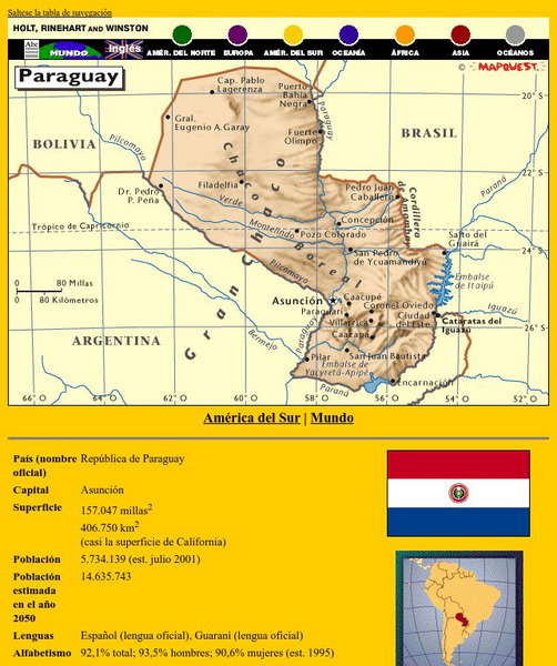
This site has a map of Paraguay in Spanish, with informational data also presented in Spanish about the country. Land mass, population, life expectancy, literacy, industry, agriculture, minerals and resources are among the topics...
Houghton Mifflin Harcourt
Holt, Rinehart and Winston: America Del Sur: Peru
This site has a map of Peru in Spanish, with informational data also presented in Spanish about the country. Land mass, population, life expectancy, literacy, industry, agriculture, minerals and resources are among the topics addressed....
Houghton Mifflin Harcourt
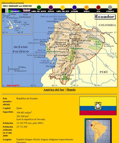
Holt, Rinehart and Winston: America Del Sur: Ecuador
This site has a map of Ecuador in Spanish, with informational data also presented in Spanish about the country. Land mass, population, life expectancy, literacy, industry, agriculture, minerals, and resources are among the topics...
Houghton Mifflin Harcourt
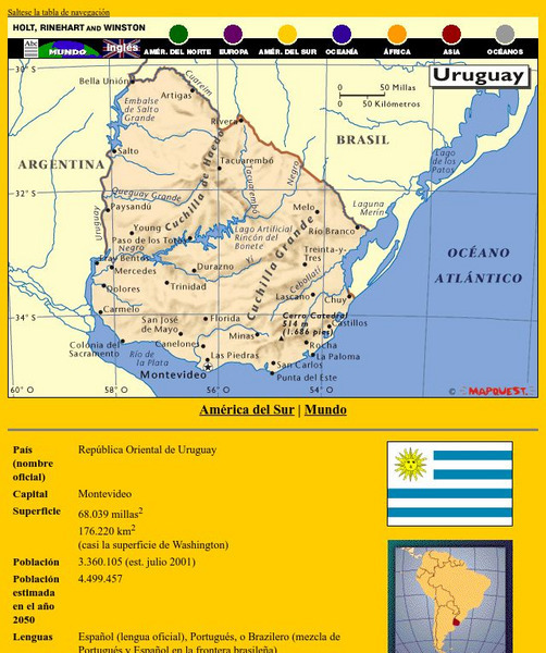
Holt, Rinehart and Winston: America Del Sur: Uruguay
This site has a map of Uruguay in Spanish, with informational data also presented in Spanish about the country. Land mass, population, life expectancy, literacy, industry, agriculture, minerals and resources are among the topics...
Scholastic
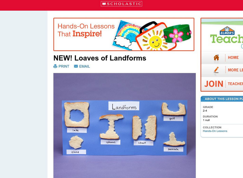
Scholastic: Loaves of Landforms
This is a comprehensive lesson plan to teach primary students about landforms. A foundation in geography begins with an understanding of the terms geographers use to describe the features of Earth. Help students grow their vocabulary and...
Rice University
Galileo Project: The Tuscan Region
This site from Rice University of The Galileo Project provides a map (16th-Century) of the Tuscan region. The region was under the control of Florence. The map is more of a terrain map but interesting nonetheless.
HyperHistory Online
Map Showing Kushan Empire and Silk Road
The map shows Kushan, the Silk Road, and Bactria between 100-200 CE.
University of Nebraska Omaha
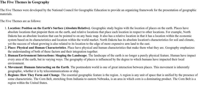
University of Omaha: The Five Themes in Geography
An explanation of the five themes in geography.
US Department of Education
U.s. Department of Education: Regions: How They Form and Change
Help your students discover what makes up a physical region and a cultural region by encouraging them to explore different ethnic cultures.
Lizard Point Quizzes
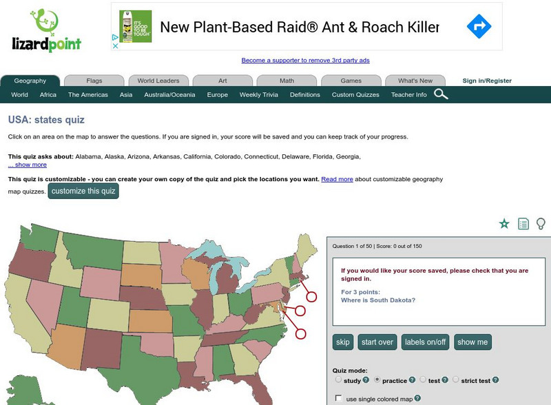
Lizardpoint: The Usa Quiz
Test your ability to identify each state on a United States map. Answer the question to the left and see your results.
Foundation for the Advancement of Mesoamerican Studies
Famsi: Map of Maya Area
Map shows the locations of Mayan sites in Belize, El Salvador, Guatemala, Honduras and Mexico.
American Indian Heritage Foundation
Mayan Civilization
This site describes the geography and landscape of the areas once inhabited by the Mayas. There is also information on Mayan writing, literature, culture, political organization, Mayan art, and other information on the Mayan Civilization.


