Curated OER
Mapping the News
Students explore cartography. In this map skills and map making activity, Students work in groups to create wall size world maps including legends, compass roses, latitude and longitude, and physical features. Students...
Curated OER
World Map Labels
In this geography skills worksheet, students identify the countries and bodies of water labelled on the maps of the world, Africa, Asia, Canada, Europe, the Caribbean, the Middle East, North America, Australia, and South America.
Curated OER
Political Legends and Map Symbols
Students identify the legend and map symbols. In this map skills lesson, students use a world map to find various locations using a map key.
Curated OER
World: Political Map
In this world political outline map worksheet, students examine boundaries of each of the countries in the world. This map not is labeled.
Curated OER
World Landforms
In this blank outline map worksheet, learners note the major landforms of the 7 continents of the world on a Robinson projection map.
Curated OER
World: Physical Map
In this world physical map worksheet, students make note of the major landforms located on this Robinson projection map.
Curated OER
Physical World Map
In this world map worksheet, learners practice their geography skills as they label the 7 continents and 5 oceans. Teachers may use this physical map for various classroom activities
Curated OER
Lesson Design Archaeology- World Map
Students practice locating positions on the world map. In this map skills lesson, students explore the world map and items such as the compass rose, Equator, mountains, cities, etc. The students practice locating positions on the world...
Curated OER
Village Children in Northern Pakistan
Student use maps to answer geographic questions. They analyze Earth's surface by using a map to identify physical features that lead to different transportation routes. Student create a collage to show geographic insight into the topic...
Curated OER
Using the Four Main Directions in the Classroom
Students use the four main directions to locate features in the classroom. In this direction lesson, students review the 4 main directions using a world map. Students use a magnetic compass to locate the north wall in their classroom and...
National Endowment for the Humanities
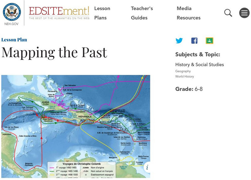
Neh: Edsit Ement: Mapping the Past
Students will examine European world maps from the Middle Ages, the Age of Discovery, and the period of New World exploration. They will then look at maps that record the early exploration of the American West and collect present-day...
University of Texas at Austin
The Perry Castaneda Library Map Collection
This collection contains more than 250,000 maps covering all areas of the world, and ranging from political and shaded relief maps to the detailed and the historical. Select from a region of the world or an area of highlighted interest.
Nations Online Project
Nations Online
This portal site offers quick access to a wide range of information about each country, continent and region of the world.
Geographyiq
Geography Iq
Detailed geographical information on any country is available at this site. Within the World Map section, you can get facts and figures about each country's geography, demographics, government, political system, flags, historical and...
Princeton University
Princeton University: Qed: Mapping Globalization: Map Category Queries
A large database of historical maps that can be searched by map type, time period (prehistory to 21st century), theme, and world location. Themes cover economics, war, disease, trade, migration, and much more.
National Endowment for the Humanities
Neh: Edsit Ement: Mapping Our Worlds
In this lesson, introduce your students to the world of maps and discover a world of information online. Students learn how to identify different types of maps, comparing maps to the rooms of a house.
abcteach
Abcteach: Maps
[Free Registration/Login Required] Find outline maps of the continents and the United States and Canada, as well as other country and city maps.
Information Technology Associates
Information Technology Associates: Quick Maps
View countries of the world. Maps are quick and easy to read. Some are designed to be printed out for coloring and/or labeling.
Other
Just Maps: World Maps
An index of maps and flags of countries throughout the world. Also provides political maps, time zones, population, and religious maps of every region of the world.
Lonely Planet
Lonely Planet: World Guide
This World Guide allows you to view information about any country anywhere in the world online. It provides you with zooming capabilities for a closer look at the maps and land layouts. Once you've selected your country, you will find a...
Yale University
The Yale Map Collection: Online Maps
Yale University provides us with one of the largest collection of maps in the United States. Here you can view historical online maps covering a variety of subjects.
Fun Brain
Fun Brain: Where Is That?
Test your knowledge of U.S. and world geography. Five levels of games challenge players to identify states, capitals, and countries.
Other
Escolar: Mapas De Continentes, Mapas Politicos Y Mapas De Paises
Check out this sizable selection of different maps of continents, countries, and states. Each page will give you additional information about the particular country or state.


