Curated OER
El Mundo Hispano
Colorful maps are clearly labeled in this PowerPoint to show viewers where different Hispanic countries are located within Central and South America. Each country is listed on its own slide with a title, the capital, close-up map, flag,...
Curated OER
The Geography of Latin America
Perfect for a geography or world cultures lesson, the slides in this presentation cover the topography, demographics, and climate of Central America, South America, and the Caribbean. From the apex of the Andes Mountains, to the depths...
Curated OER
Video Boxes
Students create a video box about a Central American country. In this world history lesson, student research Central America and pick a country they want to investigate. They work in groups to create a video box that shows images about...
Curated OER
Central America and the Caribbean
Use the library or Internet to find resources on a chosen topic. The class will comprehend the collected information, structure the information with texts and graphics for a presentation. Each presentation focuses on Hispanic culture and...
Curated OER
Canada Map Quiz
In this online interactive geography quiz worksheet, students examine the map that includes 13 Canadian provinces and territories. Students identify the names of the provinces and territories in 2 minutes, 30 seconds.
Curated OER
Central America Map Quiz
In this online interactive geography quiz worksheet, students examine the map that includes 22 Central American countries. Students identify the names of the countries in 3 minutes.
Curated OER
Welcome to the Americas
Students research and map the North and South American continents. In this geography lesson on the Americas, students can locate North, Central and South American countries and states. Students choose a location to research and prepare a...
Curated OER
A Personal Narrative on the Immigration Experience
The students create a personal narrative on their experiences with immigration. In this lesson, students are asked to read and understand examples of narrative writing as well as evaluate lyrics from Ben Folds Five to determine elements...
Curated OER
Mesoamerica: The History of Central America
Students research the life of a powerful woman of the Maya Empire. They analyze the role of women in Maya society and compare them to powerful women of today in an essay.
Curated OER
Hemispheric Harmony
Young scholars express their opinion on issues related to Central America. After reading an article, they discuss the relations between the Presidents of Mexico and the United States. Using the internet, they research a part of the...
Curated OER
Mexico and Central America Map
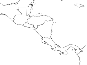
In this blank outline map worksheet, students study the political boundaries of Mexico and Central America. Each of the counties is labeled and the capital cities are starred.
Curated OER
Central America Map wtih Country Borders
In this blank outline map worksheet, students explore the political boundaries of Central America and the nations there. This map may be used in a variety of classroom activities.
Curated OER
Central America Outline Map
In this Central American political map worksheet, students make note of national boundaries and capitals in this region of the world. National capital city locations are noted with stars.
Curated OER
Central America Outline Map
In this Central American political map activity, students make note of national boundaries and capitals in this region of the world. National capital city locations are noted with stars.
Curated OER
Central America Outline Map - Labelled
In this Central American political map learning exercise, students make note of national boundaries and capitals in this region of the world. National capital city locations are noted with stars.
Curated OER
Travel to Mesoamerica
Students research books, watch movies, and look on the internet to find information on ancient America, Mexico, and Central America. In this Mesoamerica lesson plan, students participate in a social studies unit on North America of the...
Curated OER
Geograophy of Mexico And Central America
Students create a chart comparing the terrain, climate, economy, environmental issues and natural disasters for Mexico and the Central American countries. They view and discuss a video on the region then compile research on the internet.
Curated OER
Science NetLinks: Collapse 2: Interpreting the Evidence
Students continue to explore the factors that contribute to the collapse of a society; they also explore how archaeological evidence is gathered and interpreted. Students explore about the social changes that caused the collapse of...
Curated OER
Sustainable Agriculture
Students perform an experiment to find out if plants grow best when grown in soil with no fertilizer, with chemical fertilizers, or with compost that they have made themselves. Students discover how agriculture practices can benefit the...
Curated OER
Country: El Salvador
Students visit sites to explore the history, wildlife, and geography of El Salvador. They play an interactive game of Concentration and watch a slide show that includes pie charts and bar graphs on Hispanic population in the United States.
Curated OER
Visual Elements in the Giant Kites of Guatemala: Shape, Rhythm, and Color
Students view pictures of and discuss geometric shapes included in kites from Guatemala. They discuss the repetition of shapes and how that creates a motif. Students draw three concentric arches across their paper. They create a design...
Curated OER
Learning From El Salvador's Past
Students analyze El Salvador's history and the conditions that contributed to its civil war. identify the factors that led to the churchwomen's murder. Make determinations about the future of El Salvador's political and social climate...
Curated OER
Trade Missions
Students research the products of countries in Central and South America. t research which products from the countries they represent are imported to the United States. They create tables and/or graphs to indicate annual totals.


