Curated OER
Understanding Growth of the Phoenix Area
Students study the growth of the Phoenix area using geographic images, maps, tables, and graphs. They study the idea of community.
Curated OER
Why Is A City Located Where It Is?
Learners analyze how transportation influenced the development of Stillwater, Minnesota, They use the same techniques to analyze the impact of transportation on the origination and development of their own community.
Curated OER
Cities, States, Countries & Continents
In this geography worksheet, students fill in 7 blanks with the correct geography word. Clues are given for each blank, and answers are provided.
Curated OER
Urban Ecosystems 4: Metabolism of Urban Ecosystems
Cities are compared to living, breathing, metabolizing organisms. Fourth in a five-part series of lessons, this one focuses on the flow of materials through a city. Links to interesting websites and images make your delivery of...
Curated OER
Spotting Trains & Planes
Students engage in an international pastime that entails reading and interpreting train, subway, or airline schedules from a selected city. They create and problem solve design of a math game using timetables. Students use their math...
Curated OER
What is a Community?
Third graders will learn about different aspects of a community in this 11-slide PowerPoint. Different facts and images are displayed on each slide to help give your students a better sense of community. Tip: After viewing this...
Curated OER
The City I Live In
Research information about your city and state. Pupils investigate details such as the name of the city mayor, local establishments, and entertainment. For the state, they name the capital, governor, state flower, and flag. There are...
Curated OER
Let's Discover Communities
Second graders compare and contrast the city and the country. After reading books about animals, 2nd graders create picture cards of animals in both the country and city environment. In partners, students draw pictures of animals,...
Curated OER
Farms And Cities
Students differentiate the differences of living on a farm or in a city. They do this with the use of coloring pictures and have group discussion about each picture to identify characteristics and identify where the picture is from. The...
Curated OER
Stores and Shops: ESL Powerpoint
What kinds of stores and shops are in your town? Use this ESL presentation to reinforce the names of various stores, such as ice cream shop, meat market, and shoe store. Your English learners will see the world with new eyes the next...
Curated OER
Construction: A Thematic Unit
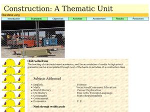
High schoolers research different city departments and organizations that make up a city and choose a type of house to model. In this construction lesson students build their own city and present it to the class.
Curated OER
History of the Local Community
Students research their local communities and identify the founding fathers of their city and county. In this communities lesson plan, students research using the library and internet. Students also interview citizens who have lived in...
Curated OER
Rural-Urban Migration in the 1990's
Students consider the reasons why people relocate from one area to another. For this relocation lesson, students read an article that includes research and statistics on which age, education level, etc., of the population moves the...
Curated OER
We've got the whole world in our hands
Students explore spatial sense in regards to maps about the globe. In this maps lesson plan, students label oceans, locate the continents and poles, follow directions, and explain the symbols on a map.
Curated OER
United States Map- Map Legend/City Symbols
Students investigate the United States map. In this map skills geography lesson, students explore city symbols on the map legend and identify them. Students use post-it notes to mark various symbols.
Curated OER
Civilizations Leadership
Learners view a segment of Prosperity and Decline. They discuss what attributes made the empire strong. Students discuss what caused the fall of the Roman Empire. They write an essay describing the cause of the fall of the Roman Empire....
Curated OER
Me on the Map Lesson 2
Students analyze and interpret maps, globes and geographic information systems to define and identify cities, counties, states, countries and continents to create a booklet called me on the map. They also determine and calculate the...
Curated OER
Community Building
Seventh graders discover the similarities and differences between cities, towns, and rural communities. Using a Neighborhood map Machine, they create a Venn diagram and map of their own community. Students build a 3-D representation of...
Curated OER
ZIP Code Math
Students add or subtract to solve ZIP Code Math word problems. A ZIP Code Math work sheet is included. This lesson combines math with geography quite nicely.
Curated OER
Models of Succession
Students create a model city in order to understand the effects human habitats have on the environment. In this environment lesson, students examine the effects human habitats have on the environment. Students create a model...
Curated OER
Graphs
In this graphing worksheet, 6th graders name the place that is at the coordinates given to them of this graph of the city. Students complete 8 problems.
Curated OER
Microsoft Publisher Country Brochure
Students explore geographic information. In this geography and technology instructional activity, students choose a county and answer related questions on a Webquest. Students create a word web and design a country brochure.
Curated OER
Changing Your City
Students write a one to two page paper about what they would like to change in their city and why. For this city analysis lesson, students brainstorm about changes for their city and write a paper on why they would make those changes.
Curated OER
City: Print and Color
In this word recognition worksheet, students trace the word "city", write the word independently, and color the picture of the city.


