PBS
Make a Balloon Globe
"We've got the whole world in our hands," is what your students will be singing after completing this fun geography activity. Using the included templates for the seven continents and a balloon, they create their very own globes.
Curated OER
Earth Science Jeopardy
This jeopardy game has 5 categories and 5 point levels, and is designed with a section of hodge podge, geography, and earth science review questions. The questions are clear and the point selections are designed to darken once used.
Curated OER
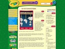
Cut-Out Continents Mobile
Students research major natural features on all seven continents. They compare and contrast continents, their sizes, shapes, and major landforms. Students create a unique display of the continents to show major landforms.
Curated OER
South America Map
In this map of South America worksheet, learners identify and label the countries in South America. Students improve their understanding of South America.
Curated OER
Countries, Continents, and Regions - Matching Quiz
Where in the world is Kyrgyzstan? Language learners are asked to match countries to their geographical areas. Might be fun to try this with young geographers as well.
Curated OER
All Around the World
In this geography worksheet, students name the 7 continents of the world (there are some letter clues) and a country in each. Students then name the 5 oceans.
Curated OER
Ecosystems Lesson Plan
Students research ecosystems (rainforest, desert, grassland, woodland, and arctic tundra). Students compare the seven continents and the importance of proximaty to the equator.
Curated OER
The Earth's BIG Features
Your students will enjoy the vivid pictures and interesting facts about world geography, in this presentation. Depicted are several major geographical features found around the world and a description of each.
Curated OER
Geography
Introduce your second graders to geography with this 13-slide PowerPoint. Students discover the names of the 7 different continents, as well as review the four oceans on the Earth. This presentation contains fabulous graphics on each slide.
Curated OER
Exploring an Atlas
Students explore global geography by participating in an atlas activity. In this countries of the world instructional activity, students collaborate in small groups and analyze an atlas while researching continents, countries and...
Curated OER
Where In the World Am I?
Learners identify their location in the world after studying latitude, longitude, relative location, and absolute location. They use assigned web site to find information to make a flipbook that answers questions about their location in...
Curated OER
Map Making
Students draw continents and oceans on a handmade globe and transfer their globe onto a flat map. For this maps lesson plan, students use paper and a tennis ball to make their globes.
Curated OER
G'Day Mate
Students understand that Australia is the smallest continent, locate it on a map and sing about the continents. In this Australia lesson, students listen to facts about Australia and complete a book about information they have learned.
Curated OER
Welcome to the Americas
Students research and map the North and South American continents. In this geography lesson on the Americas, students can locate North, Central and South American countries and states. Students choose a location to research and prepare a...
Curated OER
Geography Puzzles
Young scholars study the continents of the world. In this Internet geography lesson, students connect to online mapping games. Young scholars collaborate in order to develop their understanding of world geography, including countries and...
Curated OER
Continent Word Search
In this continents word search worksheet, students locate the names of the 7 continents, listed in the word bank, within the word search puzzle. Students fill in the blanks in 8 sentences with the appropriate continent names.
Curated OER
Mastering the Keyboard
Sixth graders view an animated program showing how the continents fit together millions of years ago. In groups, they compare and contrast the distribution of rocks and fossils based on how the continents fit together. After reading a...
Curated OER
Dancing Skeleton Puppets
Students experience, explore and study the Mexican holiday Day of the Dead. They assess the importance of having bones, identify the different bones that we have in our body and encounter how to make a skeleton and decorate it in...
Curated OER
Tear the Continents
Students tear paper into representative continent shapes and configure them with world oceans through relative location, direction and latitude and longitude starting points. They recognize the shape of the continents. Students recognize...
Curated OER
Continents on the Move
Students examine the tectonic plates of the Earth and how the landforms of Earth have changed position over time. In groups, they identify the evidence that the continents are still moving. To end the lesson, they practice measuring...
Curated OER
Exploring the World's Geography
Students discuss the seven continents of Earth and the diverse geography. After discussion, they create their own paper-mache globes which properly display all seven continents, the equator, and the prime meridian. They conduct research...
Curated OER
Modeling Earthquake Data
Students evalute evolutionary theories and processe of Geology. They examine evidence that the movement of continents has had signicicant global impact, major geological events. Students evaluate the forces which shape the lithosphere...
Curated OER
A Geological Puzzle
Students compare and contrast the various types of rocks on each continent. In groups, the calculate the rock ages and types to determine if the continents, in their opinion, were joined at one time. They develop two imaginary...
Curated OER
Putting the World in Perspective
Students work in small groups to: make a mental map of the world by tearing paper shapes of the seven continents and locating them on a flat surface in their relative positions, compare their finished mental map to a reference world map,...


