Curated OER
Volcanic Wrath
Students observe volcanic action using an internet Web site of satellite photographs. Stuents create a portfolio of observable features.
Curated OER
the Potential Consequences of Climate Variability And Change
Learners analyze the consequences of changing variables on a system. Changes in a model are measured and recorded and conclusions drawn based on the data provided in this six lessons unit.
Curated OER
Three D Constellations
Young scholars are introduced to both celestial coordinates and to the first rung on the distance determination ladder. They convert spherical coordinates to Cartesian coordinates to construct a three dimensional model of a...
Curated OER
Annotating Change in Satellite Images
Students compare a series of satellite images taken 3-4 years apart to investigate the effects of human land use. They annotate the images using ImageJ software and use the annotated images to explain their findings.
Curated OER
Life in Extreme Environments - Lakes Under Ice
Students collect chemical, physical, and biological data from a local lake throughout the year. In addition, students discuss the design of an experimental structure for water collection at several specific depths as well as assess the...
Curated OER
Satellite Mobiles
Students discuss satellites and their functions. They design and construct their own satellite out of readily available materials. Students are taught the definition of a satellite. They discuss the two main purposes of satellites:...
Curated OER
Scenes of the Earth
Students examine and study how changes in perspective can change the way that they can observe objects. They explore the relationship between a scene's area and its detail. Each student looks at the ground through cardboard tubes from...
Curated OER
Patchwork of the Planet
Students are taught how satellite images can be joined to make a picture mosaic. They use actual satellite images to make satellite mosaics regions of the United States. Students use a camera to photograph portions of a globe in the...
Curated OER
Map Coordinate Bingo
Young scholars play a bingo-type game to locate cities by coordinates. They explain the use of orientation on a map and identify cities in the western hemisphere. They compare road maps, shutttle images, and a CIR image and obtain an...
Curated OER
Science: A Tree for All Seasons
Students observe trees in their schoolyard and record the seasonal changes by drawing pictures. In this ongoing instructional activity, they discover the names of the seasons and place green paper leaves on a paper tree in the classroom,...
Curated OER
Mineral Lab
Eighth graders examine the physical properties of different minerals. In this earth science lesson, 8th graders explain the uses of minerals in their daily lives. They complete the mineral identification table during the lesson.
Curated OER
The Nebraska Brochure
Learners research the physical attributes of Nebraska. They work together to create a brochure highlighting the topic of their choice. They share their brochure to the class.
Curated OER
Watershed Management
Learners investigate the concept of a watershed. They conduct research into the concept using a variety of resources. Students take a field trip to a local watershed to make observations. The outcome is a report concerning the outside...
Curated OER
Where Does the Water Around Our School Go?
Learners in groups, map quadrants of the area around the school and make predictions about the direction of waterflow and zones of accumulation that will occur when it rains. Then when it does rain they check to see if their prediction...
Curated OER
CO Buildup City
Students conduct a controlled experiment. They collect data in an organized manner. Students analyze data to reach a conclusion and communicate findings. They explain how city size, temperature, and pollution is related to the air quality.
Curated OER
Who Can Harvest A Walleye?
Seventh graders investigate the concept of how an ecosystem is put together while conducting research using a variety of resources. They correctly differentiate between a herbivore and carnivore by placing them in the order of hierarchy...
Curated OER
Sun and Shade
Students explore the ways that plants adapt to their environments. They examine plants that thrive in the shade, versus plants that thrive in direct sunlight. Special attention is devoted to the shape of leaves on respective sun and...
Curated OER
Up, Up, and Away
Students create a model to explore the water cycle. Students also perform different experiments to witness water changing from a liquid to a gas. Students are asked to if they can find ways for water to go away without pouring the...
Curated OER
Satellite Eyes
Young scholars explore the ways in which satellite images provide details of the Earth's surface and how they are capable of taking digital images of the Earth from space they vary in resolution and breadth. They view how cameras and...
Curated OER
Water Flow Through Local Soils
Students examine the relationship between particle size and rate of water flow through soil. They collect soil samples, make predictions, conduct a water flow experiment, analyze the data, and answer conclusion questions.
Curated OER
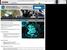
Coral Bleaching in the Caribbean
Students use authentic satellite data on the NASA website to determine when the sea surface temperature meets the criteria to induce coral bleaching.
Curated OER
Salmon Smolt: Stella PC and Mac
Students investigate the Stella Smolts Migration Model and its use in previous simulation models to help managers deal with the many factors contributing smolts decline. They participate in an interactive exercise in the role of fishery...
Curated OER
Deer Tracks
Young scholars use satellite images to track to movement patterns of deer and examine deer behavior. They write stories about a day in the life of a field scientist.
Curated OER
Two Ways About It
Young scholars take an imaginary hike in two opposite directions along a lake. They view and interpret satellite images and discuss the pros and cons of hydroelectric dams.
Other popular searches
- Earth System Origins
- 4 Major Earth Systems
- Moon Earth System
- Earth Systems Unit
- Major Earth Systems
- Earth Systems Interactions
- Sun Earth Moon System
- Earth Systems Global Winds
- Earth Systems 3209
- Earth Systems Science
- Earth Systems and Patterns
- Earth System Atmosphere


