Curated OER
Shadows and Skyscrapers
Eighth graders explain the relationship between the position of the sun, a city's latitude and shadow length. Ratio's, geometry, and algebra are used to determine the shadow lengths and building heights. A sun angle (altitude) charts to...
Curated OER
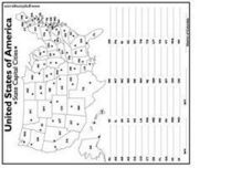
United States Capital Cities
In this identifying the United States Capital cities worksheet, students use a United States map and a list of state abbreviations to write each state' s and the District of Columbia's capital city. Students write 51 answers.
Curated OER
World War II New Guinea Campaign
Although the big picture for this lesson plan on the New Guidea Campaign of WWII is taking a field trip to the Douglas MacArthur Memorial, you can easily use it as a guide to an independent or group research project as well. However, if...
Curated OER
Where Am I?
Students identify volcano locations by latitude and longitude. They analyze a world map, and complete a "Volcano Event Locations Chart."
Curated OER
Cities and Countries Around the World
Briefly introduce your young Spanish speakers to different cities around the world. Identify the country they are located in, what the people are called from those countries, and the country's location on a class map. Make sure to use...
Curated OER
Telling Direction - Compass Rose
Keep it simple when practicing directions using this compass rose labeling worksheet. Learners read a brief text describing the cardinal and intermediate directions, then fill in the compass themselves. They can get immediate feedback...
Edgate
Great Grids
Learners use grid boxes as a measurement tool and discover how grids are used for mapmaking and scaling down an area. They begin by attempting to draw a model shape drawn by the teacher by using the gridding process. At the conclusion of...
Curated OER
1492: Using Data to Explain a Journey
Middle schoolers examine how Christopher Columbus made his way across the Atlantic. In this data lesson students use an Internet program to navigate like Columbus.
Curated OER
Seasons Worksheet #2
A tilted Earth is shown in relation to the rays of light from the sun. Earth science superstars determine latitude, month, and time of day. They compare number of daylight hours for different points on Earth. The five multiple choice...
Curated OER
Orienteering Scavenger Hunt Lesson Plan: Middle School
First, teach your class how to read a compass, and then do the scavenger hunt. This is rather a nice little activity to do. It can be done as part of a unit on orienteering or just for the fun of it as a stand-alone instructional...
Curated OER
Direction and Angle: Positions and Directions
This is an interesting mix of concepts. Half of this presentation provides double-digit addition and subtraction practice and the other half has students discuss cardinal directions and right angles. Use these together, or use them on...
Fremont Unified School District
4th Grade California Relief Map Project
Bring life to your next California geography lesson with this great project! Learners design a three-dimensional wall relief map of California, painting and decorating regions using a variety of materials and labeling major geographical...
Cornell University
Too Much of a Good Thing?
Continuing their study of beneficial insects, young entomologists discover where in the world some of these bugs are. By labeling, coloring, and using the scale on a map, pupils explore the territories and arrival of the Asian lady...
Goodwill Community Foundation, Inc.
Directions and Distances
Describe where you are—and find out where you are going—with a beginning Spanish resource on directions and maps. Spanish learners repeat and practice direction words such as norte, este, and oeste, as well as measurement terms such as...
DocsTeach
Analyzing a Map of the Louisiana Purchase
With the stroke of a pen, Thomas Jefferson roughly doubled the size of the United States. The Louisiana Purchase not only grew the new country, but also it gave rise to the legends surrounding westward expansion and accelerated the...
PBS
What's In a Name?
What is in a name? Eager historians trace the geographical history of places in the United States with Spanish names. Using a worksheet activity, clues, and web research developed in conjunction with the PBS "Latinos in America" series,...
Curated OER
Mesopotamia
Here is resource that offers a great, organized approach to your unit on Mesopotamia and early civilizations! As learners study the topics in the unit, such as the Fertile Crescent, ancient Sumeria, the Assyrian and Persian Empires, and...
Curated OER
How Worldly Are You?
Sixth graders locate and map six components to have a working knowledge of maps. In this map skills lesson, 6th graders define the six map components and work in groups to draw a map using the components. Students read a related...
Curated OER
Dandelion Seed Lesson Plan
Students create a map using the story The Dandelion Seed by Joseph Anthony. In this early childhood lesson plan, students develop map skills as they illustrate the path of the seed in The Dandelion Seed.
Curated OER
Charles Lindberghs's Flight to Paris
Students practice map skills. For this map skills lesson, students locate the cities of New York and Paris on a map. Students read about the flight made by Charles Lindbergh in May 1927 from New York to Paris. Students answer 8 questions...
Curated OER
Finding Your Spot in the World
Students practice locating places on a Thomas Brothers map. For this map skills lesson, students locate places on the map of where their ancestors are from and then practice finding various community places on a map. Students graph the...
Curated OER
Simple Route Map
Students identify the best route between various locations on a map. For this map skills lesson, students use a landscape picture map to find routes to and from certain places. Students use map markers to highlight the routes.
Curated OER
United States Map- Land Elevation
Students explore a physical map. In this map skills lesson, students discuss examples of elevation and investigate the symbols used to identify elevation on a map. Students use the map to identify various land elevations.
Curated OER
Pearl Harbor
Students identify the location of Pearl Harbor and Hawaiian Islands on a map. In this map skills activity, students use latitude and longitude coordinates to locate various places of importance of the Pearl Harbor attack.
Other popular searches
- Map Skills Lesson Plans
- Map Skills Worksheets
- Elementary Map Skills
- Geography Map Skills
- Basic Map Skills
- Social Studies Map Skills
- Globe and Map Skills
- Beginning Map Skills
- United States Map Skills
- Map Skills, Continents
- Early Explorers Map Skills
- Free Map Skills Worksheets


