Curated OER
Finding Their New World
First graders place stickers on maps indicating their understanding of the cardinal directions. They locate Jamestown, England, the Atlantic, and Virginia.
Curated OER
Are We There Yet?
Students discover how to use maps and why they are important when using a map. They calculate distance using a map scale and time using travel speed and a map scale.
Curated OER
Through the Forest and Home Again: Maps Help Us Find Our Ways
Students read Little Red Riding Hood, focusing on her path home to Grandma's house. In this language arts and geography instructional activity, students perform a reader's theater, re-creating the walk home and possible routes that could...
Curated OER
Longitude & Latitude
Seventh graders role play as ship's captains to study longitude and latitude.
Curated OER
Follow the Light
Students investigate the role of lighthouses in navigation and practice the use of cardinal directions through reading activities, discussion, locating geographical features, and mapping lighthouses along the east coast of the United...
Curated OER
Mapping Districts
Students become literate in their use of maps. In this 2010 Census lesson plan, students visualize census data on maps, use map keys to read population maps, and explore the concept of population density.
Curated OER
Mapping Districts
Students use maps to learn about the U.S. Census. In this 2010 Census lesson plan, students visualize census data on maps, use map keys to read population maps, and explore the concept of population density.
Curated OER
American Civilization
Students review map and globe skills. They gather background to the story of Christopher Columbus' voyage.
Curated OER
Lesson 2: Mapping Sub-districts
Students learn more about the census. In this mapping sub-districts lesson plan, students visualize census data on a map, use a map key to read a population map, and better understand the concept of population density.
Curated OER
Lesson Design Archaeology- U.S. Map
Students examine the U.S. map and identify cultural areas. In this archaeology lesson, students locate cultural areas on the U.S. map and fill in the proper locations.
Curated OER
Partition of Africa Questions
In this colonial Africa worksheet, students study a map of Africa from 1885-1914. Students then respond to 9 short answer questions based on the information presented in the map.
Curated OER
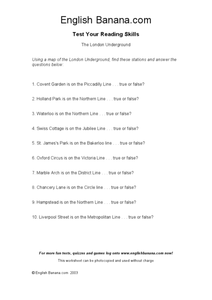
The London Underground
In this identifying stations of the London Underground transportation system worksheet, students use a map of the London Underground, which is not provided, to answer true or false questions. Students answer 10 questions.
Curated OER
The European Union
Students gain knowledge of the EU through current events and map skills. They review and increase their ability to use maps. Students work in groups to find current events about the EU in the available magazine and newspapers.
Curated OER
Whale Migrations
Students use whale migration patterns to determine sex and age of whales and determine where these whales can be located during different seasons. They use mapping skills to plot the migration patterns of four unknown whales.
Curated OER
Children's Literature
Introduce the students to basic economic concepts and types of economic systems and develop the an understanding of how economic choices involve costs and consequences; provide introduction to rural America circa 1920 and compare to our...
Curated OER
Explore your Community with Maps
Second graders acquire an awareness of their community and a development of map skills. They develop the ability to interpret and display information in graphic form and relate the study of significant people to the elements of geography.
Curated OER
Testing the Waters
Students explore water in depth through discussion, research, and experiment. Students apply map skills to locating particular regions of the world as they relate to water. Students predict water quality based on information researched...
Curated OER
Geographical Skills-- Map Scale
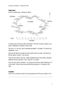
In this maps worksheet, students study a simple map and the scale in kilometres. Students read the directions and answer one question. Students then look at a sketch map of a town and answer 2 questions. Students also read how to show...
Curated OER
Me On the Map
Second graders listen to Joan Sweeney's book, Me On the Map. They design a map of their bedroom and their house emphasizing the important characteristics.
Curated OER
Second Graders on the Map
Second graders explore the various types of maps. They examine the differences between street maps and aerial photographs. Students identify various features on each map. They use cardinal directions and the compass rose. They write...
Curated OER
What do Maps Show?
Eighth graders practice the skill of reading maps. In this geography instructional activity, 8th graders participate in a classroom lecture on how to read a map.
Curated OER
Exploring Earth Through Maps and Technology
In this maps worksheet, students read 3 pages of detailed information about maps, latitude, longitude, topography, satellites and global positioning. Students then answer 10 questions. There is also a research project assignment available.
Curated OER
Tasty Mapping
Students create an edible map. In this civics and geography lesson, students research their town's features and local government. Students work in groups to design and create a physical map of their town based on research.
Other popular searches
- Map Skills Lesson Plans
- Map Skills Worksheets
- Elementary Map Skills
- Geography Map Skills
- Basic Map Skills
- Social Studies Map Skills
- Globe and Map Skills
- Beginning Map Skills
- United States Map Skills
- Map Skills, Continents
- Early Explorers Map Skills
- Free Map Skills Worksheets


