Curated OER
Latitude on World Maps
Sixth graders examine the purposes of maps. In this Geography lesson, 6th graders practice using latitude and longitude on a map.
Curated OER
Geometry: Mountain Rescue Mission
Fifth graders improve their skills using map coordinates by playing a mountain rescue game. In pairs, they roll dice to determine their moves up a mountain. The team that reaches the rescue site in the shortest distance on the grid...
Curated OER
Science: Hurricanes As Heat Engines
Students conduct Internet research to track the path of Hurricane Rita. They record the sea surface temperature of the Gulf of Mexico during and after the hurricane and draw conclusions about how hurricanes extract heat energy from the...
Curated OER
READIN', WRITIN' AN' AMERICAN MEMORY
Students research World Series baseball teams and use the information to play a game. They also use railroad maps to determine how teams traveled from one game to another.
Curated OER
People and Places
Fifth graders investigate how the geography of the land effected the human experience of the Lewis and Clark Expedition. They research using primary and secondary sources, design a map.
Curated OER
You Can Do It, Mr. And Mrs. Mallard!
Students watch the video "Make Way for Ducklings" by Robert Mc Closkey. They write letters to Mr. and Mrs. Mallard and make a map for the mallards. They talk about the importance of animal habitats.
Curated OER
Coral Bleaching in the Caribbean
Students use authentic satellite data on the NASA website to determine when the sea surface temperature meets the criteria to induce coral bleaching.
Curated OER
Viewpoints
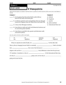
In this map worksheet, students review latitude, longitude, equator, and prime meridian. This worksheet has 5 matching and 8 fill in the blank questions.
Curated OER
"Pennsylvania Watersheds, Many Ways to the Sea"
Students trace a molecule of water through the water cycle including each of its three loops. They describe why evapotranspiration demands the largest portion of total precipitation falling on a forested watershed.
Curated OER
Tracking Satellites Using Latitude and Longitude
Young scholars investigate how to track satellites using latitude and longitude. They investigate what man learns from all the satellites currently being studied today. Students analyze the four basic types of satellite orbits.
Curated OER
Zoobilation
Students research and use their findings to design a PowerPoint presentation and zoo-type habitat with the correct ecosystem for their animal group using a variety of materials such as cardboard boxes, aquariums etc.
Curated OER
Globe Lesson 4 - The Compass
Students study compass' and their use in navigation. In this compass lesson, students use a compass and a globe to answer the questions about navigation.
Curated OER
Polar Day: Living in the Canadian North
Students study the Canadian North. In this Canadian North lesson, students study the physical characteristics and the lifestyles of people in that region. Students complete map making and creative activities that help them learn about...
Curated OER
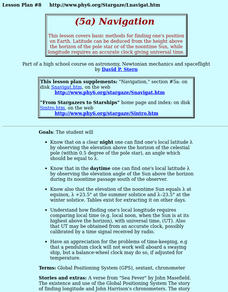
Navigation
Students study the basic methods for finding one's position on Earth. Latitude can be deduced from the height above the horizon of the pole star or of the noontime Sun, while longitude requires an accurate clock giving universal time.
Curated OER
Mission Planning: Geography
Students investigate the use of latitude and longitude to locate specific locations on Earth and evaluate that location as a potential landing site for researchers, terrestrial or alien space missions.
Curated OER
How to be a Great Navigator!
Students, through teacher lecture and class discussion, explore historical methods of navigation: dead reckoning and celestial navigation.
Curated OER
Orientation of the Earth in Space
Students hypothesize the location of the sun in the sky at diferent times of day and at different latitudes. They perform several experiments to provide evidence for their hypothesis. Experiments including observing the sun's position at...
Curated OER
How far have we traveled?
High schoolers practice longitude and latitude to determine given position on Earth's surface, convert and calculate angular measurements, and use Pythagorean Theorem to determine change in position or distance traveled between any two...
Curated OER
Research Cruise Scavenger Hunt
Students track the research cruise of the Ronald H. Brown from San Diego to the Galapagos Islands. They match research groups with the key words, using the ship's daily logs to find the answers.
Curated OER
Tell Time With Your Feet
Pupils discover what the latitude and longitude of their location is. They start walking and measure their shadow. They fill in a chart to discover the approximate time.
Curated OER
Where Am I?
Students identify the latitude and longitude of various locations and calculate the distance between two given coordinate points. They read an eBook, explore the City Zen program, and complete a worksheet.
Curated OER
Sunrise and Sunset
Students utilize a Mesonet daily solar radiation to determine the times of sunrise and sunset and the length of the day. They describe how sunrise and sunset change with latitude and longitude and how the length of the day changes with...
Curated OER
Latitude
In this latitude worksheet, students answer questions about latitude that include absolute locations of countries and coordinates. Students complete 12 questions.
Curated OER
What A Tombstone Can Tell Us
In this coordinates worksheet, learners determine the coordinates to visit a cemetery. Students determine 18 coordinates on this worksheet.
Other popular searches
- Map Skills Lesson Plans
- Map Skills Worksheets
- Elementary Map Skills
- Geography Map Skills
- Basic Map Skills
- Social Studies Map Skills
- Globe and Map Skills
- Beginning Map Skills
- United States Map Skills
- Map Skills, Continents
- Early Explorers Map Skills
- Free Map Skills Worksheets


