Curated OER
Google Earth Virtual Vacation
Learners explore different areas of America by using the internet and the "Google Earth" website in this interactive, social studies lesson for late elementary students. This lesson includes a resource link to download a free program to...
Curated OER
Math: Perimeter, Area, and Volume
Eighth graders discover how to compute the perimeter, area, and volume of different objects. With partners, they find and calculate the perimeter , area, and volume of 10 items each and exchange information. Students compile their...
Curated OER
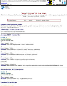
Our Class Is On the Map
Second graders review map keys, symbols, and the purpose of maps, then students design a poster size map of their classroom.
Curated OER
Tooling Around Arizona: Reading Arizona Maps
Students study geography. In this Arizona maps lesson, students develop their map reading skills. They have class discussions and work independently with various copies of Arizona maps to practice those skills. This lesson mentions...
Curated OER
1668 Map of Newark Activity
Eleventh graders read a map for historical information, decipher a map legend and symbols, and expand their knowledge of a historic time.
Curated OER
Quick-Sketch Artist Tips on Mind Mapping the Urban Landscape
Students interpret maps. They also create mental maps of regions in which they are studying. Students then explain the historical or cultural significance of map features orally or in written form. Students take a walking field trip...
Curated OER
Settling Nroth America: Improvisation and Playwriting
Students map the classroom by marking the movement of the first Americans' migration from Alaska down into North America. To improve their skills in map-reading and sense of direction, students identify physical features of the map and...
Curated OER
Geography: Mapping Newspaper Coverage
Students examine the locations of stories appearing in newspapers and determine where to assign reporters. Using various maps, they connect the stories to the correct maps and create charts of the story locations. Students explain their...
Curated OER
Geography: Islands and Alcatraz
Pupils, in groups, create maps of islands including map keys and compass roses. They compare and contrast their island communities with that of the island prison, Alcatraz. Students select from a series of projects, including writing...
Curated OER
Our Monster Travels...
Students write emails to their parents and locate specific places on a map. In this email lesson, students email their parents from the teacher's account and map locations of their parents.
Curated OER
Roller Coaster Mania
Fifth graders extend their knowledge of developing maps. They work in cooperative groups to develop an amusement park display and a brochure.
Curated OER
Getting to Know the Streets of Honolulu
Students practice identifying the streets names of Honolulu. Using a city map, they identify a main street and two intersecting streets. They research the origin of the name and complete a worksheet. They share their findings and...
Curated OER
Pixel Transmission
Students develop code systems to transmit information between groups. They explore, explain and apply techniques used to transmit remote sensing data to better understand remote sensing images.
Curated OER
Reading Around the World
Students use the internet to identify the seven continents. Using maps, they locate and identify major physical features of Earth. They are read different books by various authors on the Earth and answer questions related to it. They...
Curated OER
Destination Investigation!
Students interpret a map or Atlas. They determine latitude, longitude, and absolute location and create and evaluate a travel itinerary. They identify the benefits and drawbacks of an itinerary and conduct online research as a means to...
Curated OER
Town Planning
Seventh graders consider factors in making road transport planning directions. They write a short speech for a presentation at an inquiry. They debate and analyze the information presented in the debate.
Curated OER
Exploring with Cartography
Students are introduced to the topic of cartography. Using the internet, they research the paths and goals of early explorers. They create a PowerPoint presentation of the information they collected. They also develop a...
Curated OER
Why People Move
Fourth graders investigate within their family structure where their relatives have moved or migrated from. They compare/contrast this data with other students. Students map out their finding. They interview family members.
Curated OER
Social Studies For Elementary School
Fourth graders become familar with maps and work in groups to get an overview of what Europe is like. The real assignment is in the form of students creating their own trip if it could really be taken.
Curated OER
Little House On The Prarie
Fourth graders focus on the family's journey from Wisconsin to Kansas and their life there among the Indians.
Curated OER
Traveling Along the Indiana Underground Railroad
Learners develop a deeper understanding of the role that Indiana played in the Underground Railroad while exploring Indiana Geography.
Curated OER
Mass Matters
Fourth graders, in pairs, explore the relationship between a star's life and its mass. They use a concept map to illustration the three categories of stars.
Curated OER
Water, Water Everywhere
Students are introduced to the complex issues of water resources around the globe. In groups, they take on the role of a country and map out the location of water sources. They barter, sell or take over other groups to have access to...
Other popular searches
- Map Skills Lesson Plans
- Map Skills Worksheets
- Elementary Map Skills
- Geography Map Skills
- Basic Map Skills
- Social Studies Map Skills
- Globe and Map Skills
- Beginning Map Skills
- United States Map Skills
- Map Skills, Continents
- Early Explorers Map Skills
- Free Map Skills Worksheets


