Curated OER
Geomnemonics: Facilitating the Teaching of Social Studies Content with Geography Skills
Pupils explore how to draw a world map by hand and how to locate countries.
Curated OER
River Run Through It
With vocabulary lists, worksheets, and more, this lesson sets learners on an exploration of the Hudson River area. They read an essay about the area, analyze a relief map of New York State, and complete a worksheet.
Curated OER
Ancient Egypt Geography
Nine questions to answer and one map to read. Seventh graders will use the map of Ancient Egypt to practice map reading skills and build a visual image of Ancient Geography.
Curated OER
Geography: Puerto Rico
Take a trip to Puerto Rico! Learners engage in a web quest, identify Puerto Rico on the map, and gather information related to physical features and cultural factors. Their efforts culminate when they design a brochure comparing the...
Curated OER
This is My Neighborhood
Students predict the things that they may see, smell, or hear in their neighborhood. They take part in a neighborhood walk, creating a rough map of their neighborhood as they go. Upon return to the classroom, students create a final map...
Curated OER
State Map of Utah
In this social studies learning exercise, students examine a state map of Utah and answer 7 questions, using the map as a reference. The map includes freeways and bodies of water. There is no compass rose.
Curated OER
Map of Africa
Using a completed map (not provided), pupils will use this map to fill in the geographic features of Africa. An appropriate map can be printed using the Internet and placed under a document camera for the class to reference.
Curated OER
War of 1812: Map and Label
Map test! Hand out this map of the East Coast of the United States and let learners mark each of the nine sites listed. They'll be making a map that shows the battle sites and areas involved in the War of 1812. Great as a test or as a...
Curated OER
The Netherlands: map
Use the provided list to label a map of Europe and the Netherlands. There are 77 locations to label. You have to know your stuff to fill out this challenging map.
Curated OER
Map: Bahai'ism
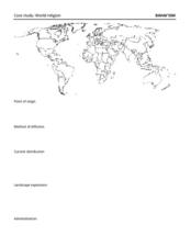
How much do you learners know about the Bahai religion? If this is a topic of study in your class, they'll be able to use the provided map to show the diffusion, location, origin, and distribution of this not-so-well-known sect that...
Curated OER
Sir Francis Drake
Help your learners prep for an exam testing content knowledge related to Florida's State History. Your class can use this printable page to review vocabulary, identify locations on a map, and research both knights and the Sir Francis...
Curated OER
Hawaii: A Stolen Star
Explore the islands of Hawaii. Investigate Hawaiian culture and compare their personal traditions to Hawaiian traditions. They locate Hawaii on a map and research the history of Hawaii.
Curated OER
The Barbarian Invasions of the Roman Empire
Fifteen different locations to map and correctly label. Use the provided list to show major areas of Barbarian invasions occurring during the Roman Empire.
Curated OER
The Spread of Printing
Document the spread of printing, which occurred in the 1500s. Use the provided list of water ways, countries, and cities to label specified locations on the map.
Curated OER
European Language Groups, 1850
Document the linguistic diversity and major language groups common to Europe in 1850. A map and a list of regions, countries, and water ways is provided.
Curated OER
The Crimean War
Use the list of cities, countries, and water ways to correctly label a map of the regions associated with the Crimean War. There are approximately 20 locations to locate and identify.
Curated OER
Decolonization in Asia
Pin point areas in Asia that went through decolonization and regained independence from colonial rule. There are 32 countries and bodies of water to identify on the provided map.
Curated OER
Eastern Europe in 1989
Major political shifts occurred in Eastern Europe during the late 1980s. Locate, identify, and label 90 different areas on the provided map. A list of cities, countries, and water ways is provided.
Curated OER
Compass Rose
Keep it simple and visual when practicing directions using this compass rose labeling worksheet. Learners fill in the compass themselves, using cardinal and intermediate direction abbreviations. Consider using their compass on a map to...
Curated OER
Early America: Jeopardy Game
Fifth graders can put their knowledge of early American life, the 13 colonies, and maps to the test when they play this Jeopardy game. The game covers terminology, famous people, and geography related to Colonial American times. Note:...
Curated OER
Global History & Geography: Latin America
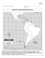
The instructions say to use a text-book to label 11 different regions in modern Latin America. If a text-book is not available a map can be found on-line and printed for student reference.
Curated OER
The Expansion of Islam to 750
Track the expansion of Islam throughout the Mediterranean and Near East. Locate and label 17 different areas that adopted the tenets of Islam.
Curated OER
Leaf Peeping at Sharpe!
While this lesson focuses on observations made at Sharpe Reservation, another area could be used. Learners map out a route from their class to a nature preserve. Then, they identify the color and features of the leaves, and describe...
Other popular searches
- Map Skills Lesson Plans
- Map Skills Worksheets
- Elementary Map Skills
- Geography Map Skills
- Basic Map Skills
- Social Studies Map Skills
- Globe and Map Skills
- Beginning Map Skills
- United States Map Skills
- Map Skills, Continents
- Early Explorers Map Skills
- Free Map Skills Worksheets


