Beverly Hills High School
Mapping Napoleon's Empire at Its Height (1812)
The complicated political history of Europe becomes apparent as young historians create a map of the borders of France when Napoleon's Empire was a its height in 1812.
Curated OER
Identifying, Mapping, and Personifying Countries Involved in WWII
Get artsy with this WWII group activity, starting with a whole-class assignment. Create a map of Europe, Northern Africa, and the Pacific using geometric shapes cut from construction paper and placed on the floor. Consider splitting the...
Ms. Catsos
Ancient Rome Map Worksheet
It wasn't just the great leaders of ancient Rome that shaped their civilization—the geography of the region played a major role as well. After first identifying major land masses, bodies of water, and city states on a map of Europe,...
Curated OER
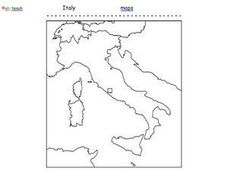
Italy Outline Map
In this outline map learning exercise, students examine the political boundaries of the European nation of Italy. The map may be used in variety of activities that individual teachers create to accompany it.
Curated OER
Countries Involved in World War II
Students create their own floor map of Europe, Northern Africa, and the Pacific. They locate, identify, and speak for one of the countries involved. In addition, they classify the country they represent as an Axis Power or as an Allied...
Curated OER
Western Civilizations, Chapter 12: The Civilization of the Renaissance
If you can't take your western civilization class to the Renaissance Faire, try this online resource to give them an idea of this era and others! While designed to accompany the Western Civilizations text, this tool can be utilized...
Curated OER
Geography, Map Skills & the Internet:
Students research various websites focusing on Italy while enhancing student utilization of computer, keyboards and the Internet. They discuss their findings on the geography, history, topography, and culture.
Curated OER
The Roman Empire-Map Activity
For this Roman Empire worksheet, learners complete a map activity in which they label and color civilizations, countries and physical features as instructed. There are no maps included.
Curated OER
Map of Italy
In this map of Italy worksheet, students find, color and label cities, surrounding countries, bodies of water and landforms in the country of Italy.
Scholastic
Drones Take Off
Ever wonder what drones are doing high above us in the sky? This article gives your class an insight to what those robots in the sky are doing. After reading an article on drone technology, pupils are prompted to respond to a...
Curated OER
Getting to know Italy
For this Italy worksheet, students complete short answer questions about the geography of Italy. Students complete 15 short answer questions.
Curated OER
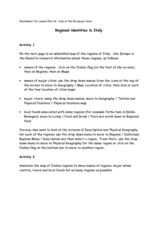
Regional identities in Italy
In this Italy map activity worksheet, students complete 2 map activities that require them to identify major cities and landforms in the country.
Curated OER
Italy: The Landscape
Students work in small groups to create a topographic map of Italy. They must include labeled line drawings of bordering countries and bodies of water. Students use salt and flour clay to make Italy three dimensional, showing the many...
Curated OER
Final Regents Review: Rome
Take a trip to ancient Rome in this presentation, which includes details about Roman life, society, politics, and religion. Viewers will be enthralled with the vivid maps and pictures in these slides, which could lead to a discussion on...
Curated OER
Creating a Map of France
In this crating a map of France learning exercise, students find and label important parts of France, bodies of water, mountains and surrounding countries.
Curated OER
Where Is Rome?
Third graders discover Ancient Rome through maps and worksheets. In this world history lesson, 3rd graders locate Rome on a world map and identify the scope of the Roman Empire. Students label an entire map of Italy after...
Curated OER
"Asking for Tourist Information" (Italian)
Students explain and use verbal directions, recognize the prepositions used in a conversation, explore Italian art, and acquaint themselves with tourist services in Italy.
Curated OER
Design a Resort: Italian Villa
Learners work in a group to design a travel brochure and television commercial for an Italian resort. They role-play having inherited a large sum of money and buying an Italian villa to turn into a resort. Students research geography,...
Teach Engineering
Who Can Make the Best Coordinate System?
Working with a map that does not have a coordinate system on it, small, collaborative teams must come up with a coordinate system for their map. Groups then explain their coordinate structure to the class.
American Battle Monuments Commission
Liberating Rome: The Anzio and Rome-Arno Campaigns
Follow the liberation of Rome in both time and space with an interactive timeline and map. As class members click on various icons on the map, they can track different countries and their troops during the Anzio and Rome-Arno Campaigns...
Curated OER
Priceless Gifts
Third graders read about Italy and the complete activities that investigate the spice trade. In this spice trade lesson plan, 3rd graders analyze characters, write a thank you note, speak Italian, and complete language activities.
Curated OER
Turin, Geography, Culture And Sports
Students study why certain locations are suitable to host the Winter Olympics. They research the characteristics of Turin, Italy, plan a trip and create a multimedia scrapbook of the trip.
Curated OER
Sixth Grade Social Studies Quiz
In this social studies worksheet, 6th graders complete multiple choice questions about economics, climate, maps, and more. Students complete 15 questions.
Curated OER
This Land is Your Land
Students consider the concept of borders and their development by looking at maps and documents. They create a presentation highlighting a current border dispute and propose solutions.


