Curated OER
Gingerbread Baby Unit
Learners participate in a variety of activities surrounding the book, Gingerbread Baby, by Jan Brett. They can create a house, a map, ornaments, and their own books. Additionally, they can draw, paint, or write out attributes for each...
Curated OER
Pastimes: Music and Dance
Play the lively music of flamenco and tango for your emerging Spanish speakers, and introduce them to popular dances from Spanish-speaking countries around the world. Discuss various types of music and dance, showing either pictures or...
Curated OER
Indus River Valley
Students examine and describe the course of the Indus River. Special Education students participate in a SMART Board activity which includes map work and the geography of the river valley. They determine what type of agriculture is grown...
Teaching Adapted PE
Locomotor and Object Control Stations
Develop children's basic locomotor and object control skills with an invigorating Adaptive PE lesson. A series of four, timed stations engaged the class in playing a game of Twister, walking on a balance beam, throwing bean bags, and...
Columbus City Schools
It’s Electric!
Shocking! Who knew so many great ideas existed for teaching middle schoolers about electricity? Find them all within this energetic framework. You'll light up at the variety of printable and web-based resources within! After building...
Curated OER
Navigating Your Community
Learners draw a map from memory describing the route between their classroom and the gym including a legend, a compass rose, a map scale, symbols, and a landmark at every change of direction. They then retrace their steps in their maps...
Curated OER
Our City
Second graders familiarize themselves with the town they live in by practicing their imagination, library research and writing skills.
Curated OER
Geography and Topography, History and Architecture
In this social studies lesson plan, students answer short answer questions about the geography, topography, history, and architecture of the east part of the United States. Students complete 24 questions.
Curated OER
Oceans: A Sensory Haiku
Students create an ocean haiku. In this haiku lesson, students use their five senses to write a haiku. Students watch videos about the ocean, make a sensory portrait, and create a class haiku.
Curated OER
Geography of the Harbor
Students study estuaries and their boundaries. In this investigative lesson students locate an estuary on a map and use nautical and topographical maps.
Curated OER
Planet Earth
Students explore and analyze data from different maps in order to explain geographic diversity among the continents. Student groups research continents' physical features and examine how they contribute to quality of life for inhabitants.
Curated OER
How Does Kansas Measure Up?
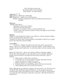
Students identify the five main crops of Kansas and crops that are produced in other states. The categorize the types of fruits and seeds of each plant and measure each to compare the length of each.
Curated OER
Tropical Regions/Mapping Biodiversity
Pupils use a world map to locate the country of Puerto Rico. In groups, they identify the various types of vegetation found on the island. They compare and contrast the biodiversity of the country to the United States. To end the...
Curated OER
Mapping My Community
Ninth graders are introduced to GPS technology. They complete fieldwork as they visit a specific area of their community to identify and map types of land use in the surveyed area. They use the collected data to create a digital map.
Curated OER
Introduction to Representing and Analyzing Data
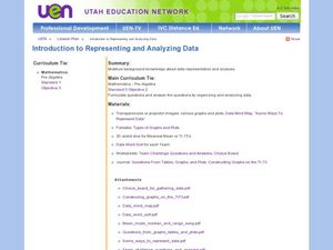
Represent data graphically. Allow your class to explore different methods of representing data. They create foldables, sing songs, and play a dice game to reinforce the measures of central tendency.
Science Matters
Slip Sliding Along
The San Andreas Fault is the largest earthquake-producing fault in California. In the seventh lesson in the 20 part series, pupils create maps of California, focusing on the San Andreas Fault system. The comparison of where California is...
NOAA
Sediments
Calcareous ooze ... what an interesting name! The 15th installment of a 23-part NOAA Enrichment in Marine sciences and Oceanography (NEMO) program focuses on sediments found on the ocean floor. After viewing the slideshow lecture,...
Curated OER
Weather instruments
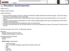
Students explore weather instruments. In this weather lesson, students make rain gauges, anemometers, and barometers following the instructions given in the lesson. Students set up a weather station using their instruments and record and...
Curated OER
Sound Walk: Discovering Data and Applying Range, Mode, and Mean
Elementary schoolers sharpen their listening skills as they use sound maps, tallies, and line plots to organize and interpret data. Everyone takes a "sound walk," and focuses on the sounds around them. They chart and tabulate the sounds...
Columbus City Schools
Geological Effects of Plate Tectonics
Don't get your classes all shook up about plate movement, instead use a thorough unit that guides learners to an understanding of plate tectonics. The lessons incorporate a study of the types of plate boundaries and their effects on the...
Curated OER
Water Quality and Watersheds: A GIS Investigation
Requiring more than one class period, this resource takes earth science learners on a journey through a watershed. Using ArcGIS Explorer, an online geographic information system, they view maps of watersheds and surrounding landscapes....
Curated OER
The Prairie Climate
Ninth graders research the average temperature and precipitation of a prairie region to determine the type of climate it is, and how it differs from other biomes. They examine the types of adaptions animals have made to live in the...
Curated OER
The Biggest Plates on Earth
The best part about teaching guides is all the great information you can use to inform your class. They infer what type of boundary exists between two tectonic plates. Then, using given information on earthquakes and volcanism they'll...
Curated OER
Domain and Range
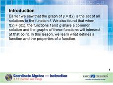
Relations, and functions, and line tests, oh my! An instructional slideshow demonstrates the definitions of a relation, a function, and the domain and range of a relation. Viewers then learn how to use mappings and vertical line tests to...


