Curated OER
Why the Y2Y?
Learners investigate the proposed route from Yellowstone to Yukon. They listen to lectures about the proposal and the different opinions concerning it. Students research the type of wildlife in the area for the road and they consider how...
Curated OER
Westward Expansion
Young scholars locate California and New York on a map and explore available means of travel in the 19th century. Students explore the role of trade in pioneer America and simulate various barter transactions.
Curated OER
1668 Map of Newark Activity
Eleventh graders read a map for historical information, decipher a map legend and symbols, and expand their knowledge of a historic time.
Curated OER
What Are Alternative Fuels? Concept Mapping Alternative Fuels Investigation
Students compare and contrast the different types of alternative fuels. They create a concept map to understand their classification. They examine the properties of matter and energy as well.
Curated OER
GIS: Mapping Watersheds of the Edwards Aquifer in Travis County
Learners manipulate existing GIS data to create and map a new layer of information that shows that watersheds in Travis County that are on top of Edwards Aquifer. They create and map that shows the watersheds in Travis County that are on...
Curated OER
Edible Resource Maps
Third graders work in groups to create an edible resource map showing locations of at least five resources in the United States. Students research on the internet different regions and the resources that are found in those areas. They...
Curated OER
Mapping Seamounts in the Gulf of Alaska
Students describe major topographic features on the Patton Seamount, and interpret two-dimensional topographic data. They create three-dimensional models of landforms from two-dimensional topographic data.
Curated OER
Mapas Bailados: Creating Visual Representations of Dances Using Maps
Third graders listen to "Frank the Monster..." and discuss the dance map on the inside cover of the book. They create their own dance map using sentence strips to record the types of movement.
Curated OER
Mapping Your Neighborhood
Students define and outline their neighborhoods using GIS (geographic information systems) or a regional map and relate their neighborhoods to the principles of Smart Growth.
Curated OER
Mapping A Stream
Students participate in mapping an actual waterway. They include reach lengths, transects, compass reading, and scale determinations. They include windfalls, plant cover, types of streambed composition, and landmarks such as trees and...
Curated OER
Planning A Two Week Trip to Tokyo, Kyoto, and Hiroshima
Ninth graders simulate being a first-time visitor to Japan. Using the internet, pupils identify answers to given questions about Tokyo, Kyoto, and Hiroshima. Students use computer technology to type their answers. Their answers also...
Curated OER
Development Issues in the Northern Suburbs
Pupils demonstrate the ability to obtain geographic information from a variety of print and electronic sources. They use a variety of maps and data to identify and locate geographical features of Minnesota and Anoka County. in addition,...
Curated OER
Asia Crossword
In this geography worksheet, students complete a crossword puzzle on the continent of Asia. They answer 21 questions related to the type of government systems found, capital cities, deepest lake, and lowest population density.
Curated OER
Learning to Give: Generosity of Spirit Folktales
High schoolers read two Inuit folktales about life and death. In this language arts lesson, students study the models of giving found in these Inuit tales about life, death, grief, sacrifice, and generosity. As the class reads these...
Curated OER
Where In the World is the Dominican Republic?
Students begin the instructional activity by discussing how where they live affects how they live. As a class, they add examples to each category such as home types, clothing, jobs and food. Using those categories, they write about...
Curated OER
Chinese Lion Dance
Students celebrate the Chinese New Year and listen to the story behind the Chinese Lion Dance. For this Chinese New Year lesson, students research the geography and culture of China. Students create puppets, dance the Lion...
Curated OER
Plate Tectonics: Sixth Grade Lesson Plans and Activities
Here is a set of pre-lab, lab, and post-lab lesson plans on plate tectonics. After completing the previous labs on volcanoes and earthquakes, sixth graders use the gained knowledge to explore plate boundaries and the movement of...
Practical Action
Moja Island
Did you know that 1.3 billion people live without any form of electricity? Discover an array of possible renewable energy options by taking a trip to Moja Island, an online learning resource that will equip you and your...
Curated OER
International Currency Exchange
Students examine coins from around the world and write down their observations. As a class, they discuss the types of symbols used on the coins from different countries and locate the country on a map. To end the activity, they calculate...
Curated OER
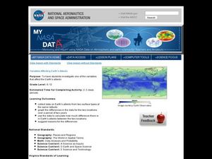
Variables Affecting Earth's Albedo
Young scholars study the variables that affect the Earth's albedo. In this environmental data analysis lesson plan students interpret and graph information and calculate changes.
Curated OER
What's For Dinner?
Eighth graders discover how the location of restaurants affects the future location of different restaurants. Using a fictionous town, they map the locations of all current restaurants and analyze the data to determine what type of...
Curated OER
Trees of Mississippi
Students research tree species found in Mississippi, and record the tree types, numbers of trees, and locations. Students then research the forest industry sites, and determine possible relationships between industry location and tree...
Curated OER
Weather
In this earth science worksheet, students use the clues given at the bottom of the sheet to solve the crossword puzzle related to weather. They identify various cloud types and how they are formed. Students also identify atmospheric...
Indian Land Tenure Foundation
Indian Trust Lands
An important aspect of studying Native American history is understanding the nature of trust lands. Budding historians will learn that as Native Americans were removed from their home lands, trust lands were provided in the form of...


