Curated OER
Karnaugh Mapping
In this electrical circuit worksheet, students answer a series of 17 questions using a Karnaugh map to generate a Boolean expression, and identify logic gates and functions. This worksheet is printable and the answers are available on-line.
Curated OER
Analyzing Two Dances and Making a Dance Map: The Nutcracker
Students discuss dance elements and create a dance map. They choose a dance theme and incorporate movement into their dance maps and choreography. They also experiment with different types of music.
Curated OER
Mapmaker, Mapmaker, Make Me a Map!
Young scholars evaluate the different types of historical and geographical information that one can gather through close study of historical maps from the 16th through the 19th centuries. They create their own maps.
Curated OER
Learning About Maps
Students investigate the many uses and features of maps and globes and locate where they live on both. In this map lesson plan, student play a travel game and create their own maps to explore states, continents, countries, and islands.
Curated OER
How Big is the Playground: Creating a Map
Students create a topographical map of an area outside of the school. In this mapping lesson, students compile data on angles, distances, and key landmarks for a predetermined area on the school grounds to create a map using Geometer's...
Seterra
Northern Europe: Countries - Map Quiz Game
Remembering geography is a tiring and tedious task to many scholars. Change it up by assigning the map quiz game. Elementary and middle schoolers alike test their knowledge and compete with the clock to match as many countries as...
EngageNY
How Do Dilations Map Lines, Rays, and Circles?
Applying a learned technique to a new type of problem is an important skill in mathematics. The lesson asks scholars to apply their understanding to analyze dilations of different figures. They make conjectures and conclusions to...
EngageNY
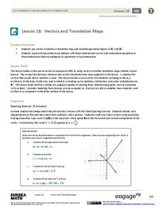
Vectors and Translation Maps
Discover the connection between vectors and translations. Through the lesson, learners see the strong relationship between vectors, matrices, and translations. Their inquiries begin in the two-dimensional plane and then progress to the...
Balanced Assessment
School Zone
Find the right house within walking distance from school. The short assessment has pupils determine the houses that are a given maximum distance from a school. Individuals then determine the shortest and longest walks from the homes that...
Curated OER
Word Pair Analogies 2
Analogies deepen the understanding of words. Help your English language learners (or native speakers studying vocabulary) develop their understanding of words like agoraphobia, brevity, and hieroglyphics. A bridge sentence is provided...
Flairify
TapTyping
Familiarize your pupils with how to type by tapping on a tablet screen. They will master the tablet keyboard with a set of lessons that get progressively more advanced. Track progress with a speed test every few lessons.
EngageNY
Mid-Module Assessment Task: Grade 8 Module 2
It's time for a concept check! Check for student understanding over the three types of rigid transformations. The assessment follows the first 10 lessons in this series and to test pupils' proficiency of these concepts. Individuals...
Curated OER
Mapping West Virginia
Fourth graders explore West Virginia. In this Unites States geography lesson, 4th graders discuss the type of land and the cities in West Virginia. Students create two overlays, with transparencies, that show the natural land and the...
Curated OER
Topographic Maps
In this topographic map worksheet, students learn how to read a topographic map and create a topographic map of their own using clay or Play-Doh. Students include contour lines by layering the clay. Students answer 6 questions about...
Curated OER
Maps
Learners investigate threee types of maps. In this algebra lesson, students idenitfy different maps and explore how they relate to the area keeping cllimate and topography in mind. They discuss maps used to navigate land. air and sea.
Curated OER
Maps, Charts, and Graphs
Students define key geographic terms and track a hurricane on a map. They examine various types of maps and find locations on them,including rivers, cities and mountains.
Curated OER
Political Legends and Map Symbols
Students identify the legend and map symbols. In this map skills lesson, students use a world map to find various locations using a map key.
Curated OER
Weather, Data, Graphs and Maps
Students collect data on the weather, graph and analyze it. In this algebra instructional activity, students interpret maps and are able to better plan their days based on the weather reading. They make predictions based on the type of...
Curated OER
" Where in the World is Your Blood Type?
Students explore a map of the worldwide distribution of blood types and observe the patterns. In this blood type lesson students conduct a lab and determine the geographic distribution of the different blood types and determine a...
Curated OER
Making a Map
Students are introduced to maps by examining the various types and practice using a key to find information. They each create their own map with a key and graph information. As a class, they read the story "Henny Penny" and share their...
Curated OER
Map Your House
Students are introduced to the concepts of maps as scale models of the whole. After a brief lecture on creating and using an accurate scale when drawing and reading a map. They create a scale drawing of the floorplan of their homes.
Curated OER
Worksheet for Analysis of a Map
In this primary source analysis worksheet, students respond to 6 short answer questions that require them to analyze the maps of their choice.
Curated OER
Paint My Counties: Map Coloring the Counties of Arizona
Fourth graders identify the counties of Arizona. In this social studies lesson, 4th graders color a county map of Arizona using the fewest number of colors possible. Students write a persuasive paragraph.
Curated OER
Gingerbread Forest Map Skills #2
Students are read the story "Gingerbread Baby". They work together to develop a 3D map of the journey the baby traveled in the story. They practice their map reading skills to complete the activity.


