Curated OER
Letters from the Road
Students examine and differentiate between rural, urban, and suburban communities. They describe their local areas, view and discuss the images on the West Virginia Quarter, and write a friendly letter describing a camping trip.
Curated OER
Japanese Culture
First graders research information about Japanese people and culture. They read a Japanese story listening for rhyme schemes. They create their own rhyme schemes. They discuss Japanese food and sample rice cakes. They read Haiku and then...
Curated OER
Exploring the Sonnet
Learners research English/Shakespearean and Italian/Petrarchan sonnet forms. They write an original sonnet on their preferred form (English or Italian), write the poem on the wordprocessor and publish and post it on the net at the Sonnet...
Curated OER
The Nature of Haiku Poetry
Students brainstorm elements of nature art prints and photos. They identify the syllable count of Haiku and take a nature walk. They write Haiku poems while practicing the use of simile, alliteration, metaphor, and analogy to describe...
Curated OER
What's So Good About Popcorn?
First graders use a thinking map to organize a paragraph. They write and edit their paragraph about popcorn and type the final copy on the computer.
Curated OER
Arbor Day Across the United States
Students perform research about hardiness zones used to guide planting. They read a hardiness zone color-key map and create their own color-key maps to show when different states celebrate Arbor Day.
Curated OER
How We Get From Here to There
Learners recognize various types of movement people rely on to get from one place to another, locate the forms of movement on a map and choose one form of movement and research its path.
Curated OER
Air Masses
Students examine the physical characteristics of several types of air masses to discover how air masses can be identified and defined by their temperature and moisture content.
Curated OER
Hagerman GIS Questions
Students examine maps and pictures to identify specific geographic information. In addition, they explore data tables and GIS data to identify fossil beds and vegetation. Students explore the correlations between soil type, vegetation,...
Curated OER
Lori Schmidt's Lovely Lesson
Young scholars color code a world map by region to show the different amphibians and reptiles that live there. They discuss the Nile Crocodile, Snapping Turtle, Komodo Dragon, Indian Python, and Lacertidae. When completed, they create a...
Curated OER
Glaciers Leave Their Imprint
Students study various types of glaciers and the landforms they create. Working in pairs, they research a type of glacial landform and construct a calendar page illustrating and describing it. The pages be compiled to create a class...
Curated OER
A Coin Out of Water
Pupils examine the Michigan state quarter and identify land and water on the quarter. They locate the Great Lakes and other bodies of water on a map. They compare and contrast streams, rivers, ponds, lakes, and oceans.
Curated OER
Why Do You Live Where You Do?
Eighth graders identify reasons why settlers bought land from the railroad and not a Homestead grant. Using that information, they compare and contrast the types of land given in each situation. They discuss the reasons why given...
Curated OER
Children's Literature
Introduce the students to basic economic concepts and types of economic systems and develop the an understanding of how economic choices involve costs and consequences; provide introduction to rural America circa 1920 and compare to our...
Curated OER
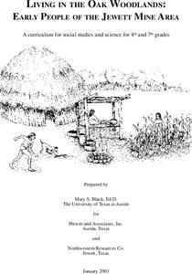
Living in the Oak Woodlands: Early People of the Jewett Mine Area
Students examine the archeology and native peoples of the Jewett Mine area of Texas. Using a map, they explain the economic patterns of the native groups and how the geography of the area affected activities. They compare and contrast...
Curated OER
Kidsville USA
Second graders create an imaginary town using Kid Pix. They demonstrate their knowledge of specific vocabulary words and their knowledge and understanding of location by placing schools, stores, parks, etc. appropriately on their maps.
Curated OER
Planning a Tourist Resort
Students work in teams of 2 to complete the presentation portion of the assignment. They may be required to work alone or may work with their partner to complete the "Board Member's Responses."
Curated OER
Borah Peak Earthquake
students use the internet, an atlas map, and other sources to explore a map of Idaho. They locate the Lost River Range and Mt. Borah. Students read the atlas map to locate earthquake faults, find the magnitude, fault, and epicenter of...
Curated OER
Bonding Review
Students differentiate metallic, ionic and covalent bonding. In this chemistry lesson, students explain how these bonds are formed. They classify substances according their bond type.
Curated OER
Investigation 1 - Wetlands, Forests & Deserts
Fourth graders examine surface terrain and how plants and animals are affected by the temperatures and precipitation that elevation and terrain creates. Then students predict what type of environment plants and animals live in.
Curated OER
Oregon Rainshadows
Students brainstorm list of possible highest locations in Oregon, identify and label places from list on map using color code, and discuss and identify causes of a rain shadow.
Curated OER
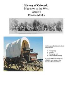
History of Colorado-Migration to the West
Fourth graders identify reasons for people moving to the Colorado Territory and examine how moving in the 1800's is different than moving today. They also practice reading maps and gathering information from maps, as well as, describe...
Curated OER
The Mathematics of Space and Place
Students investigate the measurements and geometry of the school grounds. They conduct inquiry while measuring the campus and some of the city blocks. Then students draw a map to scale and categorize property types using a pie graph.
Curated OER
Boats Graph
Students read from the Bible about the travels of Paul, particularly the boat rides. They trace Paul's travels on a map of Asia Minor. Students review a field trip they took and make a graph showing the numbers of each type of boat they...


