Curated OER
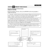
Defense Against Infectious Diseases
In this infectious diseases worksheet, students read about the two types of defenses the body has against pathogens: innate (nonspecific) and adaptive (specific). Students then complete a graphic organizer by filling in 11 blanks.
Curated OER
Ancient Egypt: Connecting Literature and Geography
Students brainstorm prior knowledge of Ancient Egypt, locate Egypt on map of Africa and on world map, watch King Tut film, discuss term biography, and map geographical information mentioned in stories and documentaries about Ancient Egypt.
Curated OER
Changing Images of Childhood in America: Colonial, Federal and Modern England
Students compare and contrast maps of New Haven, Connecticut from today and the past. After taking a field trip, they draw sketches of the types of architecture and discuss how the buildings have changed over time. They read journal...
National Park Service
Petrified Forest National Park
Poetry Soup, a reading and writing unit constructed by the Petrified Forest National Park, will have scholars hungry to learn about nature. The cross-content unit contains topics related to history, science, and language arts. Content...
Curated OER
Angles - Unlocking Geometry
Students investigate the concept of angles and how they are used in geometry. They construct polygons using various types of angles and then classify them according to their physical properties. Students use a computer program in order...
Howard Hughes Medical Institute
Lactase Persistence: Evidence for Selection
What's the link between lactase persistence and dairy farming? Biology scholars analyze data to find evidence of the connection, then relate this to human adaptation. Working individually and in small groups, learners view short video...
Curated OER
A Place Called Fairfax
Students are introduced to the various types of maps of Fairfax County, Virginia. Using the maps, they explain the relative and absolute locations of the county and discuss the importance of both. They also discover how the county is...
Curated OER
When You're Hot, You're Not!!
Middle schoolers investigate volcanoes. In this landforms activity, students locate two volcanoes on a world map. Middle schoolers compare and contrast the types of volcanoes by using various Internet sites.
Curated OER
Create a Story May
First graders review the terms characters, setting and events in stories. They are shown how to access the Kidspiration Map, and how to add pictures in the correct spaces on the map. Students insert pictures in the map of the story...
Curated OER
Europe Map Quiz
For this online interactive geography quiz worksheet, students respond to 45 identification questions about the countries located in Europe. Students have 5 minutes to complete the quiz.
Curated OER
Study Skills Assignment
Students utilize six different types of study skills as they review material for a final exam. They are graded on the exam and on the study process for the exam.
Curated OER
Using Graphic Organizers for Sensemaking
Students create concept maps in order to assess the information that they have gathered during research. They study the concept map to determine if the research is complete.
Curated OER
Europe Before and after WWI
Eighth graders compare and contrast maps of Europe before and after World War I. In this World War I activity, 8th graders color and label maps of Europe prior to the war and after it. The historical maps can be accessed online.
Curated OER
Compass Rose Directions
Second graders use cardinal and intermediate directions to locate places on maps and places in the classroom, school, and community. They draw a setting map of "Little Red Riding Hood." Students give five steps of cardinal or...
Curated OER
Discovering New Mexico
Seventh graders discuss the elements of maps and using basic linear measurement. They calculate the distance between the cities and create a simulated journey around New Mexico using a road map. They write out the directions for their...
Curated OER
Name That Continent
Young scholars practice locating the seven continents, four hemispheres, and four oceans using a large world map and a review song. They also import a world map to the Kid Pix computer program then type in proper labels on the map. There...
Curated OER
Arthur's Tooth
Young scholars practice their reading comprehension by reading a story in their class. In this story map lesson, students read the Marc Brown book Arthur's Tooth and discuss the story, characters and setting. Young scholars create a...
Curated OER
Climb a Mountain, Raft a River on Your Own Land
Students are introduced to the characteristics of a map. As a class, they discuss the uses of public lands in their community and develop symbols for each feature. They use the symbols to create a map showing the recreational uses of...
Curated OER
World Map and Globe-Equator, North Pole, and South Pole
Students identify the Equator, North Pole, and South Pole on a map. In this geography lesson, students use a world map and circle the North and South Pole. Students locate the Equator on a globe and use a map marker to highlight it.
Curated OER
Map Your Local Watershed!
Pupils study how to map their local watershed from a topographic map. They find the watershed on an aerial photograph and use maps and aerial photos from the Web to identify the human activity within the watershed, as well as various...
Curated OER
Continents of the Globe
Students identify the continents on the globe. In this map skills lesson, students define the term "continent" and identify the seven continents on the globe.
Curated OER
Where People Live- Neighborhoods
Students use a map. In this neighborhood instructional activity, students describe a neighborhood, emphasizing the common characteristics between all neighborhoods. Students locate a neighborhood on a landscape picture map and discuss.
Curated OER
Forecasting Weather
In this weather worksheet, students use a weather map to determine which station has the lowest and highest pressure. Then they describe the various types of fronts that can come through a location. Students also explain the difference...
Curated OER
Pictures of Data
In this data worksheet, students look at maps and charts and answer multiple choice questions about them. Students complete 10 questions.


