Chicago Botanic Garden
Climate Change Around the World
It is unknown if cloud cover increases in response to carbon dioxide levels changing, helping climate change slow down, or if cloud cover decreases, allowing Earth to warm faster. Part four in the series of five lessons has classes...
NOAA
Exploring Potential Human Impacts
Arctic sea ice reflects 80 percent of sunlight, striking it back into space; with sea ice melting, the world's oceans become warmer, which furthers global warming. These activities explore how humans are impacting ecosystems around the...
Consortium for Ocean Science Exploration and Engagement (COSEE)
Life in an Ocean World
How does the shell color of crabs and the habitat they live in impact the predator-prey relationship? The fourth lesson in a series of five is a game where participants try not to get eaten if they are a prey and try to eat if they are...
Curated OER
Breaking News English: Noise Pollution in the Oceans
In this noise pollution in the oceans activity, students read the article, answer true and false questions, complete synonym matching, complete phrase matching, complete a gap fill, answer short answer questions, answer discussion...
Curated OER
Investigating Our Place in the World
Students study the concept of geography in a year long unit. In this geography unit, students participate in different activities that explain the spatial sense of the world, the physical landmasses and bodies of water, geographic...
Curated OER
Learning About the Equator, The Seven Continents and the Four Oceans
Students use a globe or map to locate the equator, oceans and continents. Using the internet, they spend time surfing through predetermined websites on continents and oceans. They write facts on different parts of the globe on index...
Curated OER
Oceans of the World
Second graders demonstrate their ability to find the five oceans on a globe and on a world map and relate their knowledge of mountains and other physical characteristics of land masses to the physical characteristics of the ocean floor.
Curated OER
Map Skills: Explorers, Continents, and Oceans
Third graders use a software program to make and label a map of the world. On the map, they locate the seven continents, oceans and the countries of Europe. They also draw the routes of Christopher Columbus, Juan Ponce de Leon and...
Curated OER
Leapin' Landmarks: Locating 10 Man-made Landmarks Around the World
Third graders label continents, oceans, and major mountain ranges on maps and use the maps to write an informational report about landmarks. For this landmarks lesson plan, 3rd graders write about 1 major landmark.
Curated OER
World Map
For this world map worksheet, students practice their geography skills as they label the 7 continents and 5 oceans. A word bank in included.
Curated OER
Causes of World War One
For this causes of World War I study guide worksheet, students discover details regarding this time period in world history. Students read 5 sections of information and examine photographs. Students also respond to 12 short answer...
Curated OER
Ocean World
In this online interactive geography skills worksheet, students answer 5 multiple choice questions regarding El Nino. Students may submit their answers to be scored.
Curated OER
Geography A to Z: Letter O
The world is full of places that start with the letter O. It's true! Your class can use what they know about geography to answer seven curious questions related to world locations that all begin with letter O. Like Ohio, Ottowa, and...
Curated OER
Physical World Map
For this world map worksheet, students practice their geography skills as they label the 7 continents and 5 oceans. Teachers may use this physical map for various classroom activities
Curated OER
Oceans and Coasts
Students explore the topic of marine pollution. They define key vocabulary words, list examples of marine pollution, complete a true/false handout, read an article, and participate in a class discussion.
Curated OER
Capitals, Oceans, And Border States
Students investigate geography by completing games with classmates. In this United States of America instructional activity, students examine a map of North America and identify the borders of Mexico and Canada as well as the Pacific and...
Curated OER
Where in the World? Oceans & Continents
In this geography worksheet, students answer 6 questions using a coded map as a reference, then students identify labeled geographic features.
Curated OER
Map Puzzles
Students make puzzles from world maps, dramatizing how much of the globe is covered by ocean.
American Museum of Natural History
What is Marine Biology?
A marine environment covers the majority of the earth but is arguably the least understood. Teach young scientists about the characteristics of oceans and ocean species using an interactive online lesson. The in-person or remote learning...
Curated OER
Learning About Our World
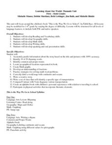
Pupils explore their world using the book "This is the Way We Go to School." They predict information about the story based on the title and pictures. Students label a world map with the names of continents and oceans. They write a set...
Curated OER
English Exercises: It's A Small World
In this countries of the world instructional activity, 6th graders watch a musical video, interactively select the correct words (11) for the lyrics of the song, complete 9 sentences about foreign countries, match 10 flags with their...
Curated OER
Blue Planet: Coral Seas
Students create a poster about coral reefs. In this oceanography lesson plan, students teach the class about a given aspect of the coral reefs. Students create posters with images and facts about this habitat.
Curated OER
Europeans in the New World
In this world history worksheet, students utilize a word bank of 10 terms or phrases to answer 10 fill in the blank questions about the Europeans settlement of the New World. A short answer question is included as well.
Curated OER
Oceanic Heat Budget Activities
Students map and research imaginary islands located in different parts of the world. They describe the weather and climate of their island and show how local currents, water temperatures and waves may influence the weather patterns.


