Curated OER
Exploring China
Second graders explore the geography, holidays, important teachers, and inventions from China in the nine lessons of this unit. The results of their inquiries are expressed through a variety of products, writings, and presentations.
Museum of Tolerance
Immigration Journeys
Through the journey of four stories of immigration, scholars complete graphic organizers and apply knowledge to create a visual representation of their findings on a large poster. Third and fourth readers write a letter to their family...
Curated OER
Land of the Rising Sun
Students survey aspects of traditional and modern Japanese customs and beliefs in the seven lessons of this unit. Both the culture and the geography of the country are studied in this unit.
Curated OER
Africa: Political Map
Students create a political map for Africa. In this country identification lesson, students locate Africa on a globe and discuss some of its major countries and bodies of water. Students complete a political map of Africa and test...
Curated OER
China Vocabulary Quiz
For this recognizing meanings of words worksheet, students match words about the country China with their definitions. Students match 16 answers.
Curated OER
Geography and Culture
Students explore African geography, study the overall continent of Africa and its individual countries, discuss demographics, and participate in research and class activities.
Curated OER
The Geography of Africa
Hop a flight to Africa in this presentation, which includes brilliant and appealing photographs of the continent as well as maps and graphs about its geography, topography, and climate. Those who are researching Africa for a project or...
Curated OER
The Importance of Imports
Learners explore world trade by examining items they find at home and listing countries those items came from. Data is displayed on a map and charted according to continent. They discuss how products are transported.
Curated OER
Chart the Weather for Cities Around the World
Students orally describe Northern and Southern hemispheres, identify 7 continents, and point out specific countries and cities. They locate and record weather information.
Curated OER
Personal Travel Guide to a Chinese City
Scholars become travel guides in this group research project to investigate a Chinese city or region for a presentation. Heavily based on Internet research, the activity requires participants to jigsaw the final project, so each team...
Curated OER
What is Kwanzaa?
Describe the general characteristics of Kwanzaa after reading Seven Candles of Kwanzaa. For this Kwanzaa lesson, learners study the principles of the Kwanzaa holiday and interpret the principles through music and dance. They...
Curated OER
Characteristics of Africa
Students describe basic land features and characteristics that make up the continent of Africa, describe the people of Africa, where they live, and how they live and get a sense of what it is like to live in Africa.
Curated OER
The Race to Dominate the Known World
Students describe cause/effect relationship of a European country's need for resources, exploration, colonization, and settlement of different regions of the world beginning in the 14th Century, and role play representatives of assigned...
Science 4 Inquiry
Fluid Streams Affecting Weather
The jet stream can reach speeds of up to 250 miles per hour. Scholars learn about the jet stream and ocean currents as they rotate through stations. They answer questions leading them to understand the impact these fluid streams have on...
Curated OER
Australia: the Land Down Under
Students give a solid history and geographic explanation of the country of Australia and explain why it is important. They use some creativity in designing their own island, by using the physical features of this particular country.
Curated OER
What is the connection between rice and estimation?
Sixth graders investigate estimating. In this estimating lesson, 6th graders estimate how much rice is eaten around the world. Students estimate the percentages of rice eaten by other countries. Students compare rice production to other...
Curated OER
Location, Location, Location!
Twelfth graders locate cities, states and countries on maps. They use the cardinal directions to locate places on maps. They describe where they were born by giving clues without naming the exact state. They trade papers and try to guess...
Curated OER
Geography Words
This learning exercise uses maps of South America and Canada to combine basic geography vocabulary and using prepositions. Students use the maps to answer questions about the locations of various countries on the two maps. This would be...
Curated OER
Foods and Languages of the World
Students celebrate diversity. In this multicultural appreciation lesson, students celebrate diversity by sampling food from different cultures, learning a few words in Spanish and identifying the seven different continents.
Curated OER
The borders of Europe. Geographically location or cultural artifice?
Twelfth graders discuss where they regard the boundaries of Europe to be. They raise their awareness that "Europe" may be more of a cultural construct than geographical defined continent.
Curated OER
North America Puzzle Answer Sheet
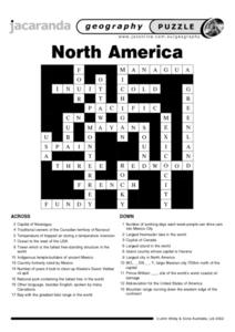
In this geography worksheet, students name the capitals of various countries found in North America. They also identify the various weather patterns across the continent and specific bodies of water. There are 21 descriptions and 21...
Curated OER
Community Culture Trunk
Second graders examine the similiarities and differences between the various cultures represented in their class. After being read a story about immigration, they identify things they would have to bring with them if they were moving to...
Curated OER
Asia Crossword
In this geography worksheet, students complete a crossword puzzle on the continent of Asia. They answer 21 questions related to the type of government systems found, capital cities, deepest lake, and lowest population density.
Curated OER
Ramadan (Islamic Holiday)
Learners recognize that different groups of people have celebrations unique to them. They identify countries on a map where Islam is a dominant religion. They demonstrate their understanding of fasting and abstinence.


