Curated OER
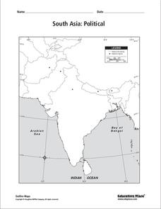
South Asia: Political Map
In this South Asia political map worksheet, students examine the national boundaries. The map also highlights each country's capital city.
Curated OER
Asia Physical Map
In this Asia physical map learning exercise, students make note of the major landforms and bodies of water located on the continent.
Curated OER
Southeast Asia and the South Pacific: Political
In this Southeast Asia and the South Pacific political map worksheet, students examine boundaries of each of the countries and the placement of the capital cities. The major bodies of water are labeled.
Curated OER
South east Asia and the South Pacific: Political: Labeled Map
In this Asia and the South Pacific map worksheet, students examine the boundaries of the nations in this region of the world. Students also note the location of capital cities as they are denoted by stars. This map is labeled.
Curated OER
South Asia: Political Map
In this South Asia outline map worksheet, learners & examine boundaries of each of the countries in the region. This map is labeled with the country and capital city names.
Curated OER
Asia and the South Pacific: Political Map
In this Asia and the South Pacific map instructional activity, learners examine national political boundaries and national capitals in this region of the world.
Curated OER
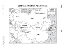
Central and Northern Asia: Political
In this Central and Northern Asia map instructional activity, students examine national political boundaries and national capitals in this region of the world. The map is labeled.
Curated OER
Central and Northern Asia: Political
In this Central and Northern Asia outline map, students examine the political boundaries of the nations in this region and note the location of their capital cities. This unlabeled map may be used in a variety of classroom activities.
Curated OER
Asia and the South Pacific : Political Map
In this Asia and the South Pacific map worksheet, learners examine the boundaries of the nations in this region of the world. Students also note the location of capital cities as they are denoted by stars. Major bodies of water are labeled.
Curated OER
Asia Capitals Map Quiz
In this online interactive geography quiz activity, students examine the map that includes 31 countries in Asia. Students match the names of the capital cities to the appropriate countries on the map.
Curated OER
North Africa & Southwest Asia Map Quiz
In this geography skills instructional activity, students examine the blank outline map of North Africa and Southwest Asia. Students label the countries located in the region.
Curated OER
Children's Values and Aspirations
Discuss the lives of the children of East Asia using this resource. Learners read an article about children's values, aspirations, and expectations in East Asia. Students match ten vocabulary words to their correct definition and write a...
Curated OER
Being There: Exploring China And Japan
Students discover the culture, society, geography, and history of Asia through games, food, art, and literature in this multi-day activity about China and Japan. An exciting activity for upper-elementary or lower-middle school classrooms.
Curated OER
Teaching About East Asia
Seventh graders research East Asian countries. In groups, pupils are assigned to research China, Japan or Korea. Using the internet and other resources, classmates create a multiple tier time line. They consider aspects such as...
Curated OER
East Asia: Population Facts and Figures
Students examine population information from East Asian countries. Using a specified website, pupils explore the population of China, Japan, North Korea and South Korea. Classmates examine the population density compared to the world's...
Curated OER
Learning About Asia
Learners study about Asia from class lecture. They study about the continent, the main places in Asia, the products, the climate, and other important facts so they can write an outline for their paper. Students write their outline and...
Curated OER
Lesson Plan on Map Skills for South Asia
Seventh graders observe and discuss an overhead transparency map of South Asia. In small groups, they label a blank map of South Asia, and listen to a lecture on the realm.
Curated OER
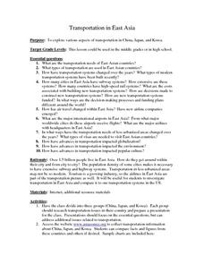
Transportation in East Asia
Pupils engage in research about the subject of transportation in Eastern Asia. The size of countries and population pose challenges that are studied and reflected upon in student writings from the information found.
Curated OER
What is Southeast Asia?
Students participate in various classroom activities designed to teach them about the location and cultures of countries in Southeast Asia.
Curated OER
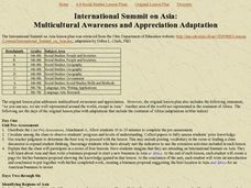
International Summit on Asia
Students conduct research into the continent and culture of Asia. The tapping of prior knowledge is done with a pre-unit assessment. The appreciation of Asian culture is the intended outcome of the unit plan.
Curated OER
East Asia: Current Events
Ninth graders read and evaluate current events of East Asia. They select an article, read and summarize the article and identify the key people, places, dates, and events in the article. As they summarize, they write a personal...
Curated OER
Balinese Music As An Aspect Of Art In Southeast Asia
Students listen to music from Southeast Asia, study the place on a map, and are exposed to the culture.
Curated OER
Trade Route By Sea To Asia
Eighth graders study a map and identify the countries of Spain, Portugal, India, China and Thailand. After a class discussion, 8th graders explain the advantages of trading over land and by sea and they explore the men who journeyed to...
Curated OER
The Arts of Africa, Asia and the Middle East: An Exploration of Art, Music and Film
Students examine the arts of the Middle East, Asia and Africa. After viewing films, they discuss the views of the various characters and identify the differences in the cultures presented. They also use the internet to evaluate various...
Other popular searches
- Asian History
- Asia Geography
- Southeast Asia
- Asia History
- Asian Art and Music
- Asian Cultures
- Asian Pacific American
- Southwest Asia
- Asian Folktales
- +Asia +Education
- East Asia
- South Asia


