Curated OER
Survival in Antarctica
Explore the harsh climate of Antarctica and its wildlife. Participate in experiments to determine how humans survive in the continent's climate, and address the difficulties faced by scientists.
Curated OER
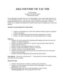
Asia Country: Tic Tac Toe
Enhance your geography class's knowledge of the countries on the Asian continent with this research lesson. Individuals or groups use books, the library, and the Internet to research one Asian country of their choice. Handouts and...
Curated OER
How were European nations capable of dominating the African contintnt?
Help your class determine why European was able to dominate the African continent. They read 5 excerpts, each related to a reason why Europe colonized Africa. Then they answer 4 critical-thinking questions.
Institute for Geophysics
Understanding Maps of Earth
Here is your go-to student resource on primary geography concepts, including facts about the surface of the earth and its hemispheres, latitude and longitude, globes, types of maps, and identifying continents and oceans.
American Museum of Natural History
Race to the South Pole
Antarctica was the last continent humans explored. Explore how two teams raced to be the first using an interactive online lesson. Users learn about the climate challenges and how the teams sought to overcome them. The resource is...
Curated OER
Where in the World?
Learners participate in an activity promoting them to use different balancing skills while they review/learn important facts about each of the continents.
Curated OER
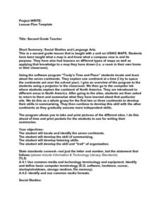
Project WRITE
Second graders have been taught hwot o use a map. They also know about a compass and different types of maps. Students use a software program to locate and learn about the seven continents. At each continent they are to summarize what...
Curated OER
Mapping Dinosaurs in Place and Time
Third graders study the continents that specific dinosaurs lived on. They compare the continent's location and climate when dinosaurs live there with its current location.
Curated OER
Making a Globe
Students examine the mercator projection or nautical chart and observe how global maps do not have the same distance as flat maps. They design handmade globes using the meridians and equator as guides to draw in the land. They paint and...
Curated OER
Introduction to African Folklore
Students are read "Anansi the Spider" to begin their discussion on continents. Using a map, they locate the continent of Africa and the country of Ghana. They discover who the Ashanti people are and view examples of their artwork. They...
Curated OER
Planet Earth
Learners explore and analyze data from different maps in order to explain geographic diversity among the continents. Student groups research continents' physical features and examine how they contribute to quality of life for inhabitants.
Curated OER
A Look at the Geological History
In this geological history worksheet, students draw a cartoon strip to sequence how the North American continent grew. Students use information about continental drift to sequence events of how the different continents were formed.
Curated OER
Names of Places
In this names of places worksheet, students read 12 place names in a word bank. Students fill out a chart with these names and place them in the correct category: continents, countries or cities.
Curated OER
At the Edge of the Continent
Learners study how to interpret a bathymetric map. They study the main features of the continental margin. They plot and graph bathymetric data. They think about and discuss the bathymetry of the edge of the cont
Curated OER
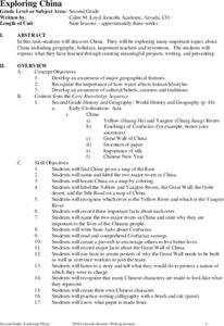
Exploring China
Second graders explore the geography, holidays, important teachers, and inventions from China in the nine lessons of this unit. The results of their inquiries are expressed through a variety of products, writings, and presentations.
Curated OER
Crossroads of the Continent: Early Trade in Kansas
Learners study early Native American-European trade. They play bartering games to discover trade as an economic funtion, as well as other implications of trading one good for another.
Curated OER
Dancing Skeleton Puppets
Students experience, explore and study the Mexican holiday Day of the Dead. They assess the importance of having bones, identify the different bones that we have in our body and encounter how to make a skeleton and decorate it in...
Curated OER
Geography: Snow Cover on the Continents
Students create maps of snow cover for each continent by conducting Internet research. After estimating the percentage of continental snow cover, they present their findings in letters, brochures or Powerpoint presentations.
Curated OER
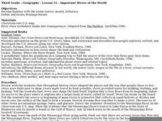
Important Rivers of the World
Third graders become familiar with names of the different parts of a river, define and locate drainage basins, locate six of the continents and explore the major rivers on each one, conduct research on a river of their choice.
Curated OER
Sorting Information Calories from Food
In this computer research worksheet, students load ViewPoint and open the Countries file. They utilize the search tool to select countries outside the continents of Europe and North America. Students also utilize the Sort tool to sort...
Curated OER
Continents And Islands
Students engage in a literature study in order to address the concept of exploring the culture of Puerto Rico. The lesson looks at the culture through the eyes of two children. This helps students to connect to the content of the lesson....
Curated OER
Volcanoes!: The Dangers of Snow and Ice
Students observe a demonstration of how melting snow and ice can contribute to mudflows. They then observea list of continents with the number of snow and ice covered mountains on each continent and discuss. They then label a group of...
Curated OER
"The Clever Monkey"
First graders read and discuss the story elements of the book "The Clever Monkey" by Rob Cleveland. They discuss the continent of Africa, then answer story comprehension questions. Students then complete words, adjectives, sequencing,...
Curated OER
Underwater Mountains & Trenches
Students determine Earth's deepest trench, outline continents, major ocean mountains, and trenches on color-key map using Crayola Erasable Colored Pencils, identify oceans' geographic features, locate significant oceanic features around...
Other popular searches
- Continents and Oceans
- 7 Continents
- Continents Oceans
- The Seven Continents
- Learning 7 Continents
- Map Skills, Continents
- Continents and Countries
- Acronym for Continents
- Social Studies Continents
- 7 Continents and Oceans
- Blank Map Seven Continents
- Seven Continents Worksheet


