Curated OER
Me on the Map: Homes, Neighborhoods, and Communities
Students read a book about maps and identify the differences between a picture and a map. For this maps lesson plan, students also label maps of their home, neighborhood, and community.
Curated OER
Through Time: Change in Sedona
Learners locate events on a timeline of Sedona, Arizona and describe human and physical characteristics of the city. In this Sedona lesson plan, students locate the city on a map and listen to stories about Sedona.
Curated OER
Lights On ! Lights Off! Exploring Human Settlement Patterns
Third graders write informational paragraphs based on the settlement patterns of the United States. In this settlement lesson plan, 3rd graders read about population and how it affects where people settle next.
Curated OER
What's Holding Up the Water?
Students read about the history and locate dams in Arizona. In this Arizona dams lesson plan, students write a summary about what they read focusing on word choice, ideas, conventions, and geography content.
Curated OER
Which Way is Up? The Tree of Life in Africa
Students read a book titled This is the Tree about a baobab tree and draw a picture and label the tree. In this tree lesson plan, students also write a paragraph explaining why they drew that tree.
Curated OER
How the West Was One: A Layered Book
Students create a layered book about the information they learn about the Western region of the United States. In this Western states lesson plan, students create a book about the land, economy, and culture.
Curated OER
I Am A Rock, I Am An Island: Describing Landforms and Bodies of Water
Students identify common landforms and bodies of water from descriptions of distinguishing features. In this landforms and bodies of water lesson plan, students describe the features they see in the pictures given to them.
Curated OER
Desert Views - First Impressions: Travelers on the Gila Trail
Learners draw animals and plants that are described to them as they read passages of people who traveled across the Gila Trail in the Southwest. In this Gila Trail lesson plan, students also write a letter describing a plant or animal in...
Curated OER
This Place is Just Like the Other
Pupils write paragraphs that compare and contrast the geographical characteristics of Arizona and the Southwest region. In this geographical characteristics lesson plan, students complete a diagram and discuss how Arizona differs from...
Curated OER
Mountain Magic: Identifying the Basic Physical Characteristics of Mountains
Students read about and identify on maps the physical characteristics of mountains. In this mountains lesson plan, students also write about the characteristics using personification.
Curated OER
Maize to Maquiladoras: Movement from Mexico to Arizona
Fourth graders label maps of Arizona and Mexico to show the people, goods, and ideas that have moved between the two places. In this Arizona and Mexico lesson plan, 4th graders summarize the effects of the movement on Arizona life.
Curated OER
Great Monuments of the World
Students explore the wonders of the world through inquiry. In this world monuments lesson, students investigate famous landmarks around the world as they conduct and apply research. Students create products that feature their findings...
Curated OER
The Mountain Community: Why Flagstaff?
Learners identify geographical features that hindered or promoted settlement in the city of Flagstaff, Arizona. For this settlement lesson plan, students write a summary of what they learned and identify geographical features on a map.
Curated OER
Kansas Prairie Homes
Students read about settlers in Kansas and the adaptations they made in order to build different kinds of houses. In this Kansas settlers lesson plan, students participate in choral reading and retell information they learn.
Curated OER
Leapin' Landmarks: Locating 10 Man-made Landmarks Around the World
Third graders label continents, oceans, and major mountain ranges on maps and use the maps to write an informational report about landmarks. In this landmarks lesson plan, 3rd graders write about 1 major landmark.
Curated OER
Petroglyphs and Pictographs
Fourth graders make necklaces out of petroglyphs that they stamp into clay. In this petroglyphs lesson plan, 4th graders draw designs and explain where they come from as well.
Curated OER
Today We Encountered the White Man
Students analyze and interpret artifacts and a timeline to get specific information. In this timeline lesson plan students work in groups to research an Indian tribe and write an information piece of their research.
Curated OER
Macbeth Madness
Learners participate in various social studies activities in correlation to William Shakespeare's Macbeth. In this Macbeth lesson, students study maps of Scotland, England, and Norway to identify locations mentioned in Macbeth. Learners...
Curated OER
Utah Weather
Fourth graders explore Earth science by researching weather patterns on the Internet. In this Utah climate lesson, 4th graders discuss why each climate on our planet is exposed to different weather settings and how they are measured....
Curated OER
The Fall and Rise of the White-tailed Deer Population: Conservation Success Story?
Students analyze the problems that have come along with the conservation movement and the fall and rise of the white tailed deer population. For this conservation lesson plan, students see how important the deer were to the Native...
Curated OER
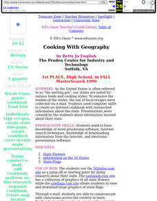
Cooking With Geography
Sstudents use desktop publishing to create "real world" documents from information received from collaborating classes. They create an electronic presentation from Internet research. They experience foods from different states and regions.
Curated OER
Exploring Islamic Lands
High schoolers examine the lives of Islamic teens. In this global studies lesson, students explore selected Internet sites to discover the attributes of Islam, the cultural traditions of Islam, and information regarding Middle Eastern...
Curated OER
Surface Area and Measuring
Tenth graders explore volume and surface area through percentages. In this geometry lesson plan, 10th graders analyze the surface area of two and three dimensional shapes, then use percents and ratio to compare the two.
Curated OER
Magical Maps
Second graders discuss the importance of using maps and how they are used. After they listen to a folktale, they develop their own story line maps and write their own folktale to accompany a map. They also identify and locate the seven...


