Curated OER
Educational Technology Clearinghouse: Maps Etc: Hawaii, 1920
A map from 1920 of the Hawaiian Islands showing the main islands, the capital of Honolulu on the island of Oahu, district boundaries, cities, towns, ports, railroads, principal steamship lines, submarine cable routes, terrain, and...
Curated OER
Educational Technology Clearinghouse: Maps Etc: Hawaii, 1914
A map from 1914 of the Hawaiian Islands showing the main islands, the capital of Honolulu on the island of Oahu, district boundaries, cities, towns, ports, railroads, principal steamship lines, submarine cable routes, terrain, and...
Curated OER
Educational Technology Clearinghouse: Maps Etc: Hawaii, 1920
A map from 1920 of the Hawaiian Islands showing the capital of Honolulu on the island of Oahu, cities, towns, ports, district boundaries, railroads, submarine cable routes, volcanoes, and coastal features. The map is color-coded to show...
Curated OER
Educational Technology Clearinghouse: Maps Etc: Hawaii, 1920
A map from 1920 of the Hawaiian Islands showing the eight main islands of Hawaii, Maui, Kahoolawe, Lanai, Molokai, Oahu, and in the inset Kauai and Niihau, the capital of Honolulu on the island of Oahu, cities, towns, ports, railroads,...
Curated OER
Educational Technology Clearinghouse: Maps Etc: United States, 1917
A map of the United States and territories showing the expansion from the formation of the original states to the purchase of the Danish West Indies (Virgin Islands) in 1917. The map is color-coded to show the original states, the states...
Curated OER
Etc: Territorial Acquisitions of the United States, 1783 1900
A map from 1920 of the United States and its territories between 1783 and 1900 showing the nation's expansion and date of acquisition of each new territory or possession. The map is color-coded to show the progression from the original...
Curated OER
Etc: United States Showing Acquisition of Territory, 1783 1900
A map from 1911 of the United States and its territories between 1783 and 1900 showing the nation's expansion and date of acquisition of each state or territory. The map also shows major cities, waterways, and mountain ranges. Includes...
Curated OER
Etc: United States Showing Acquisition of Territory, 1783 1900
A map from 1912 of the United States and its territories between 1783 and 1900 showing the nation's expansion and date of acquisition of each state or territory. The map also shows major cities, waterways, and mountain ranges. Includes...
Curated OER
Wikipedia: National Historic Landmarks in Hawaii: Washington Place
Built in 1844-1847, this was the home of Queen Lili?uokalani, the last reigning monarch of the Hawaiian kingdom, from the time of her marriage in 1862 to her death in 1917. While living here, she saw the monarchy overthrown and Hawai?i...
Curated OER
Wikipedia: National Historic Landmarks in Hawaii: Honokohau Settlement
Site of an ancient Hawaiian settlement; includes fishponds, kahua (house site platforms), ki?i pohaku (petroglyphs), holua (stone slide) and heiau (religious site).
Curated OER
Wikipedia: National Historic Landmarks in Hawaii: Kaunolu Village Site
This former fishing village, abandoned in the 1880s, is the largest surviving ruins of a prehistoric Hawaiian village. The archaeological site is very well preserved.
Curated OER
Wikipedia: Natl Historic Landmarks in Hi: Kawaiahao Church and Mission Houses
Formerly the national church of the Hawaiian Kingdom and chapel of the royal family.
Curated OER
Wikipedia: National Historic Landmarks in Hawaii: Lahaina Historic District
Preserves the atmosphere of a mid-19th century Hawaiian seaport.
Curated OER
Wikipedia: National Historic Landmarks in Hawaii: South Point Complex
Site of one of the earliest Hawaiian settlements and Southernmost point in the United States.
Curated OER
Wikipedia: National Historic Landmarks in Hawaii: Cook Landing Site
Captain James Cook landed here at the mouth of the Waimea River on January 20, 1778; He was the first European known to have sighted the Hawaiian Islands.
Curated OER
Educational Technology Clearinghouse: Clip Art Etc: Captain James Cook
A British explorer who made detailed maps of Newfoundland before he achieved the first European contact with the eastern coastline of Australia and the Hawaiian Islands.
EL Education
El Education: The Fish and Their Gifts
High school students write and illustrate original fables for younger students and create bilingual children's books to encourage cultural awareness on the Big Island of Hawaii.
EL Education
El Education: Let's Make Desserts
Students write and illustrate a bilingual recipe book for younger students in order to increase cultural awareness.
Other
Aloha hawaii.com: Celebrating the Birth of Hula
An interesting description of the history of hula in Hawaii. Use this site to learn the origins of this ancient folk dance and how it evolved to become the most popular symbol of the state of Hawaii.
Other
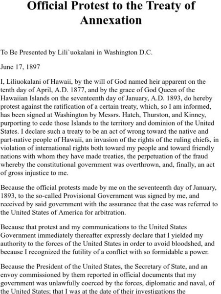
Free Hawaii: Queen Liliuokalani's Protest to the Treaty of Annexation
This website contains the text of an official protest to the annexation of Hawaii, presented by Queen Liliuokalani in Washington D.C. on June 17, 1897.
Curated OER
View of Haleakala Crater, Island of Maui, Hawai`i, Looking Ene
Find information about the Haleakala Crater and the East Maui volcano, including the volcano's eruptive history, maps of the crater, and geologic data sets.
Other popular searches
- Hawaiian Music
- 8 Hawaiian Islands
- Hawaiian Culture
- Hawaiian Islands
- Hawaiian Marine Biology
- Hawaiian Ecosystem
- Hawaiian Studies
- Hawaiian History
- Hawaiian Dance
- Hawaiian Archipelago
- Hawaiian Music Activities
- Hawaiian Mythology


