Curated OER
Chinese Classroom Internet Activity
Students use the internet to complete an online activity in Chinese. Using the weather section, they research the weather conditions in Hong Kong and other popular cities in China. They answer Chinese questions in Chinese about the...
Curated OER
Sioux Treaty of 1868
Students explore and research the history of Native Americans in North America.
Curated OER
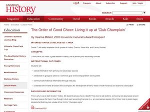
The Order of Good Cheer: Living it Up At "Club Champlain"
Seventh graders participate in a role play activity to study the development of the fur trade in North America and leaders like Champlain.
Curated OER
Different Perspectives: The Durham Report and Act of Union
Pupils research and write an essay on the "Report on the Affairs of British North America," also known as the Durham Report.
Curated OER
Like Comparing Bison and Fish
Fourth graders examine the cultures of early American Indians in North America and how geographic characteristics impacted the development of American Indian cultures. Students discuss Lewis and Clark, their journey, the Plains Indians,...
Curated OER
People Of The Plains
Learners engage in a lesson that discusses how Native Americans lived in all different parts of North America. They focus on investigating the region's natural resources and how the indians used them to build shelter, make clothing, and...
Curated OER
The Great Exchange
Sixth graders examine the connection that the present has to the past and how different cultures impact each other with lasting results. They discuss European exploration in North America and West Africa by describing cultural...
Curated OER
Landforms and Resources of the United States and Canada
In this North American geography activity, students read about the physical features and resources of the United States and Canada. Students take notes and answer 3 short answer comprehension questions as they read the selection.
Curated OER
Whose Manifest Destiny?
Students examine the Westward expansion. For this North American settlers lesson, students will view a PowerPoint presentation and answer critical thinking questions. Students will write an essay that analyzes the impact of westward...
Curated OER
Bison on the Plains
Fifth graders explore U.S. geography by reading assigned text about American Indians. In this migration lesson, 5th graders identify the differences between Native Americans and European settlers who traveled through middle America in...
Curated OER
Directions, Directions
Third graders review cardinal directions, moving around the room so that they are standing in the part of the room that is nearest the north, south, east and west. They are asked what would you do if they are lost? Pupils work as a...
Curated OER
Water Resources
Students study water resources that are important to the people of North American and Africa. They use satellite images and data to explore how human actions can degrade, improve, or maintain water resources. They analyze and interpret...
Curated OER
The Story of Corn
Students use primary sources to compare the early development of corn with current techniques of biotechnology and genetically engineered seeds, and identify plants natural to the Americas and those natural to Europe that were part of...
Curated OER
South American Architecture
Seventh graders review and discuss what they read about North American architecture. They then study images of North and south American architecture and make comparisons
Curated OER
Fort Clatsop: The Corps of Discovery's Winter at Fort Clatsop
Students investigate the Lewis and Clark expedition and how it helped to shape American expansion during its early history. Students reflect upon the period of history and its implications for America.
Curated OER
Differences in Location Lesson Plan: Treatment of Early African Americans
Students reach The Domestic Slave Trade, then examine the differences between the people enslaved in North America as opposed to those in Brazil.
Curated OER
Tracing Our Own Family Pilgrimages
Students observe a world map and are introduced to vocabulary like: cities, continents, rivers, lakes, and oceans. They discuss the names of the cities they live in and locate them on the map; then using a colored pushpin indicate: the...
Curated OER
United States of America
In this writing worksheet, students read short paragraphs about United States facts. Students then generate questions about the paragraphs using given facts.
Curated OER
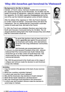
Why Did America Get Involved in Vietnam?
In this Vietnam study guide learning exercise, students investigate what led the United States into involvement in the Vietnam War. Students respond to 7 short answer questions based on the learning exercise as well as textbook reading.
Curated OER
Why Did America Lose the Vietnam War?
In this Vietnam study guide worksheet, students locate reasons that the United States lost the Vietnam War. Students respond to 3 short answer questions based on their worksheet as well as their textbook reading.
Curated OER
Canada Outline Map
In this blank outline map activity, learners study the political boundaries of the North American country of Canada as well as those of the provinces located there.
Curated OER
Canada Outline Map: Labeled
For this blank outline map worksheet, students study the political boundaries of the North American country of Canada as well as those of the provinces located there. This map is labeled.
Curated OER
Canada Outline Map
In this blank outline map worksheet, students study the political boundaries of the North American country Canada as well as those of the provinces located there. The capital cities of the provinces are listed.
Curated OER
Canada Outline Map
In this blank outline map instructional activity, students study the political boundaries of the North American country of Canada as well as those of the provinces located there.
Other popular searches
- American North
- North America Map
- North America Geography
- Crops North America
- North American Geography
- North American Biomes
- Early Cultures North America
- Map of North America
- North American Indians
- North America Lesson Plans
- Explorers of North America
- Indians of North America


