Curated OER
North America Capitals Map Quiz
In this online interactive geography quiz learning exercise, learners respond to 16 identification questions regarding capital cities of North American countries.
Core Knowledge Foundation
European Exploration of North America Tell It Again!™ Read-Aloud Anthology
Third graders listen to read-alouds and participate in extension activities about European Explorers—Christopher Columbus, Juan Ponce de León, Hernando de Soto, Francisco Vasquez de Coronado, John Cabot, Henry Hudson, and Samuel de...
Curated OER
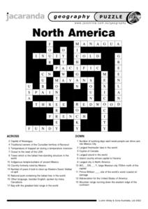
North America Puzzle
In this geography worksheet, students complete a crossword puzzle in reference to North America. They identify capitals of some countries, the specific landforms of different areas, and languages spoken. There are 21 clues to solving the...
Curated OER
North America Puzzle Answer Sheet
In this geography worksheet, students name the capitals of various countries found in North America. They also identify the various weather patterns across the continent and specific bodies of water. There are 21 descriptions and 21...
Constitutional Rights Foundation
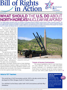
What Should the US Do About North Korea's Nuclear Weapons?
North Korea, a shadowy nation distrustful of America, is working on a nuclear weapons program. What should the United States do? The question has plagued American presidents for years, but now young scholars get to make their...
Curated OER
Document-Based Essay on U.S. Reaction to North Korean Nuclear Policy
Students compose essays on nuclear policies. In this North Korea lesson, students examine political cartoons and primary documents regarding nuclear build-up by North Korea. Students write essays about North Korea's military goals and...
Curated OER
Journey North: Tulip Garden
First graders plant tulip gardens. They explore the nature of bulbs and plant growth. Students participate in a project that tracks the growth of tulips in various climatic areas of North America.
Curated OER
North American Rivers Map Quiz
In this online interactive geography quiz worksheet, students examine the map that includes 13 rivers in North America. Students match the names of the rivers to the appropriate places on the map.
K12 Reader
Coyote: The Survivor of North America
Coyotes in Chicago? Yip. Middle schoolers demonstrate their ability to identify details that support the idea that coyotes are adaptable creatures.
Curated OER
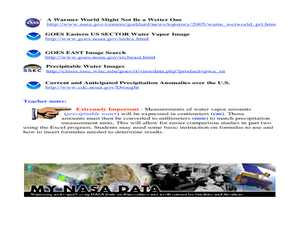
A Comparison Study of Water Vapor Data to Precipitation over North America
Students use NASA satellite data to compare water vapor over the United States. In this data analysis lesson students use an Excel spreadsheet to map their data.
Curated OER
Neither Wind Nor Rain
Here is another in the interesting series of lessons that use the special State Quarters as a learning tool. This one uses the North Dakota State Quarter. During this lesson, your class learns about the different patterns of erosion, and...
Curated OER
Pre-Columbian Cultures in the Americas
Native American studies is fun, educational, and highly motivating. Fifth graders will gain a deeper understanding of the six major pre-Columbian culture areas on the North American continent. They will choose one group and conduct...
Curated OER
Early European Explorers Map
Fifth graders create an explorer's map. In this explorers lesson students use a map of the world as reference to draw their own map of Europe, North America, Central America, and the Caribbean Islands. The students use their maps to show...
Curated OER
Clothesline Sleuth
Fifth graders investigate the effect of North American colonization on human history. In this colonization lesson, 5th graders explore the global impact of colonization of North America. Students investigate the impact of geography on...
Curated OER
Biome-Ecology Unit with a "Design a Zoo" Extension
Learners participate in a three part unit about biomes. Part one, students research the biomes of North America and part two consists of research on zoos and a field trip to a zoo. While part three ties together the first two when...
Curated OER
Max Knows Mexicao, United States and Canada
Students utilize their map skills to explore the regions of North America. They explore the physical characteristics and climates of the regions. Students label their map and prepare a presentation of their findings.
Curated OER
Antebellum North Carolina
Eighth graders examine pictures & documents relating to the Hayes Plantation (Edenton, NC). They also use various maps of North Carolina to help them analyze how James Cathcart Johnston used, modified and adapted to the physical...
Smithsonian Institution
A Ticket to Philly—In 1769: Thinking about Cities, Then and Now
While cities had only a small fraction of the population in colonial America, they played a significant role in pre-revolutionary years, and this was certainly true for the largest city in the North American colonies: Philadelphia. Your...
Curated OER
Traveling Through North America
Students identify places and landmarks in North America, specifically Canada and the United States, by using and constructing maps. Six lessons on one page; includes test.
Curated OER
Bears
First graders investigate the bears of North America that include the grizzly, polar, black, and Alaskan brown. They conduct research on each of these different varieties. The goal is for students to find common characteristics and...
PBS
What's In a Name?
What is in a name? Eager historians trace the geographical history of places in the United States with Spanish names. Using a worksheet activity, clues, and web research developed in conjunction with the PBS "Latinos in America" series,...
Curated OER
Comparison of Colonial Regions in British North America
Students compare and contrast the colonies in British North America. As a class, they brainstorm a list of people, places and ideas associated with the Colonial Era. They discover the relationships and interactions between the...
Curated OER
Democracies in North America: Canada, the United States, and Mexico
Students examine democratic values. In this democracy lesson, students research the political systems of Canada, Mexico, and the United States in order to compare and contrast them. Students also discuss domestic and international events...
Curated OER
North America, Then and Now
Learners identify ocean, lake, gulf, and continent on maps of North America from 1845 and the present, and identify Pacific and Atlantic Oceans, the Great Lakes, and the Gulf of Mexico on maps of North America from 1845 and the present.
Other popular searches
- American North
- North America Map
- North America Geography
- Crops North America
- North American Geography
- North American Biomes
- Early Cultures North America
- Map of North America
- North American Indians
- North America Lesson Plans
- Explorers of North America
- Indians of North America


