Curated OER
Coming to America: A Look at Colonization in the 1600s
High schoolers analyze the European colonization of America. In this colonial America lesson, students use provided Internet resources to research colonization and representative government. High schoolers use their finding to create...
Curated OER
New World, Old Evils: Latin America and the Holocaust
Pupils examine how Latin America was affected by the Holocaust in Europe. In groups, they research topics related to Latin America and World War II. They interview survivors if possible and discover how entire nations were effected by...
Curated OER
The Coming of Independence
Provide your learners with an opportunity to show what they know. Have them answer 10 questions on colonial America, 13 Colonies, colonial legislature, and popular sovereignty. There are 5 true/false and 5 multiple choice questions.
Curated OER
Plains Indians
Young scholars design a realistic replica of a Crow or Kiowa circular shield. They examine the material culture of the Plains Indians and the role of shields for the Crow and Kiowa. They study animal symbolism as used by North America's...
Global Oneness Project
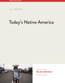
Today’s Native America
The 2016-2017 protests over the Dakota Access Pipeline (DAPL) motivated Camille Seaman to create "We Are Still Here," a photo essay featuring portraits of contemporary Native Americans who protested the pipeline. This eight-page packet,...
National Park Service
News Bearly Fit to Print
There are an average of three human fatalities by bears in North America every year, which is low when you compare it to the 26 killed by dogs and the 90 killed by lightning annually. The lesson encourages researching human-bear...
Science 4 Inquiry
Edible Plate Tectonics
Many people think they can't observe plate tectonics, but thanks to GPS, we know that Australia moves at a rate of 2.7 inches per year, North America at 1 inches per year, and the Pacific plate at more than 3 inches per year! Scholars...
K12 Reader
From Nomad to Farmer
The gradual evolution of the earliest settlers in North America from nomads to farmers is the subject of a reading comprehension worksheet that asks kids to answer a series of questions using information provided in the reading passage.
Curated OER
Geographic Regions and Backyard Geology with the USGS Tapestry Map
A beautiful tapestry map of North America is examined by geology masters. The map incorporates the topography and geology of different regions. You can purchase printed copies or a large poster of the map, or if you have a computer lab...
Channel Islands Film
Arlington Springs Man: Lesson Plan 3
Imagine being part of a team of scientists that discover the oldest human remains in North America. Imagine being part of the crew that documents this discovery. Class members get a change to be part of such an exciting adventure in a...
University of Richmond
Canals 1820-1860
While canals are not a common mode of transportation today, they were part of the fuel for America's industrialization. However, most of them were located in the North, also feeding regional differences and sectionalism. Using an...
Curated OER
Regions of North America:The Chesapeake Bay
In this Chesapeake Bay worksheet, students read a 1-page article about the region and then respond to 5 fill in the blank and 3 short answer questions.
Curated OER
Americas: Physical Map
In this Americas physical map worksheet, students make note of the major landforms and bodies of water located on the North American and South American continents.
Curated OER
Story Stretching: Tall Tales in North America
Students are introduced to tall tales. In this introductory tall tales unit, students explore the tall tales of Casey Jones and Johnny Appleseed. This unit includes many interdisciplinary lessons including graphing skills and geography.
Curated OER
Vikings in Vinland
Students examine the role of archaeology in gaining information about past civilizations. After reading an article, they discover evidence of the Viking settlement of North America. They summarize the information in the article by...
Curated OER
The Continent Game
Young scholars order the continents in terms of area, population and other geographic terms.
Curated OER
Travel to Mesoamerica
Students research books, watch movies, and look on the internet to find information on ancient America, Mexico, and Central America. In this Mesoamerica lesson plan, students participate in a social studies unit on North America of the...
Curated OER
North American Mountain Ranges Map Quiz
In this online interactive geography quiz worksheet, students respond to 7 identification questions regarding North American mountain ranges.
Curated OER
Coming To America
Students investigate the history of America with the help of children's literature. The story is structured as a timeline that begins at the time of Columbus and progresses to the present. The teacher reads the story with the class and...
Curated OER
South American Outline Map
In this blank outline map worksheet, students study the political boundaries of the continent of North America and those of the countries located there.
Curated OER
North America Knowledge
Second graders move around a large map of the North America drawn on the playground. They follow the directions called out by the teacher. They may also develop their own tasks for other students to follow.
Curated OER
Mapping Change
Students compare a political map of North America today with one from 1845. They identify items of continuity in the political map of the United States today and that of 1845 and describe the influence of Indian and Hispanic cultures on...
Midwest Institute for Native American Studies
Introduction to Pre-Columbian Lessons
Native peoples established civilizations all over Central and North America. Introduce native civilizations with a unit that promotes discussion, reinforces map skills, enhances reading comprehension, and exposes young historians to the...
PHET
Where to See an Aurora
Where can you see an aurora in North America? After completing an astronomy activity, scholars can locate the exact coordinates. Pupils plot points of the inner and outer ring of the auroral oval and answer questions based on their...
Other popular searches
- American North
- North America Map
- North America Geography
- Crops North America
- North American Geography
- North American Biomes
- Early Cultures North America
- Map of North America
- North American Indians
- North America Lesson Plans
- Explorers of North America
- Indians of North America


