Curated OER
Educational Technology Clearinghouse: Maps Etc: Porto Rico, 1919
A map from 1919 of Porto Rico (Puerto Rico) with inset maps of the islands to the west and east belonging to Porto Rico. The map shows the capital of San Juan, major cities and towns, steamship lines, railways, lakes and rivers,...
Curated OER
Educational Technology Clearinghouse: Maps Etc: Porto Rico, 1912
A map from 1912 of Porto Rico (Puerto Rico) with inset maps of the islands to the west and east belonging to Porto Rico. The map shows the capital of San Juan, departments, major cities and towns, existing and proposed railways, main...
Curated OER
Educational Technology Clearinghouse: Maps Etc: Porto Rico, 1909
A map from 1909 of Porto Rico (Puerto Rico) with inset maps of the islands to the west and east belonging to Porto Rico. The map shows the capital of San Juan, major cities and towns, existing and proposed railways, main roads and cart...
Curated OER
Educational Technology Clearinghouse: Maps Etc: Porto Rico, 1920
A map from 1920 of Porto Rico (Puerto Rico) with inset maps of the islands to the west and east belonging to Porto Rico. The map shows the capital of San Juan, major cities and towns, existing and proposed railways, main roads and cart...
Curated OER
Educational Technology Clearinghouse: Maps Etc: Porto Rico, 1920
A map from 1920 of Porto Rico (Puerto Rico) with inset maps detailing the Danish West Indies (St. Thomas and St. John) and British Virgin Islands, Santa Cruz (St. Croix), and the islands of Culebra and Crab Island (Isla de Vieques). The...
Curated OER
Educational Technology Clearinghouse: Maps Etc: Porto Rico, 1906
A map from 1906 of Porto Rico (Puerto Rico) with inset maps detailing the Danish West Indies (St. Thomas and St. John) and British Virgin Islands, Santa Cruz (St. Croix), and the islands of Culebra and Crab Island (Isla de Vieques). The...
Curated OER
Educational Technology Clearinghouse: Maps Etc: Porto Rico, 1906
A map from 1906 of Puerto Rico showing the major cities and departments (political subdivisions), and the three major railroads at the time.
Curated OER
Boricua Kids: History of Puerto Rico for Children
Information on Puerto Rico's history, geography, culture, wildlife, etc. Mostly in English, but with links to poetry, songs, and Puerto Rico?s anthem in Spanish. Also contains lesson plans for classroom activities.
Curated OER
Rhythms of Puerto Rico Plena
Study the rhythms of Puerto Rico through the musical form of the plena. Included are explanations of the different types of drums used in the plena. Audio examples and a pdf document of sheet music demonstrating the plena can also be...
Curated OER
Rhythms of Puerto Rico Plena
Study the rhythms of Puerto Rico through the musical form of the plena. Included are explanations of the different types of drums used in the plena. Audio examples and a pdf document of sheet music demonstrating the plena can also be...
Curated OER
Rhythms of Puerto Rico Plena
Study the rhythms of Puerto Rico through the musical form of the plena. Included are explanations of the different types of drums used in the plena. Audio examples and a pdf document of sheet music demonstrating the plena can also be...
PBS
Pbs Learning Media: Primary Source Set: Postwar Rise of the Suburbs
This collection uses primary sources to explore the postwar growth of the American suburbs.
US Department of Agriculture
Usda Forest Service: Caribbean National Forest
Learn about El Yunque, the tropical rain forest in the Luquillo Mountains of Puerto Rico. The article discusses the topography, geology, rainfall amounts, soil, and water quality of the forest.
Other
Mcm Biographias: Jose De Diego
This is a brief biography of the Puerto Rican writer Jose de Diego.
Curated OER
Unesco: Usa: La Fortaleza and San Juan National Historic Site in Puerto Rico
Between the 15th and 19th centuries, a series of defensive structures was built at this strategic point in the Caribbean Sea to protect the city and the Bay of San Juan. They represent a fine display of European military architecture...
Curated OER
Educational Technology Clearinghouse: Maps Etc: Islands West of Porto Rico, 1920
A map from 1920 of the islands east of Porto Rico, including Mona, Monito, and Desecheo.
Curated OER
Educational Technology Clearinghouse: Maps Etc: Islands East of Porto Rico, 1920
A map from 1920 of the islands east of Porto Rico, including Vieques, Culebra, and the smaller islands and cays.
Curated OER
Etc: Maps Etc: Economic and Commercial Activity in Porto Rico, 1920
A map from 1920 of Porto Rico and the Virgin Islands showing the economic and commercial activity, including principal products, railroad transportation, and import and export information.
US Census Bureau
U.s. Census Bureau: Student State Facts
Ever wonder how many 8 year old boys or girls live in your state? Do you know what day your state joined the Union? Take some time to explore the fifty states and Puerto Rico and discover many fun facts collected by the U.C. Census.
US Environmental Protection Agency
Epa: Air Data
The AirData website gives you access to air quality data collected at outdoor monitors across the United States, Puerto Rico, and the U. S. Virgin Islands. The data comes primarily from the AQS (Air Quality System) database. You can...
PBS
Wnet: Thirteen: Savage Earth: Earthquake!
This animation shows the movement of seismic waves as they moved from Bolivia to San Juan Puerto Rico during a 1994 earthquake.
Mariners' Museum and Park
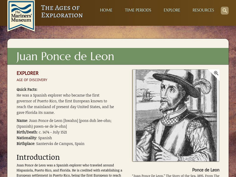
Mariners' Museum: Juan Ponce De Leon
Discover details of Ponce de Leon's expeditions in search of land for Spain in the new world. Follow the Spanish explorer's trips to present day Puerto Rico, St. Augustine, and Dry Tortugas, see a map of his journey, images featuring...
Other popular searches
- History of Puerto Rico
- Puerto Rico Art Activity
- Education Reform Puerto Rico
- Puerto Rico 1
- Puerto Rico Map
- Map of Puerto Rico
- Cuba, Haiti, Puerto Rico
- Geography Puerto Rico
- Maps of Puerto Rico
- Christmas in Puerto Rico
- Rainforest Puerto Rico
- Puerto Rico Country Project


