Curated OER
Map Skills
Do you need to practice map skills? Children with a range of abilities will complete a KWL chart about maps, practice important map vocabulary and then read a few pages from their textbook. They will use their vocabulary words and...
Curated OER
The Ruins of Pompeii: A Window into History
Sixth graders research the history of Pompeii and its destruction. Locate important geographical features of Rome. Gain insight into the past through archaeological interpretation. Synthesize historical information through imaginative...
Curated OER
The Dynamics of Plate Tectonics
Simple lab and modeling activities can help your students understand the movements of the Earth's crust.
Curated OER
Spiffing Up Text
Students change the size and color of specific portions of text in a web page. They create superscripts and subscripts for text in a web page. They specify the font for portions of text on a web page.
Curated OER
Tables
Students design a web page table with rows and columns of text in a gridded display. They write a HTML for integrated layout schemes of text and pictures. They create a table that has different colored cells.
Curated OER
Coasts
Students explain the different types of marine coasts and where they are located in the United States and its territories. They explain and identify some of the life forms that inhabit different marine coastal regions.
Curated OER
Topos, Compasses, and Triangles, Oh My!
Students triangulate using a compass, topographical (topo) map and a view of outside landmarks. They take a field trip to another location away from school and mark discernible landmarks (like mountains or radio towers) and changes in...
Curated OER
TE Activity: Survive That Tsunami!
Students examine the causes of tsunamis and observe a table top wave making machine. They make model houses while working in groups so that the can see how different construction types work. They discuss how engineers can design and...
Curated OER
Geological Features: How Weathering & Erosion Help Create Landforms
Students explore how the Earth's surface changes resulting in geological features and landforms. They perform a read-a-loud on Thomas
Locker's Mountain Dance, complete a KWL chart, and create a
landform using plaster of paris.
Curated OER
My Own Private Idaho; Using Social Studies to Explore Idaho
Students engage in several activities to explore Idaho and Social Studies themes. Using an variety of media, students become familiar with Idaho's geography and geology.
Curated OER
Gorillas In The Midst
Learners consider the idea of the eco-tour, and examine different aspects of the Mountain Gorilla Project eco-tour in Rwanda. They synthesize their understanding by acting as expert panelists on a morning news show that focuses on the...
Curated OER
Pollution Search
First graders identify forms of pollution and describe effects that various pollutants can have on people, wildlife, and plants; students describe relationships between various forms of pollution and human actions.
Curated OER
Mapping Plate Boundaries
Students discover plate boundaries based on the uneven geographic occurrence of geologic hazards. After discussing geologic hazards, students plot different sets of earthquakes and volcanic eruptions on maps.
Curated OER
Preformatted Text
Students examine how to create a table of aligned text. They apply tabs and spaces to control the placement of text on a page.
Curated OER
Layers Of The Earth
Students examine the layers of the earth and the basic composition and thickness of each. Using construction paper, each student models the layers of the earth.
Curated OER
Life of an Island: From Mountain to Atoll
Students research the evolution of a volcanic island from origin to erosion. They determine the relative ages of the Northwestern Hawaiian Islands given their position in the archipelago.
Curated OER
The Rock Cycle
Students study the rock cycle of different types of rock. They arrange cut-outs of the parts of the rock cycle in the correct order and then draw the rock cycle or research different types of rocks.
Curated OER
Island formation
Young scholars explain what an island is, and distinguish islands from similar landforms. They compare and contrast the different ways in which islands are formed.
Curated OER
The Science of Tsunamis: Seeking Understanding in the Wake of Tragedy
Young scholars use Internet research, articles, discussion and models to explore the dynamics of a tsunami. They focus on the 2004 Asian Tsunami and create posters illustrating their understanding of this phenomenon.
Curated OER
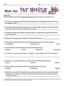
Hunt the Fact Monster Hunt #14
In this internet research worksheet, students answer ten questions by using the search engine at the Fact Monster site. Seven questions are short answer and three are multiple choice.
Curated OER
Whole Lotta Shaking Going On
Students explore earthquake activity in California. They observe the historical data and create databases and graphs of the earthquakes. Students analyze the data and form a hypothesis about future earthquakes.
Curated OER
Definition Lists
Students create a list of items with indented text block definitions in an HTML document. They produce a bibliography with a definition list.
Curated OER
Breaking It Up Into Paragraphs
Students examine the appearance of a paragraph break tag in HTML. They insert paragraph breaks into the text of an HTML document and view the changes in their web browser.
Curated OER
Easter Island
Fifth graders describe the location and physical environment of Easter Island. This description include: identification of the closet continent to Easter Island, ocean in which Easter Island is located, and some geographical features of...


